Maps of United States
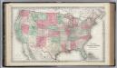
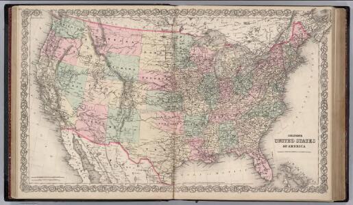
United States of America.
1 : 6336000 Colton, G.W.
Mitchell's reference & distance map of the United States
1 : 6340000 Spojené státy americké Young, J. H. Dankvort, F. S. Augustus Mitchell
United States.
1 : 11100000 Lucas, Fielding Jr.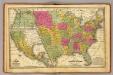
United States, Mexico.
1 : 11400000 Mitchell, Samuel Augustus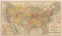
Routen der Missouri - Pacific, sowie der Wabash St. Louis und Pacific Eisenbahnen
United States.
1 : 7700000 Symonds, Maria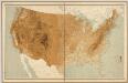
United States relief map / comp. by Henry Gannett ; engr. by U.S.G.S.
1 : 6900000 Henry Gannett 1846-1914; U.S.G.S [S.l. : U.S. Geological Survey]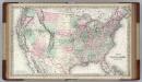
United States of America.
1 : 6336000 Colton, G.W.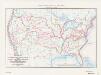
Map of the conterminous United States showing routes of the principal explorers from 1501 to 1844, whose work had an important bearing on the settlement of the country and the fixing of its successive boundaries
1 : 8500000 "Taken from Bulletin 1212, Plate 1." Original title: United States map showing routes of principal explorers and early roads and highways. Bond, Frank, 1856-1940 United States. General Land Office.; Geological Survey (U.S.); Reston, Virginia : U.S. Geological Survey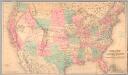
Railroad map of the United States to accompany the "Commercial travellers guide book".
From Whole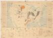
Coal fields of the United States
1 : 7000000 Spojené státy americké Campbell, R. Marius U.S. Geological Survey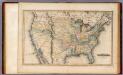
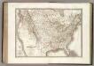
United States.
1 : 11088000 Lucas, Fielding Jr.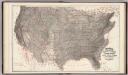
Climatological Map of the United States.
1 : 3740000 Blodget, Lorin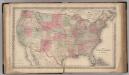
United States of America.
1 : 8000000 Colton, G.W.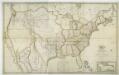
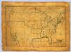
Map of the United States with the contiguous British & Spanish possessions / compiled from the latest & best authorities by John Melish; engraved by J. Vallance & H.S. Tanner.
from Whole John Melish; J. Vallance; Henry S. Tanner,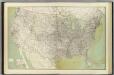
United States.
1 : 5500000 Geological Survey (U.S.)
Nord-Americanische Freistaaten.
1 : 12800000 Radefeld, Carl Christian Franz, 1788-1874
Vereinigte Staaten von Nord-America
1 : 13000000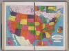
United States.
1 : 8183000 Hammond, C.S.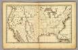
United States.
1 : 14300000 Weeks, Lydia S.
United States of America: corrected & improved from the best authorities / engraved by H. Anderson.
from Whole H. Anderson.,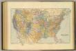
United States.
1 : 7603200 Stanford, Edward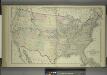
Map of the United States and Territories
from Combination atlas map of Broome County, New York; / compiled, drawn and published from personal examinations and surveys by Everts, Ensign & Everts.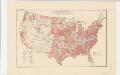
Areas covered by the soil survey, completed to January 1934
1 : 7900000 Includes numbered list of reconnaissance surveys. "Atlas of American Agriculture, Soils, Plate 1." United States. Bureau of Chemistry and Soils. [Washington, D.C.?] : The Bureau
Vereinigte Staaten Von Nordamerika
Etats-Unis d'Amerique.
1 : 9300000 Lapie, M. (Pierre), 1779-1850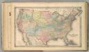
The United States of America.
1 : 8000000 Colton, G.W.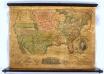
United States.
1 : 7000000 Thrall, Willis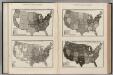
(United States. Population Attributes).
Rand McNally and Company