Maps of Cortés
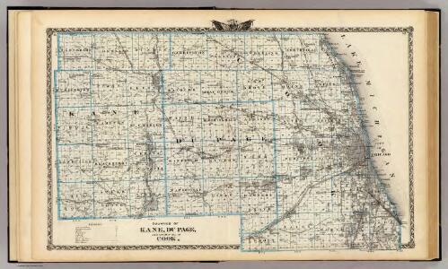
Counties of Kane, Du Page, and nearly all of Cook.
1 : 150000 Warner & Beers
Kankakee, Iroquois, Ford counties.
1 : 350000 Campbell, R.A.
Map of Champaign County.
1 : 150000 Warner & Beers
Map Of The Country Between Monterey, Tenn. & Corinth, Miss.
1 : 31680 Matz, Otto H.
Douglas, Edgar, Coles, Cumberland, Clark counties.
1 : 350000 Campbell, R.A.
Map of Iroquois County.
1 : 165000 Warner & Beers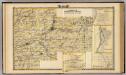
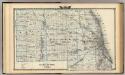
Kendall, Will, Grundy, and Cook counties, Lacon, Morris, Wilmington and Braidwood.
1 : 180000 Warner & Beers
Champaign, Vermillion counties.
1 : 350000 Campbell, R.A.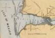
Lloyd's Military Campaign Charts: Mobile Bay
Lloyd's Military Campaign Charts, showing the principal places of interest, compiled from official data by Gen. E.L. Viele and C. Haskins. Published under the auspices of the American Geographical and Statistical Society. Mobile Bay.
Cook, Dupage, Will, Kankakee, Kane & Kendall.
1 : 130000 Rees, J. H.
Mobile Bay.
1 : 200000 Bache, A. D.
Map of Ford County and Paxton.
1 : 126720 Warner & Beers
Chicago and vicinity, Ill.-Ind. : 1953
1 : 24000 Geological Survey (U.S.) The Survey
Map of Vermilion County, Mason City, Virginia and Petersburg.
1 : 180000 Warner & Beers
Map of Kankakee County, Kankakee and Gilman.
1 : 158400 Warner & Beers
Prang's Naval Expedition Maps: Mobile Harbor
Prang's Naval Expedition Maps: Mobile Harbor L. Prang & Co.
Map of Gallatin and Hardin counties, Harrisburg and Elizabethtown.
1 : 150000 Warner & Beers
Map of Posey County.
1 : 126720 Baskin, Forster and Company
Map of Edgar County.
1 : 126720 Warner & Beers
Map of White County.
1 : 126720 Warner & Beers
Map of Edwards & Wabash counties and Albion.
1 : 126720 Warner & Beers
Map of Clark County.
1 : 110000 Warner & Beers
Map of Coles County.
1 : 120000 Warner & Beers
Map of Crawford County, Robinson, Kinmundy and Newton.
1 : 126720 Warner & Beers
Map of Jasper County, Lawrenceville, Benton and Marion.
1 : 126720 Warner & Beers
Map of Douglas County. Map of Cumberland County.
Warner & Beers
Marshall Co. and Irving Kansas.
1 : 126720 L.H. Everts & Co.
Blanchard's map of Chicago and environs.
1 : 52000 National School Furnishing Co.
Fort Morgan
1 : 62500
Fort Morgan
1 : 62500