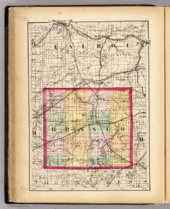
Maps of Branch County

(Map of Branch County, Michigan)
1 : 190080 Walling, H. F.
Camden
1 : 24000
Bronson South
1 : 24000
Bronson South
1 : 24000
Camden
1 : 24000
California
1 : 24000
Camden
1 : 24000
California
1 : 24000
Bronson North
1 : 24000
Coldwater East
1 : 24000
Allen
1 : 24000
Allen
1 : 24000
Coldwater East
1 : 24000
Tekonsha
1 : 24000
Litchfield
1 : 24000
Union City
1 : 62500
Union City
1 : 62500
Homer
1 : 62500
Homer
1 : 62500
Homer
1 : 62500
Union City
1 : 62500
Union City
1 : 62500
Union City
1 : 62500
Burr Oak
1 : 24000
Burr Oak
1 : 24000
Colon
1 : 24000
Reading
1 : 24000
Reading
1 : 24000
Leonidas
1 : 24000
Hillsdale
1 : 24000