Maps of Alaska

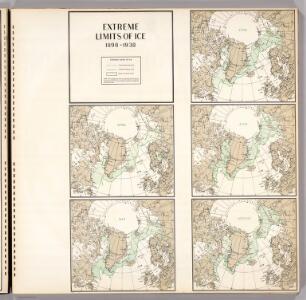
Extreme Limits of Ice, 1998 - 1938, April - August
U.S. Navy
[140][143] Poli Arctici ..., uit: Atlas sive Descriptio terrarum orbis
Annotatie: Gedigitaliseerde versie. Amsterdam. Heiloo : Picturae (vervaardiger), 2015. tiff-bestand. Gedigitaliseerd: 07-01-2015; Origineel: Universiteitsbibliotheek Vrije Universiteit (XL.05127.-) ; Netherlands; Titelpagina ontbreekt Wit, Frederik de Amsterdam : Frederick de Wit
North Polar Regions.
1 : 22000000 Rand McNally and Company
Polar-Karte enthaltend: die Lander u. Meere vom Nord-Pol bis 50 degrees N.
1 : 29000000 Stieler, Adolf
Regiones Sub Polo Arctico. [Karte], in: Novus Atlas, das ist, Weltbeschreibung, Bd. 1, S. 19.
1 Karte aus Atlas Blaeu, Joan Blaeu, Willem Janszoon
The Arctic regions
1 : 14673400 Arktida National Geographic Society
Northern Regions.
1 : 22176000 Colton, G.W.
3. Terre polari.
1 : 45000000 Touring club italiano
Polar Regions.
1 : 35000000 Philip, George
Regiones Sub Polo Arctico. [Karte], in: Theatrum orbis terrarum, sive, Atlas novus, Bd. 1, S. 31.
1 Karte aus Atlas Blaeu, Joan Blaeu, Willem Janszoon
Nova et accvrata Poli Arctici et terrarum circum iacentium descriptio
1 : 17500000 Annotatie: Rechtsboven: IV; Origineel is Blad 148 in atlas factice Amstelodami : apud Ioannem Ianßonium
River Ice in Relation to Navigation, Average Annual Number of Days with Ice.
U.S. Navy
Ice Chart, Northern Hemisphere, April.
U.S. Navy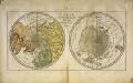
Carte des deux regions polaires
2 Karten auf einem Blatt : Kupferdruck ; Durchmesser je 20 cm Lange; Berndt s.n.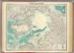
North Polar regions.
1 : 14000000 John Bartholomew and Son
Carte Generale de la Russie d'Asie ou Siberie.
1 : 14300000 Vivien de St Martin, L.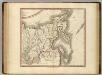
Russian Empire east.
1 : 9400000 Cary, John, ca. 1754-1835
L'empire de Russie, en Europe et en Asie
1 : 12640000 Rusko Bonne, Rigobert André
Russie orientale.
1 : 13000000 Bonne, Rigobert, 1727-1794
E. Siberia.
1 : 11000000 Society for the Diffusion of Useful Knowledge (Great Britain)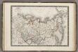
Siberie ou Russie d'Asie.
1 : 18000000 Monin, C.V.
Nord Pol.
1 : 32000000 Meyer, Joseph, 1796-1856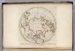
North Pole countries.
1 : 40000000 Carey, Mathew
North Pole countries.
1 : 40000000 Carey, Mathew
Countries situate about the North Pole.
1 : 41000000 Carey, Mathew
Map of the Countries situate about the North Pole.
1 : 40000000 Carey, Mathew
Map of the Countries situate about the North Pole.
1 : 40000000 Carey, Mathew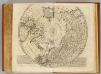
North Pole.
1 : 21500000 Bowen, Emanuel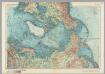
Arctic. Pergamon World Atlas.
1 : 20000000 Polish Army Topography Service