Maps of Vologda

Maps of Vologda

$title$

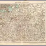
69-70. Russia centrale.

1 : 3000000 Touring club italiano
$title$

Moschovia nuova tavola

1 : 11000000 1 Karte : Kupferdruck ; 19 x 24 cm Ptolemaeus, Claudius [Vincenzo Valgrisi]
$title$

Moschovia nuova tavola

1 : 11000000 1 Karte : Kupferdruck ; 19 x 24 cm Ptolemaeus, Claudius [Vincenzo Valgrisi]
$title$

Vollstaendiger Kriegs-Schauplatz in Pohlen und Russland im Jahre 1812

1 : 2312000 Polsko im Kunst und Industrie Komptoir
$title$

[V]oll[st]and[i]ger Kriegs-Schauplatz in [P]o[h]len [und Rus]sland im Jahre [1]812

1 : 2312000 Polsko Kunst und Industrie Komptoir
$title$

Karte der Entstehung des Zarthums Moskau

Russland Moskauer Reich
$title$

19-20. RSFSR (Russian Soviet Federated Socialist Republic) in Europe, Central. The World Atlas.

1 : 3000000 USSR (Union of Soviet Socialist Republics).
$title$

Europäisches Russland

Hand-Atlas über alle Theile der Erde nach dem neuesten Zustande und über das Weltgebäude Stieler, Adolf bei Justus Perthes
$title$

[IX], uit: Geognostische Karte des Oesterreichischen Kaiserstaates mit einem grossen Theile Deutschland's u. Italien / hauptsachlich nach ... Haidinger's geognostischer Karte dieses Staates bearb. von Josef Scheda

1 : 3000000 titelvariant: General-Karte von Europa in 25 Blättern; Annotatie: Bijlage bij: General-Karte von Europa in 25 Blättern. - 1:2.592.000. - 1845-1847 Scheda, Joseph Wien : K.K. Militär. Geografisch. Institut
$title$

La Moscovie septentrionale, suivant les nouvelles observations de Messrs. de L'Académie Royale de S

1 : 5800000 2 Karten auf einem Blatt : Kupferdruck ; 22 x 30 cm (gesamt, inklusive Rahmen 52 x 39) Chez Pierre vander Aa
$title$

Carte hydrographique de la principale partie de la Russia Europeenne

1 : 3000000 Rusko západní Wiebeking, Carl Friedrich von Ranzinger, Jean
$title$

[Ost-Europa in 6 Blättern, Blatt 4]

Handatlas über alle Theile der Erde und über das Weltgebäude Stieler, Adolf Justus Perthes
$title$

[Ost-Europa in 6 Blättern, Enthaltend: Norwegen, Schweden, Russland, Kaukasien und die Türkei, Blatt 4]

Hand-Atlas über alle Theile der Erde und über das Weltgebäude Stieler, Adolf Justus Perthes
$title$

[Ost-Europa, Blatt 4]

Adolf Stieler's Handatlas über alle Theile der Erde und über das Weltgebäude Stieler, Adolf Justus Perthes
$title$

Europäisches Russland

Hand-Atlas über alle Theile der Erde nach dem neuesten Zustande und über das Weltgebäude Stieler, Adolf bei Justus Perthes
$title$

Europäisches Russland

Stieler's Hand-Atlas Stieler, Adolf bei Justus Perthes
$title$

Tabvla Asiae II

1 : 7900000 1 Karte : Holzschnitt ; 26 x 33 cm Münster, Sebastian [Bey den Henricpetrinischen]
$title$

Moscovia, pars avstralis / auctore Isaaco Massa

1 : 3700000 1 Karte : Kupferdruck ; 36 x 48 cm Massa, Isaac Abrahamsz typis apud P. Schenk et G. Valk
$title$

Nouvelle carte géographique du grand royaume de Moscovie représentant la partie méridionale &c. /

1 : 2600000 1 Karte : Kupferdruck ; 48 x 69 cm Visscher, Nicolas [Verlag nicht ermittelbar]
$title$

Rvssiæ, vulgo Moscovia, pars australis / auctore Isaaco Massa

1 : 3910000 1 Karte : Kupferdruck ; 38 x 51 cm Blaeu, Joan Apud Johan et Cornelium Blaeu
$title$

La Moscovie meridionale, suivant les nouvelles observations de Messrs. de L'Académie Royale de Scie

1 : 5800000 1 Karte : Kupferdruck ; 21 x 29 cm chez Pierre van der AA
$title$

La Moscovie meridionale, suivant les nouvelles observations de Messrs. de L'Académie Royale de Scie

1 : 5800000 1 Karte : Kupferdruck ; 21 x 29 cm chez Pierre van der AA
$title$

La Moscovie meridionale, suivant les nouvelles observations de Messrs. de L'Académie Royale de Scie

1 : 5800000 1 Karte : Kupferdruck ; 21 x 29 cm chez Covens et Mortier
$title$

La Moscovie meridionale, suivant les nouvelles observations de Messrs. de L'Académie Royale de Scie

1 : 5800000 1 Karte : Kupferdruck ; 21 x 29 cm chez Covens et Mortier
$title$

Ost-Europa, No. 4: Central-Russland.

1 : 3700000 Petermann, A.
$title$

Rvssiæ, vulgo Moscovia, pars australis / auctore Isaaco Massa

1 : 3957000 Annotatie: Met wapen; Origineel is Blad 137 in atlas factice; Annotatie geografische gegevens: Met 2 schaalstokken Isaac Abrahamszoon Massa 1586-1643 [Amsterdam : apud Johan. et Cornelium Blaeu]
$title$

Regni Poloniae magnique ducatus Lithuaniae nova et exacta tabula / ad mentem Starovolcij descripta

1 : 3100000 1 Karte : Kupferdruck ; 48 x 56 cm Homann, Johann Baptist [Johann Baptist Homann]
$title$

Regni Poloniæ magnique ducatus Lithuaniæ nova et exacta tabula / ad mentem Starovolcij descripta

1 : 3100000 1 Karte : Kupferdruck ; 48 x 54 cm Starovolski, Simon [Johann Baptist Homann]
$title$

U.S.S.R. in Europe - Central. Pergamon World Atlas.

1 : 2500000 Polish Army Topography Service
$title$

© MapTiler © OpenStreetMap contributors
How does it work?
These instructions will show you how to find historical maps online.
Getting started
Type the place name in the search box to find the exact location. You can further adjust the search by zooming in and out.
Zoom
Zoom in and out with the buttons or use your mouse or touchpad natively.
Exact Area tool
Click here and draw a rectangle over the map to precisely define the search area.
Set filters
Narrow your search with advanced settings, such as Years (from/to), Fulltext, Publisher, etc.
Results
See the results of your search on the right side. You can scroll down to find more maps of this location.
?

Download OldMapsOnline Mobile