Maps of Portugal

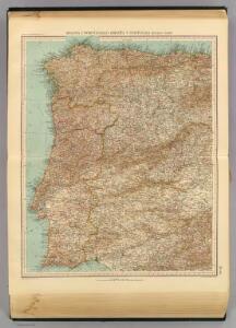
39-40. Spagna, Portogallo ouest.
1 : 1500000 Touring club italiano
Spanien westliche Hälfte
Grosser Hand-Atlas über alle Theile der Erde in 170 Karten Meyer, J. Verlag des Bibliographischen Instituts
Spanien west.
1 : 2350000 Radefeld, Carl Christian Franz, 1788-1874
Carte nouvelle et curieuse du royaume d'Espagne / C. Inselin, 1
1 Blatt : Inselin
Spain and Portugal.
1 : 4308480 Tallis, J. & F.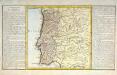
Le royaume de Portugal
1 Karte : Kupferdruck ; 30 x 31 cm, Bildgrösse 32 x 55 cm Clouet Mondhare
Espagne et Portugal. Flle. N.O.
1 : 1250000 Vivien St Martin, L.
El reyno de Portugal subdividido en muchas provincias
1 Karte : Kupferdruck ; 67 x 50 cm Longchamps en casa del autor, en casa del Barthelmy
Portugal, Algarve.
1 : 1250000 Robert Laurie & James Whittle
Les royaumes de Portugal et des Algarves
1 Karte : Kupferdruck ; 50 x 62 cm Delafosse; Mondhare chez Mondhare rue S. Jacques près S. Severin
Royaume de Portugal
1 Karte : Kupferdruck ; 32 x 42 cm Mentelle; Tardieu E. Mentelle
Le Portugal et ses rontieres avec l'Espagne / par ordre de M. le duc de Choiseul par le Sr. Bellin
1 Mapa, b/n. Datació aproximada. Bellin, Jacques Nicolas Dépôt de la Marine
[Spanien und Portugal, Blatt 1]
Adolf Stieler's Handatlas über alle Theile der Erde und über das Weltgebäude Stieler, Adolf Justus Perthes
[Spanien und Portugal in 4 Blättern, Blatt 1]
Handatlas über alle Theile der Erde und über das Weltgebäude Stieler, Adolf Justus Perthes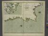
The coasts of PORTUGALL and part of SPAIN from cape finifterre to Gibralter
from The sea-atlas : containing an hydrographical description of most of the sea-coasts of the known parts of the world.
Utriusque Castiliae nova descriptio. [Karte], in: Novus atlas absolutissimus, Bd. 6, S. 40.
1 Karte aus Atlas Janssonius Offizin
Les frontieres d'Espagne et de Portugal
1 Karte : Kupferdruck ; 57 x 42 cm Fer; Starckman chez l'auteur dans l'isle du Palais sur le quay de l'orloge a la sphere royale
A new Military Map of Spain and Portugal compiled from The Nautical Surveys of Don Vincent Tofiño, the new Provincial maps of Don Tomas Lopez, the large map of the Ptrenees by Roussill, and various original documents
1 Mapa en 4 seccions dins d'un estoig. John Stockdale J. Stockdale
Regnorum Castellae veteris, legionis, et Gallaeciae principatuumque Biscaiae, et Asturiarum accuratissima descriptio
1 : 1400000 per F. de Wit Amstelodami : ex officina Frederici de Wit
Utriusque Castilliae nova descriptio. [Karte], in: Theatrum orbis terrarum, sive, Atlas novus, Bd. 2, S. 231.
1 Karte aus Atlas Blaeu, Joan Blaeu, Willem Janszoon
Utriusque Castiliae nova descriptio. [Karte], in: Le théâtre du monde, ou, Nouvel atlas contenant les chartes et descriptions de tous les païs de la terre, Bd. 2, S. 224.
1 Karte aus Atlas Blaeu, Willem Janszoon und Blaeu, Joan Blaeu, Willem Janszoon
Vtrivsqve Castiliæ nova descriptio
1 Karte : Kupferdruck ; 40 x 49 cm Janssonius Joannes Janssonius
Vtrivsqve Castiliæ nova descriptio
1 Karte : Kupferdruck ; 39 x 48 cm Schenk; Janssonius; Valck apud G. Valk et P. Schenk
Vtrivsqve Castiliæ nova descriptio
1 Karte : Kupferdruck ; 40 x 49 cm Blaeu; Blaeu bey Ioh. und Cornelio Blaeu
Utriusque Castiliae nova descriptio. [Karte], in: Novus Atlas, das ist, Weltbeschreibung, Bd. 2, S. 231.
1 Karte aus Atlas Blaeu, Joan Blaeu, Willem Janszoon
Utriusque Castiliae nova descriptio
1 : 1700000 Annotatie: Oorspr. verschenen in: Novus atlas ... - Amsterdami : apud Guiljelmum Blaeu, 1635; Origineel is Blad 8 in atlas factice Blaeu, Willem Jansz. [Amsterdam : W.J. Blaeu]
Spain = España : I
1 mapa. J. & C. Walker sculp. The Society for the Diffusion of Useful Knowledge; Charles Knight & Co
Partie septentrionale de la couronne de Castille
1 Karte : Kupferdruck ; 46 x 57 cm Robert de Vaugondy; Santini; Remondini chez Mr. Remondini
Partie septentrionale de la couronne de Castille
1 Karte : Kupferdruck ; 47 x 58 cm Robert de Vaugondy G. et D. Robert de Vaugondy
Portugal.
1 : 915000 Pinkerton, John, 1758-1826