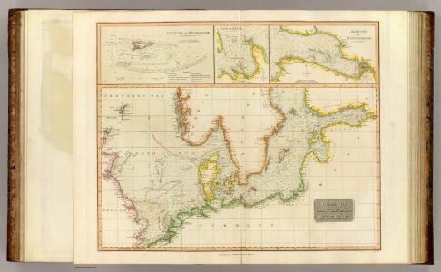
Maps of Götaland
North, Baltic seas.
1 : 3600000 Thomson, John
Nord- und Ostseeherrschaft III
1 : 10000000 Ostseeraum, Deutscher Orden, Deutsche Hanse
The Baltic Sea.
Mitchell, Samuel Augustus
The Baltic Sea.
Mitchell, Samuel Augustus
Part of North of Europe.
1 : 3800000 Melish, John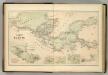
Chart of the Baltic.
Hughes, William
Téatre De La Guerre Des Couronnes du Nord. [Karte], in: Atlas nouveau, contenant toutes les parties du monde [...], Bd. 1, S. 67.
1 Karte aus Atlas Sanson, Nicolas Jaillot, Alexis Hubert und Mortier, Pieter
Schweden. Größte Machtentfaltung (1658)
1 : 18000000 Ostseeraum, Schweden, Expansion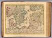
Courones du nord 2.
1 : 2500000 Covens et Mortier
Denmark Sweden and Russia on the Baltic.
1 : 3380000 Sharpe, J.
Ost-Europa, No. 3: Sud-Schweden, die Russischen Ostsee-Provinzen, Polen & West-Russland.
1 : 3700000 Petermann, A.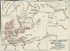
Nord- und Ostseeherrschaft II: Reich Waldemars II.
1 : 10000000 Ostseeraum Valdemar II., Danmark, Konge
Schweden, Norwegen 2.
1 : 4500000 Flemming, Carl
Uebersichtskarte von der Ost - See und den anliegenden Ländern

Nord- und Ostseeherrschaft IV
1 : 7000000 Ostseeraum, Polen-Litauen, Deutscher Orden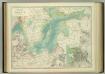
Basin of the Baltic.
1 : 2400000 Johnston, W. & A.K.
Kaart van de Oost-Zee met hare golven, baaijen, eilanden, rotsen, klippen, diepten, enz. enz. benevens den platten grond op groote schaal van de voornaamste zee-plaatsen krijgs- en handelhavens
1 : 2584000 uit de naauwkeurigste bronnen geput en uit de beste zee- en landkaarten opgemaakt door A.J. Bogaerts lithograaph Breda : Bogaerts
Schweden und Norwegen auch Daenemark
Stieler's Hand-Atlas Stieler, Adolf bei Justus Perthes
Pascaart vande Noort-Zee Waer in vertoont wort [...] Tabula Hydrographica Oceani Borealis [...] [Karte], in: Novus atlas absolutissimus, Bd. 9, S. 194.
1 Karte aus Atlas Janssonius Offizin
[Schweden und Norwegen auch Dänemark, Südliches Blatt]
Hand-Atlas über alle Theile der Erde nach dem neuesten Zustande und über das Weltgebäude Stieler, Adolf bei Justus Perthes
Pascaart vande Noort-Zee [...] gelegen tußchen Calis ende Dronten, als mede tußchen Doeveren en Hitlandt [...] [Karte], in: Het vijfde Deel Des Grooten Atlas : Vervatende De Water-Weereld, S. 145.
1 Karte aus Atlas Jansson, Jan Jansson, Jan
[Ost-Europa in 6 Blättern, Blatt 3]
Handatlas über alle Theile der Erde und über das Weltgebäude Stieler, Adolf Justus Perthes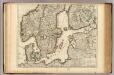
Courones du Nord (sud)
1 : 2600000 L'Isle, Guillaume de, 1675-1726
[Ost-Europa in 6 Blättern, Enthaltend: Norwegen, Schweden, Russland, Kaukasien und die Türkei, Blatt 3]
Hand-Atlas über alle Theile der Erde und über das Weltgebäude Stieler, Adolf Justus Perthes
[Ost-Europa, Blatt 3]
Adolf Stieler's Handatlas über alle Theile der Erde und über das Weltgebäude Stieler, Adolf Justus Perthes
Erdkarte zur Übersicht des Kolonialbesitzes, der konsularischen und
1 : 50000000 Kiepert, Richard ; Limpricht, Max Geographische Verlagshandlung Dietrich Reimer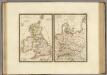
Iles Britanniques anciennes, Germanie ancienne, Rhetie, Pannonie, Norique.
1 : 3800000 Brue, Adrien Hubert, 1786-1832
Tabula Europae IIII. [Karte], in: Geographia universalis vetus et nova complectens Claudii Ptolemaei Alexandrini enarrationis libros VIII, S. 231.
1 Karte aus Atlas Münster, Sebastian [und Ptolemaeus, Claudius]
Carte générale aéronautique internationale
1 : 2186607 Evropa střední Ministerstvo veřejných prací