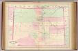
Maps of Nebraska
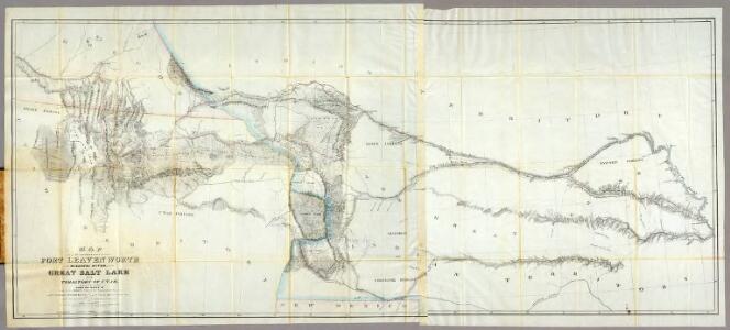
Map of a Reconnoissance between Fort Leavenworth ... and the Great Salt Lake ...
1 : 1000000 Stansbury, Howard
142. Colo., Kans.
1 : 3000000 Touring club italiano
Kan., Neb., Colo.
1 : 4000000 Mitchell, Samuel Augustus
Utah. Colorado.
1 : 3100000 Colton, G.W.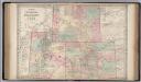
Wyoming, Colorado and Utah.
1 : 2090880 Colton, G.W.
Post route map of the states of Kansas and Nebraska : showing post offices with the intermediate distances and mail routes in operation on the 1st of December, 1900 / published by order of Postmaster General Charles Emory Smith under the direction of A.
from Parts
Chart of the Internal Part of Louisiana.
1 : 2550000 Pike, Zebulon Montgomery
Utah and Colorado.
Rand McNally and Company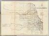
Kansas, Nebraska.
1 : 1170000 U.S. General Land Office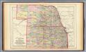
Kansas, Nebraska.
1 : 1850000 Mitchell, Samuel Augustus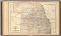
Kansas, Nebraska.
1 : 1850000 Mitchell, Samuel Augustus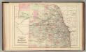
Kansas, Nebraska.
1 : 1850000 Mitchell, Samuel Augustus Jr.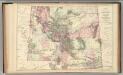
Montana, Idaho, and Wyoming.
1 : 2600000 Mitchell, Samuel Augustus Jr.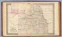
Kansas, Nebraska.
1 : 1850000 Mitchell, Samuel Augustus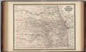
Kansas and Nebraska.
1 : 1370000 Johnson, A.J.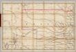
(Nebraska, Colorado) Railroad Map of the United States.
1 : 506880 Rand McNally and Company
Nebraska and Kansas.
1 : 4840000 Colton, G.W.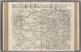
AutoTrails Map, Southern Nebraska, Eastern Colorado, Kansas, Northeastern New Mexico, Northern Oklahoma.
1 : 1626000 Rand McNally and Company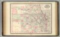
Kansas and Nebraska.
1 : 1370000 Johnson, A.J.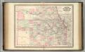
Kansas and Nebraska.
1 : 1370000 Johnson, A.J.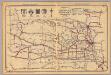
Nebraska.
1 : 2000000 Rand McNally and Company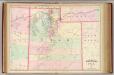
Utah.
1 : 1267200 Asher & Adams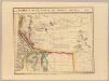
Parties, Etats-Unis et Nouv. Mexique. Amer. Sep. 48.
1 : 1641836 Vandermaelen, Philippe, 1795-1869
Nebraska. Oklahoma.
1 : 1665000 Hammond, C.S.
Nebraska.
Rand McNally and Company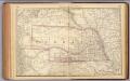
Nebraska.
1 : 2100000 Rand McNally and Company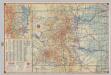
Shell Highway Map of Colorado.
1 : 1267200 Shell Oil Company
Map of Military Department of the Platte, Nebraska. sheet no. 2
1 : 1200000 Jones, William Albert 1841-1914; États-Unis. Corps of Engineers [Omaha, Nebr.] : Engineer Dept., U.S. Army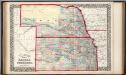
County & township map of the states of Kansas and Nebraska.
1 : 1900000 Mitchell, Samuel Augustus Jr.