Maps of Seine-Saint-Denis

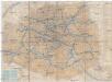
Nord-Est: Paris Et Ses Environs.
1 : 40000 Service Geologique Des Mines (France)
Flle. 3. St. Denis, uit: Carte topographique des environs de Versailles dite "Carte des chasses du Roi"
1 : 28800 titelvariant: Carte des chasses du Roi; Annotatie: Herdruk van originele koperplaten; Oorspr. uitg.: 1764-1807; Voor aanwezige bladen zie overzichtsblad; Annotatie geografische gegevens: Opname: 1764-1773 [Paris : IGN]
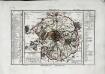
Topographia regii ac inclyti monasterii S. Dionysii in quo mausolea regum Franciae a Dagoberto I. usque ad nostra tempora visuntur
1 : 5000 Saint-Denis (Francie) Weigel, Christoph C. Weigelius
Plan Monumental de Paris au XVII siécle I.

Grundriss des Friedhofes Pére la Chaise
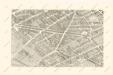
La Topographie de Paris ou Plan détaillé de la Ville de Paris 8

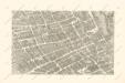
La Topographie de Paris ou Plan détaillé de la Ville de Paris 7

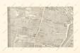
La Topographie de Paris ou Plan détaillé de la Ville de Paris 9

La Topographie de Paris ou Plan détaillé de la Ville de Paris 3
Paris au XVIII siécle 14
Paris au XVIII siécle 10
Paris au XVIII siécle 5

[Linkerhelft], uit: La ville, cité, université de Paris
1 : 4500 titelvariant: Le plan de Paris par Truschet et Hoyau; Annotatie: Bijlage bij: Le plan de Paris par Truschet et Hoyau ... - Zürich : Seefeld, 1980; Facs. van de uitg.: A Paris : par Olivier Truchet, & Germain Hoyau, [1550] Olivier Truschet; Germain Hoyau Zürich : Seefeld
La Topographie de Paris ou Plan détaillé de la Ville de Paris 13

La Topographie de Paris ou Plan détaillé de la Ville de Paris 11-14

Plan de la ville de Paris

Nieuwe kaart van de buitenstreeken van Parys : meetkundig opgenomen in 1792 en 1793 met alle de nieuwe sterkten, verschansingen en versperringen tusschen de rivieren de Seine en de Marne
1 : 80000 Allart, J. (Johannes), 1754-1816 by Johannes Allart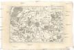
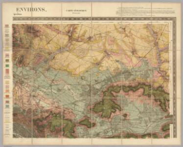
Environs de Paris
1 : 130000 Paříž-oblast (Francie) Bonne, Rigobert André
Carte topographique du département de Paris
1 Karte : Kupferdruck ; 25 x 36 cm, Bildgrösse 32 x 42 cm Desnos chez le Sr. Desnos ing.r geog.e et lib.re du roi de Danemark rue St. Jacques
Paris, France.
1 : 97000 Colton, G.W.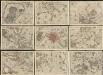
Environs de Paris : levés geometriquement
1 : 18500 Lagrive, Jean de, 1689-1757 De l'imprimerie de Charbonnier, rue S. Jacques au Chariot d'or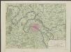
Nieuwe kaart van de buitenstreeken van Parys : meetkundig opgenomen in 1792 en 1793 met alle de nieuwe sterkten, verschansingen en versperringen tusschen de rivieren de Seine en de Marne
Te Amsterdam : by Johannes Allart
Environs de Paris
1 : 40000 Paříž-oblast (Francie) Longuet magasin de cartes géographiques de Longuet s.eur de Simonneau
Plan des verschanzten Lagers von Paris

Stanford's map of the environs of Paris : shewing the fortifications
1 : 61000 Edward Stanford Ltd Edward Stanford
Paris
Paříž-oblast (Francie) Landes Industrie Comptoirs
Fortifications du Departement de la Seine
Département de Paris
1 Karte : Kupferdruck ; 17 x 18 cm, Bildgrösse 18 x 27 cm Houdan au dépôt de l'atlas national de France rue de la Monnoye no. 5
Environs Paris.
1 : 90000 Letts, Son & Co.