Maps of Seven Seas (Open Ocean)

Pacific Ocean.
1 : 50000000 Society for the Diffusion of Useful Knowledge (Great Britain)
Pacific Ocean.
1 : 50000000 Letts, Son & Co.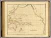
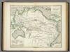
Pacific Ocean.
1 : 35000000 Arrowsmith, John
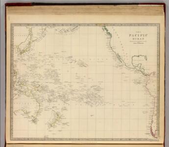
Pacific.
1 : 75000000 Andree, Richard; Times (London, England)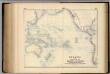
Oceania, or Islands in the Pacific Ocean.
1 : 41000000 Fullarton, A. & Co.
Grosser Ocean.
1 : 75000000 Andree, Richard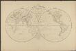
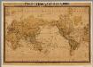
Mappemonde en deux hémisphères où sont tracées les lignes de faîte des grands bassins qui partagent la surface du globe
1 : 44000000 par L. Vivien gravé par Desbuisson [...] ; écrit par Arnoul Paris : Hachette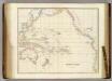
Pacific Ocean.
1 : 40000000 Arrowsmith, John
Pacific Ocean.
1 : 90000000 Arrowsmith, Aaron; Lewis, Samuel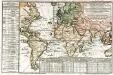
Carte des lieux où les differentes longueurs du pendule à secondes ont été observées
1 Karte : Kupferdruck ; 24 x 37 cm, Blattgrösse 46 x 61 cm Buache Philippe Buache
Magnum Mare del Zur cum insula California
1 Karte : Kupferdruck ; 49 x 55 cm Renard by L. Renard
Ocean Atlantique et Ocean Indien.
1 : 50000000 Vivien St Martin, L.
Inhabited World.
1 : 93000000 Woodbridge, William C.
Isothermal chart.
1 : 95000000 Woodbridge, William C.
Isothermal chart, productions.
1 : 80000000 Woodbridge, William C.
Pacific Ocean : compiled from Admiralty surveys & other official sources
1 : 15000000 India-Rubber, Gutta-Percha & Telegraph Works Co J.D. Potter
Africa
1 : 6500000 Arrowsmith, Aaron, 1750-1823 A. Arrowsmith, Rathbone Place
[Pocket] Map of the Borough of Queens, New York City.
From Queens
Longueurs du pendule.
1 : 75000000 L'Isle, Guillaume de, 1675-1726
Les câbles anglais
1 : 80000000 Léon de Montarlot; Le monde illustré Paris : Le Monde illustré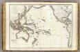
Oceanie.
1 : 29500000 Brue, Adrien Hubert, 1786-1832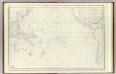
Grand Ocean.
1 : 25000000 France. Depot-general de la Marine
Oceana or Pacific Ocean.
1 : 54000000 Tanner, Henry S.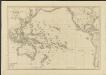
Océanie ou cinquième partie du monde
1 : 29450000 carte encyprotype réduite de celle sur 4 feuilles du même auteur par A. Brué [...] Paris : chez Ch. Picquet
Oceana Or Pacific Ocean.
1 : 55000000 Tanner, Henry S.
Oceana Or Pacific Ocean.
1 : 55000000 Tanner, Henry S.
Objevy zemí na hranici středního a nového věku
Productenkaart der Aarde / neu bearb. Osw. Meinke
1 : 54600000 Meinke, Osw. Esslingen : Harburger
Atlas über die Entwicklung von Industrie und Handel der Schweiz in dem Zeitraume vom Jahr 1770 bis zum Jahr 1870
1 : 45000000 1 Atlas ([3], VIII Bl.) im Auftrage der schweizerischen Commission für die additionellen Ausstellungen in Wien, bearbeitet von Dr. Hermann Wartmann Wurster Randegger & Co., Winterthur