Maps of Al Wahat

Maps of Al Wahat

$title$

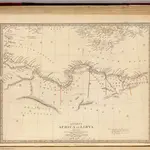
Ancient Africa or Libya II.

1 : 5100000 Society for the Diffusion of Useful Knowledge (Great Britain)
$title$

Tunis et Tripoli

Nouvel atlas physique politique et historique de l'Empire ottoman et des états limitrophes en Europe, en Asie et en Afrique, en quarante feuilles Hellert, J.J. Bellizard, Dufour et Cie
$title$

Sev. Afrika

$title$

Karte der Nordküste Afrika's

Afrika severní Voss, C. L. Reimer
$title$

General outline of the Authors route as adapted to the second section of part the second of these travels

1 : 1
$title$

[XXIII], uit: Geognostische Karte des Oesterreichischen Kaiserstaates mit einem grossen Theile Deutschland's u. Italien / hauptsachlich nach ... Haidinger's geognostischer Karte dieses Staates bearb. von Josef Scheda

1 : 3000000 titelvariant: General-Karte von Europa in 25 Blättern; Annotatie: Bijlage bij: General-Karte von Europa in 25 Blättern. - 1:2.592.000. - 1845-1847 Scheda, Joseph Wien : K.K. Militär. Geografisch. Institut
$title$

Africa 1:2.000.000, Cyrenaica

Cyrenaica, Libya
$title$

Africae Propriae Tabula, In qua, Punica regna vides; Tyrios, et Agenoris urbem. [Karte], in: Theatrum orbis terrarum, S. 523.

1 Karte aus Atlas Ortelius, Abraham Vrients, Jan Baptista
$title$

Africae Propriae Tabula, In qua, Punica regna vides; Tyrios, et Agenoris urbem. [Karte], in: Theatrum orbis terrarum, S. 439.

1 Karte aus Atlas Ortelius, Abraham
$title$

Grece et ses Colonies.

Andriveau-Goujon, J.
$title$

Feuille 46 (D VII), uit: Carte géologique internationale de l'Europe : la carte, votée au congrès géologique international de Bologne en 1881, est exécutée conformément aux décisions d'une commission internationale, avec le concours des gouvernements, sous le dir. de M.M. Beyrich et Hauchecorne

Annotatie: Blad 48 gamme des couleurs; blad 49: bladwijzer en titelblad Heinrich Ernst Beyrich 1815-1896; Wi. Hauchecorne Berlin : Reimer / (Berlin: Institut lithographique)
$title$

Feuille 47 (E VII), uit: Carte géologique internationale de l'Europe : la carte, votée au congrès géologique international de Bologne en 1881, est exécutée conformément aux décisions d'une commission internationale, avec le concours des gouvernements, sous le dir. de M.M. Beyrich et Hauchecorne

Annotatie: Blad 48 gamme des couleurs; blad 49: bladwijzer en titelblad Heinrich Ernst Beyrich 1815-1896; Wi. Hauchecorne Berlin : Reimer / (Berlin: Institut lithographique)
$title$

[Kaart], uit: Aegypten und Sues-Canal

1 : 3500000 titelvariant: Oorlogskaart; Egypte en Suez-kanaal; Annotatie: In omslag met titel: Oorlogskaart : Egypte en Suez-kanaal. - Amsterdam : Seyffardt, 1882; Annotatie geografische gegevens: Aangegeven zijn vaarroutes over de Middellandse Zee en de Rode Zee; Inzetkrt.: Nil-Delta und Landenge von Sues. - 1:1.500.000; [Noord-Afrika, West-Azië, Zuid-Europa] Gotha : Justus Perthes
$title$

Aegypten und Sues-Canal

1 : 3500000 Egypt Justus Perthes
$title$

[XXIV], uit: Geognostische Karte des Oesterreichischen Kaiserstaates mit einem grossen Theile Deutschland's u. Italien / hauptsachlich nach ... Haidinger's geognostischer Karte dieses Staates bearb. von Josef Scheda

1 : 3000000 titelvariant: General-Karte von Europa in 25 Blättern; Annotatie: Bijlage bij: General-Karte von Europa in 25 Blättern. - 1:2.592.000. - 1845-1847 Scheda, Joseph Wien : K.K. Militär. Geografisch. Institut
$title$

Africa 1:2.000.000, Tunisie

Tripolitania, Libya (also Tunisia)
$title$

Letecká navigační mapa

$title$

Eastern Libya, Aerodrome Map

Aerodrome map of Eastern Libya, DR 326. Great Britain. Army. Royal Engineers. Field Survey Company, 512th. [Cairo] : [Survey Directorate, Middle East]
$title$

Barca. Afrique 4.

1 : 1641836 Vandermaelen, Philippe, 1795-1869
$title$

Carte De La Mer Mediterranee. VIII.

Roux, Joseph
$title$

Een gedeelte van de kust van Barbarija beginnende van P. Soliman tot C. Mezurata

Libya Gerard van Keulen
$title$

Tripoli.

1 : 2000000 Society for the Diffusion of Useful Knowledge (Great Britain)
$title$

Partie, l'Egypte. Afrique 5.

1 : 1641836 Vandermaelen, Philippe, 1795-1869
$title$

Carte De La Mer Mediterranee. IX.

Roux, Joseph
$title$

Feuille No. 7, uit: Carte de la Turquie d'Asie (moins l'Arabie) / dessiné et héliogravé au Service géographique de l'Armée

1 : 1000000 titelvariant: Turquie d'Asie; Annotatie: Titel boven de kaart: Turquie d'Asie; Bl. genummerd 1-4 en 7-10; Met lijst van de meest gebruikte woorden op de kaart vertaald uit het Turks, Arabisch en Perzisch; Annotatie geografische gegevens: Inzetkrt. op bl. 9: Plan de Jérusalem et de ses environs, Plan d'Alep, Plan de Damas et de ses faubourgs, Plan de Beyrout et de ses environs (alle 1:50.000) Service géographique de l'Armée [S.l. : Service géographique de l'Armée]
$title$

Tripoli, Egypt.

1 : 2000000 Society for the Diffusion of Useful Knowledge (Great Britain)
$title$

Western Libya, Aerodrome Map

Aerodrome map of Western Libya, DR 326. Great Britain. Army. Royal Engineers. Field Survey Company, 512th. [Cairo] : [Survey Directorate, Middle East]
$title$

Europe 1:1.000.000

1 : 1000000 Kréta (Řecko) Geographical Section, General Staff
$title$

Mittelmeer

1 : 600000 Egejské moře Reichs-Marine-Amt
$title$

Carte De La Mer Mediterranee. VI.

Roux, Joseph
© MapTiler © OpenStreetMap contributors
How does it work?
These instructions will show you how to find historical maps online.
Getting started
Type the place name in the search box to find the exact location. You can further adjust the search by zooming in and out.
Zoom
Zoom in and out with the buttons or use your mouse or touchpad natively.
Exact Area tool
Click here and draw a rectangle over the map to precisely define the search area.
Set filters
Narrow your search with advanced settings, such as Years (from/to), Fulltext, Publisher, etc.
Results
See the results of your search on the right side. You can scroll down to find more maps of this location.
?

Download OldMapsOnline Mobile