Maps of Czech Republic

Germany. Deutschland IV. Austrian Dominions I.
1 : 1760000 Society for the Diffusion of Useful Knowledge (Great Britain)
Bez titulu: Rakouské dějiny
59-60. Cecoslovacchia, Ungheria.
1 : 1500000 Touring club italiano
Mapa vsi Dědová s přilehlým vrchnostenských dvorem a lesem
1 : 3625
SO Deutschland, Oesterreich. Lande.
1 : 5500000 Brudin, J. L.; Stieler, Adolf
Austrian Empire 1.
1 : 1774080 Letts, Son & Co.
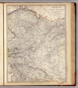
Germany.
Rakousko Fallon, Ludwig August von Lipský, Ján Baldwin & Cradock
SE pt. of Germany.
1 : 2650000 Bowen, Emanuel
Provincia Austriaca Societatis Iesu
1 : 1700000 Mollova mapová sbírka Seutter, Matthäus Mayr, Johann Baptist Seutter, Matthäus
Die Kaiserl. Oesterreichischen Provinzen in Deutschland nebst dem Fürstenthume Liechtenstein
Österreich
[Süd-Östliches Deutschland]
Schul-Atlas über alle Theile der Erde nach dem neuesten Zustande, und über das Weltgebäude Stieler, Adolf Justus Perthes
Les Pays Tchéques
Morava (Česko) Conseil National Tschécoslovaque
Sbírka map a diagramů použitých na mírových konferencích v Paříži v letech 1919 - 1920

L'Empire, d'Allemagne
1 : 1200000 Mollova mapová sbírka Sanson, Nicolas Quasy, Robert
Bez titulu: Čechy

Routen und Manipulations-Karte der oesterr[eichischen] ungar[ischen] Eisenbahnen
Rakousko-Uhersko Stulík, František Nechvíle, Josef J. Farský
Süd-Östliches Deutschland, enthält die Oesterreichischen Lande
Schul-Atlas über alle Theile der Erde nach dem neuesten Zustande, und über das Weltgebäude Stieler, Adolf bei Justus Perthes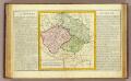
La Boheme, la Silesie.
1 : 3800000 Clouet, J. B. L. (Jean-Baptiste Louis), b. 1730
Süd Deutschland und die Alpenlaender
[Allgemeiner Atlas über alle Theile der Erde in 29 Blättern] Ziegler, Jakob Melchior Top. Anstalt v. J. Wurster u. Comp.
Československo v mapách

Verkehrs - Karte von Böhmen, Mähren, Schlesien, Erzh. Oesterreich...

[Rakousko]
1 : 2115000 Evropa střední
Finland. Poland. Austria, Czechoslovakia, and Hungary. Yugoslavia.
1 : 4127000 Hammond, C.S.
Evropa]
1 : 2100000 Mollova mapová sbírka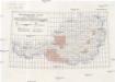
Österreichische Karte 1:25 000
1 : 25000 Rakousko Militärgeographisches Institut
Österreichische Karte 1:25 000
1 : 25000 Rakousko
[Oesterreichisch-Ungarischen Monarchie]
1 : 25000 Rakousko-Uhersko Militärgeographisches Institut
[Oesterreichisch-Ungarischen Monarchie]
1 : 50000 Rakousko-Uhersko K. u. k. Militärgeographisches Institut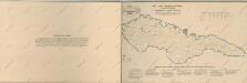
Atlas d'industrie de la république tchécoslovaque