Maps of Switzerland

Switzerland.
1 : 910000 Society for the Diffusion of Useful Knowledge (Great Britain)
Switzerland.
1 : 615000 Playfair, Principal
Carte ancienne de la Suisse
1 Karte : Kupferdruck ; 19 x 19 cm, Bildgrösse 36 x 45 cm Châtelain s.n.
<<Die>> Eydgnoschafft mit dero Grentzen
1 : 2000000 1 Karte Hans Conradt Geiger delinea. ; Con. Meyer sc. [J.J. Bodmer], [Zürich]
Die Schweiz.
1 : 1400000 Reichard, C. G.
Süd-West Deutschland und Schweiz
Adolf Stieler's Handatlas über alle Theile der Erde und über das Weltgebäude Stieler, Adolf Justus Perthes
Die Schweiz.
1 : 800000 Stein, Christ. Gottfr. Dan.
[Süd-West Deutschland und Schweiz, Südlicher Theil]
Hand-Atlas über alle Theile der Erde und über das Weltgebäude Stieler, Adolf Justus Perthes
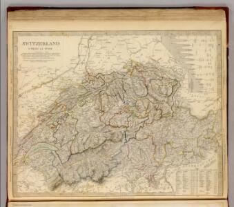
Switzerland.
1 : 955000 Teesdale, Henry
Sud-West Deutschland Und Schweiz. Sudlicher Theil.
1 : 925000 Vogel, C.
Zweite Manuskriptkarte der Schweiz
1 : 350000 Mit Einzeichnung der Kantonsgrenzen mittels lasierenden Farbbändern. Ohne Datumsangabe (Datierung gemäss Angaben von Samuel Wyder und Hans-Uli Feldmann in ihrem Aufsatz in Cartographica Helvetica, Heft 43 (2011): Die Karten der Schweiz (1620-1657) von Hans Conrad Gyger, S. 11-14). Gyger, Hans Conrad, andere Schreibweisen: Geiger, Geyger, (1599-1674), Kartograf und Ingenieur, von Zürich
Historischer Atlas der Schweiz
1501 - 1536 Mandrot, Louis-Alphonse de Deutsche Buchhandlung von J. Kessmann
Les Suisses Leurs Alliez Auec les Sujets des Suisses, et des Alliez
1 : 750000 Mollova mapová sbírka Du Tralage, Jean Nicolas Nolin, Jean Baptiste II.
Carte physique et politique de la Suisse
1 Karte : Kupferdruck ; 31 x 42 cm Mentelle; Chanlaire; Blondeau chez les auteurs P. G. Chanlaire rue Geoffroy-Langevin no. 328, et E. Mentelle cour du Louvre no. 7
Exactissima Helvetiae, Rhaetiae, Valesiae caeterorumq. confoederatorum ut et finitimorum populorum regionum tabula
1 Karte ex conatibus Nicolai Visscher ; A. Hogeboom sculp. Visscher, [Amsterdam]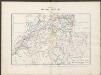
Historischer Atlas der Schweiz
1536 - 1650 Mandrot, Louis-Alphonse de Deutsche Buchhandlung von J. Kessmann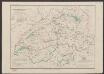
Übersichtskarte des schweizerischen Pegel und Witterungsstationennetzes
1 : 600000 Topogr. Anstalt v. Wurster, Randegger & Cie
[Süd-West Deutschland und Schweiz, Südlicher Theil]
Handatlas über alle Theile der Erde und über das Weltgebäude Stieler, Adolf Justus Perthes
Reliefkarte der Schweiz
Originaltitel: Nova Helvetiae Tabula geographica Illustrissimis et Potentissimis Cantonibus et Rebuspublicis Reformatae Religionis Tigurinae, Bernensi, Glaronensi, Basilensi, Scaphusianae, Abbatis cellanae. Scheuchzer, Johann Jakob (1672-1733), Arzt und Naturforscher, von Zürich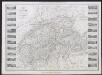
Nouvelle carte illustrée de la Suisse présentant les divisions physiques et politiques, les routes et les chemins de fer, les villes industrielles, les lieux remarquables par des curiosités naturelles
Vuillemin, Alexandre Delarue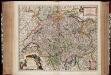
Exactissima Helvetiae Rhaetiae, Valesiae caeterorumq. confoederatorum ut et finitimorum populorum regionum tabula / ex conatibus Nicolaum Visscher Amst. Bat. ; A. Hogeboom sculp
1 : 800000 Annotatie: Cum privil. praepotentiss. Ordinum General. Belgii Foederati; Met opdracht van Nicolaus Visscher; Origineel is Blad 117 in atlas factice; Annotatie geografische gegevens: Met 5 schaalstokken; Legenda Nicolaes Jansz. Visscher jr. 1649-1702; Andries Hogeboom fl. 1665-1682 Amst. Bat. : ex conatibus Nicolai Visscher
Helvetia
1 : 2500000 1 Karte [Pierre Duval] [Hoffmann], [Nürnberg]
Nova et accuratissima Helvetiae foederatarumque cum ea, nec non subditarum, regionum tabula
1 Karte primum composita per de l'Isle, nunc vero aucta & emendata = Les cantons suisses, leurs alliés & pays sujets / composée par Guillaume de l'Isle, corrigée & augmentée le plus nouvelles chez I.B. Elwe, Amsterdam
Helvetia
1 : 1700000 1 Karte [von Heinrich Heidegger] [bey Orell, Füssli und Compagnie], [Zürich]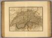
Suisse.
1 : 745000 Picquet, C.
Switzerland.
1 : 923000 Johnson, A.J.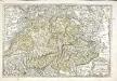
Les Suisses, les alliés des Suisses et leurs suiets
1 Karte : Kupferdruck ; 36 x 53 cm Sanson; Cordier Nicolas Sanson
Switzerland and the county of the Grisons, wherein is described the XIII Switz Cantons with their allies & c
1 : 760000 humbly inscrib'd to [...] the Marquiss of Harold & c. rev. by J. Senex [London] : [Brown]
Nova et accuratissima Helvetiae foederatarumque cum ea, nec non subditarum, regionum tabula
1 Karte primum composita per de l'Isle, nunc vero aucta & emendata = Les cantons suisses, leurs alliés & pays sujets / composée par Guillaume de l'Isle, corrigée & augmentée, le plus nouvelles chez Elwe & Langeveld, Amsterdam
Exactißima Helvetiae Rhaetiae, Valesiae Caeterorumque Confoederatorum ut et finitimorum Populorum Regionum Tabula
1 : 760000 Mollova mapová sbírka Hogeboom, Andries Schenk, Peter II