Maps of Swabia

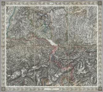
Sheet VI: Karte Des Oesterreichischen Kaiserstaates.
1 : 576000 Scheda, Josef
VI, uit: General-Karte des oesterreichischen Kaiserstaates mit einem grossen Theile der angrenzenden Länder / durch Josef Scheda ... bearb. und hrsg
1 : 576000 Annotatie geografische gegevens: Maatstokken: oesterreichische Meilen, geografische oder deutsche Meilen, preussische Meilen, türkische Berri, französische Lieues, russische Werste; Maatstok per blad: wiener Klafter, öster. Meilen; Blad XIX: statistische en taalkundige informatie; Blad XIX: legenda [Wien : K.K. Militärisch-Geografisches Institut]
[Zürich-Innsbruck]
1 : 576000 Bodamské jezero-oblast
<<Die>> erst Tafel innhaltend das Schweytzerlandt mit anstossenden Ländern
1 : 750000 1 Karte [Sebastian Münster] [Henricpetri], [Basel]
Les Marches ou Frontieres d'Allemagne, et d'Italie
1 : 700000 Mollova mapová sbírka Fer, Nicolas de Berterham, Jan Baptist Fricx, Eugené Henry
Natur und Kunst Producten Karte von Vorder Oestreich
1 Karte : Kupferdruck ; 25 x 33 cm Blum von Kempen; Bernard Johann Otto
<<[Die>> Gaugrafschaften im 11. Jahrhundert]
1 : 800000 1 Karte Wurster, Winterthur
Neue Karte von der Schweiz oder Helvetien in die XIII Eidgenossenschaften, ihre Bundsverwandten und Unterthanen eingetheilt
1 Karte in 2 Bl nach den zuverlässigsten Nachrichten und neuesten astronomischen Beobachtungen, London 1778 bei W. Faden [, neu hrsg. von F.A. Schraembl] Schalbacher, Wien
Carte de la Suisse, ou l'on a marqué les routes suivies par Wil. Coxe
1 : 450000 1 Karte in 2 Teilen [par William Coxe] [Verlag nicht ermittelbar], [Erscheinungsort nicht ermittelbar]
Innsbruck, Trient, Basel, Zürich
1 : 750000 Basilej (Švýcarsko : oblast) Hübl, E. K. u. k. Militärgeographisches Institut
Innsbruck, Trient, Basel, Zürich
1 : 750000 Basilej (Švýcarsko : oblast) K. k. militär-geographisches Institut
Circvli Sveviae Mappa
1 : 470000 Mollova mapová sbírka Hase, Johann Matthias Homann, Johann Baptista - dědici
Die in und um Schwaben gelegenen östreichischen Antheile in der ämtlichen Sprache Vorderöstreich
1 Karte : Kupferdruck ; 22 x 24 cm Reilly F. J. J. von Reilly
Circvlvs Svevicvs
1 Karte : Kupferdruck ; 32 x 38 cm Weigel; Kauffer Christoph Weigel
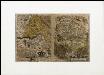
Landtaflen
1 Atlas [von Johannes Stumpf] Christoffel Froschower, Zürych
Kanton Zürich: Staats-, Gemeinde- und Genossenschaftswaldungen: Übersichtsplan mit Blatteinteilung
1 : 50000 Ohne Erstellungsdatumsangabe. Ausgangskarte: Ausschnitt aus der Übersicht der Blätter des Topographischen Atlasses der Schweiz (Siegfried-Karte). Hartmann, Karl, Forstadjunkt im Zürcher Oberforstamt, von Aarau, in Unterstrass
<<Die>> Eydtgnoschafft oder das Schweitzerland mit den anstossenden Ländern
1 : 750000 1 Karte [Sebastian Münster] [Henricpetri], [Basel]
La Souabe
1 : 870000 Mollova mapová sbírka Sanson, Guillaume Sanson, Guillaume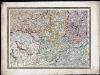
[Bodensee oder Kostnitzersee] : XVIII
Schrämbl, Franz Anton
S. R. I. Sueviæ circulus atq[ue] ducatus
1 Karte : Kupferdruck ; 46 x 54 cm Schenk; Visscher nunc apud P. Schenk iun
Circulus siue liga Sveviae, vulgo Schwabische Kraiss
1 Karte : Kupferdruck ; 31 x 23 cm Seltzlin; Ortelius s.n.
Circulus siue liga Sveviae, vulgo Schwabische Kraiss
1 Karte : Kupferdruck ; 31 x 23 cm Seltzlin; Ortelius s.n.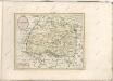
Circulus siue Liga Sveviae vulgo Schwabische Kraiß
Seltzlin, David
Tabula nova heremi Helvetiorum
1 : 400000 1 Karte [hrsg. von Martin Waldseemüller?] [Schott], [Strassburg]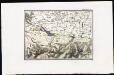
[Lac de Constance]
Tardieu, Ambroise
Circuli Sveviae
1 : 477000 Švábsko (Německo) Hase, Johann Matthias Homan[n]ianorum Heredum
Niederschlagsmengen der Nordschweiz im Jahre 1891
1 : 1300000 1 Karte Schlumpf, Winterthur