Maps of Hesse

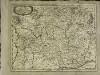
Sheet I: Karte Des Oesterreichischen Kaiserstaates.
1 : 576000 Scheda, Josef
General-Karte des österreichischen Kaiserstaates mit einem großen Theile der angrenzenden Länder
1 : 576000 Scheda, Josef k.k. Militärgeograph. Inst.
I, uit: General-Karte des oesterreichischen Kaiserstaates mit einem grossen Theile der angrenzenden Länder / durch Josef Scheda ... bearb. und hrsg
1 : 576000 Annotatie geografische gegevens: Maatstokken: oesterreichische Meilen, geografische oder deutsche Meilen, preussische Meilen, türkische Berri, französische Lieues, russische Werste; Maatstok per blad: wiener Klafter, öster. Meilen; Blad XIX: statistische en taalkundige informatie; Blad XIX: legenda [Wien : K.K. Militärisch-Geografisches Institut]
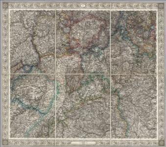
Süd-West Deutschland und Schweiz
Adolf Stieler's Handatlas über alle Theile der Erde und über das Weltgebäude Stieler, Adolf Justus Perthes
[Süd-West Deutschland und Schweiz, Nördlicher Theil]
Handatlas über alle Theile der Erde und über das Weltgebäude Stieler, Adolf Justus Perthes
[Süd-West Deutschland und Schweiz, Nördlicher Theil]
Hand-Atlas über alle Theile der Erde und über das Weltgebäude Stieler, Adolf Justus Perthes
Sud-West Deutschland Und Schweiz.
1 : 925000 Vogel, C.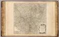
Haut, Bas Rhin.
1 : 640000 Robert de Vaugondy, Gilles, 1688-1766
Circulus Franconicus ad occidentem vergens
1 Karte : Kupferdruck ; 37 x 32 cm Weigel; Kauffer Christoph Weigel
Grand Theatre de la Guerre sur les Frontieres de France & d'Allemagne
1 : 240000 Mollova mapová sbírka Delisle, Guillaume Ottens, Josua
Avstrasiorvm sive Franciae orientalis dvcatvs cvm pago Thvringiae avstralis, in svos pagos singvlares svb imperatoribvs Francicis et Saxonicis ex variis medii aevi diplomatibvs chartis ac docvmentis descriptvs
Durynsko (Německo)
L'electorat de Mayence partie de la Hesse et du palatinat du Rhin
1 Karte : Kupferdruck ; 54 x 48 cm Le Rouge chez le Rouge ruë des Augustins vis a vis le Panier fleuri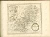
Electoratus Moguntinus...
Franconia
1 Karte : Kupferdruck ; 28 x 36 cm Sandrart Jakob von Sandrart
Franconia
1 Karte : Kupferdruck ; 28 x 37 cm Merian
L'electorat de Mayence, le bas palatinat, et une partie du pays de Hesse et de la rivière du Mein
1 Karte : Kupferdruck ; 53 x 46 cm Condet chez Cóvens et Mortier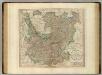
Upper, Lower Rhine circles.
1 : 700000 Cary, John, ca. 1754-1835
Teatre De La Guerre sur le Rhein, Moessele, Mayn, &c le Necker [Karte], in: Atlas nouveau, contenant toutes les parties du monde [...], Bd. 1, S. 229.
1 Karte aus Atlas Sanson, Nicolas Jaillot, Alexis Hubert und Mortier, Pieter
Hassia Superior Cum tractu Rheni Ac Moeni atque adiacente Archiepiscopatu Moguntino, &c.
1 : 590000 Oberhessen mit Rhei- und Mainlauf und angrenzendem Erzbistum Mainz etc. Merian, Matthäus Merianische Erben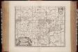
Nova et accurata Moguntini archiepiscopatus delineatio / [Jan Jansson]
1 : 620000 Annotatie: Origineel is Blad 106 in atlas factice; Annotatie geografische gegevens: Schaalstok op de kaart: Milliaria Germanica communia; Oosten boven; Rechtsboven naast wapen: XXXVI Jan Jansson -1655 [Amstelodami] : [Joanni Janssonii haeredes]
Circvlvs Sveviae Compositus ex principatibus Ecclesiasticis et secularibus Praelaturis Comitatibus & liberis Civitatibus
1 : 1900000 Mollova mapová sbírka Franz, Johann Michael Homann, Johann Baptista - dědici

Charte von den Königlich Preusischen Provinzen Westphalen, Cleve-Berg und Niederrhein dem Kurfürstenthume Hessen, Grosherzogthume Hessen, dem Herzogth. Nassau, Fürstenth. Waldeck und dem Gebiete der freien Stadt Frankfurt
1 : 1080000 Dolní Porýní (Německo) Weiland, Karl Ferdinand im Verlage des Geograph. Instituts
Übersichtskarte von Mittel - Europa

Grand theatre de la guerre sur les frontieres de France & d' Allemagne ou carte nouvelle du cours du Rhin et des pais circonvoisins contenant la Haute & Basse Alsace & le Palatinat & les electorats de Mayence, de Treves & une partie de Cologne de Hesse, de Franconie, de Baviere, le cercle de Souable le duché de Wurtenberg, de Brisgaw, de Bade, de Suntgaw & c. & c. & c
Francie Delisle, Guillaume Jean Covens & Corneille Mortier
Le Cercle De Franconie subdivisé entous les Estats qui le composent [Karte], in: Atlas nouveau, contenant toutes les parties du monde [...], Bd. 1, S. 275.
1 Karte aus Atlas Sanson, Nicolas Jaillot, Alexis Hubert und Mortier, Pieter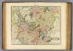
Upper, Lower Rhine.
1 : 720000 Lizars, Daniel
Palatinatus Ad Rhenum [Karte], in: Novus Atlas, das ist, Weltbeschreibung, Bd. 1, S. 267.
1 Karte aus Atlas Blaeu, Joan Blaeu, Willem Janszoon