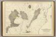
Maps of Great Basin
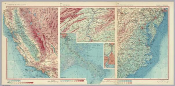
United States of America - California. U.S.A. - Selected Areas. Atlantic Coastal Plain - Central. Pergamon World Atlas.
Polish Army Topography Service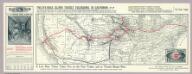
Phillips Tourist Excursions.
1 : 8496000 A. Phillips & Co.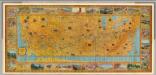
Illustrated Map of the Route of Transcontinental Air Transport, Inc.
1 : 5500000 Transcontinental Air Transport, Inc.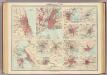
American cities on uniform scale.
1 : 300000 John Bartholomew & Co.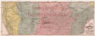
Official map of the Union Pacific Railway
Colorado Hamburg-Amerikanische Packetfahrt-Action-Gesellschaft
Reduced section, sketch, W. pt. of North America, 1818.
1 : 18000000 Warren, Gouverneur Kemble, 1830-1882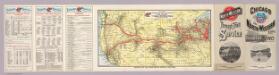
Through train service from Chicago.
1 : 9676800 Chicago and North Western Railway Company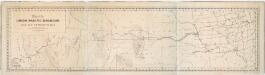
Map of the Union Pacific Railroad and its connections / prepared by order of the board of directors under the supervision of S. Seymour, consulting engineer ; James J. O'Brien, del.
from Parts
Route of the California Limited.
1 : 20000000 Atchison, Topeka, and Santa Fe Railroad Company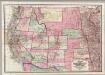
Colton's Map Of The States And Territories West Of The Mississippi River.
1 : 3105000 Colton, J. H.
Composite: Country drained by the Mississippi.
1 : 4625280 Long, Stephen H.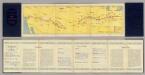
Air Route from Los Angeles to Columbus.
1 : 5702400 Transcontinental Air Transport, Inc.
209-210. United States of America, West. The World Atlas.
1 : 5000000 USSR (Union of Soviet Socialist Republics).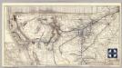
Santa Fe.
1 : 9380000 Atchison, Topeka, and Santa Fe Railroad Company
Carte de la Louisiane et du cours du Mississipi dressée sur un grand nombre de memoires entr'autres sur ceux de Mr. le Maire, / par Guillme. de L'Isle de l'Academie Rle. des Sciences.
from Charts and maps Guillaume de l'Isle; Mr. le Maire,
Carte de la Louisiane et du cours du Mississipi dressée sur un grand nombre de memoires entr'autres sur ceux de Mr. le Maire, / par Guillme. de L'Isle de l'Academie Rle. des Sciences.
from Charts and maps Guillaume de l'Isle; Mr. le Maire,
Carte de la Louisiane et du cours du Mississipi: dressée sur un grande nombre de memoires entrautres sur ceux de Mr. le Maire / par Guillaume Delisle de lAcademie rle. des sciences.
from Whole Guillaume de l'Isle; Mr. le Maire,
Skeleton Map Of the Territory of the United States west of the Mississippi River.
1 : 6000000 Wheeler, G.M.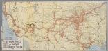
The Atchison, Topeka and Santa Fe railway system
1 : 3500000 New York, N.Y. : Montross & Clarke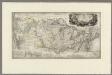
Map to illustrate the route of Prince Maximilian of Wied in ... North America.
1 : 4050000 Thorn, William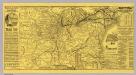
Michigan Central Railroad.
1 : 6251500 Michigan Central Railroad Company
Oregon, Californien, Utah, New Mexico, etc.
1 : 10800000 Lange, Henry, 1821-1893.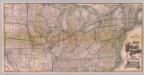
Great Wabash System.
1 : 3186000 Wabash, St. Louis, and Pacific Railway Company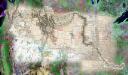
(Lewis and Clark Expedition 200th anniversary mosaic)
1 : 1426000 Rumsey, David, 1944-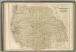
Western States.
1 : 5000000 Black, Adam & Charles
Post route map of the states of Kansas and Nebraska : showing post offices with the intermediate distances and mail routes in operation on the 1st of December, 1900 / published by order of Postmaster General Charles Emory Smith under the direction of ...
From Parts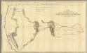
Map Of An Exploring Expedition To The Rocky Mountains.
1 : 1950000 Fremont, J.C.
Map of Kansas, Nebraska, and Colorado. Showing also the eastern portion of Idaho.
from New general atlas.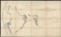
Map of an exploring expedition to the Rocky Mountains in the year 1842 and to Oregon & north California in the years 1843-44
1 : 2000000 Frémont, John Charles United States. Congress. Senate