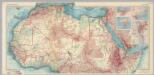
Maps of Sahara
Africa - North. Pergamon World Atlas.
1 : 10000000 Polish Army Topography Service
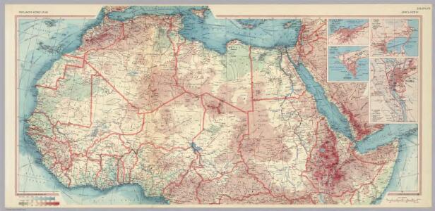
Mauritania, Morocco, Algeria, Tunisia, Libya, United Arab Republic, Chad, Sudan. Pergamon World Atlas.
Polish Army Topography Service
Karte von Africa
Afrika Robert de Vaugondy, Didier Alberti, Ignaz F.A. Schraembl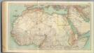
109-11. Africa nord.
1 : 10000000 Touring club italiano
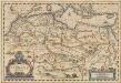
Africae antiquae, et quarundam Europae, Asiaeque adiacentium regionum
1 : 1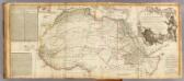
Africa (north)
1 : 8300000 Robert Laurie & James Whittle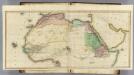
(Africa N sheets)
1 : 11200000 Lizars, Daniel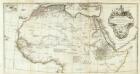
Afrique nord.
1 : 8300000 Anville, Jean Baptiste Bourguignon d, 1697-1782
Carte détaillée (en deux feuilles) de l'Afrique et des îles qui en dépendent (partie septentrionale)
1 : 16323500 par A. Brué, d'après les observations astronomiques, les découvertes et les hypothèses les plus récentes Paris : chez l'auteur
North Africa.
1 : 16600000 Sharpe, J.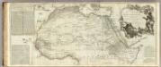
Africa, with all its states, kingdoms, republics, regions, islands, &ca. (northern section)
1 : 8400000 Boulton, S.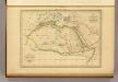
Afrique Ancienne.
1 : 27500000 Malte-Brun, Conrad, 1775-1826
N. Africa, S. Africa.
Thomson, John
Africa vetus florentibus Romanorum rebus
1 : 27429000 Afrika subsaharská Martin Gleditsch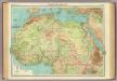
Northern Africa.
1 : 12000000 John Bartholomew and Son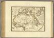
Afrique, septentrionale.
1 : 15000000 Brue, Adrien Hubert, 1786-1832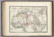
Afrique partie Nord.
1 : 16000000 Levasseur, E.
Mohammedanischen Staaten-Systems.
1 : 25000000 Flemming, Carl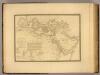
Monde connu des Hebreux.
1 : 14000000 Picquet, C.
Africae Antique, et quarundam Europae Asiaeque Adiacentium Regionum, accurata delineatio
Blankaart, Nikolaas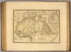
Afrique, septentrionale.
1 : 16000000 Picquet, C.
Africa Antiqua.
1 : 58000000 Fenner, Rest.
Africæ Antiquæ, et quarundam Europæ, Asiæque adiacentium regionum, accurata delineatio, ad historiarum lucem edita / à Nicolao Blancardo, Batavo, Leidensi, historiarum et politices professore
1 : 15000000 Annotatie: Rechtsonder acht muntafbeeldingen. Cartouche met opdracht aan Iohannes Brunæus Nicolaas Blanckaert 1624-1703 [Amsterdam : Janssonius]
Libya et Aethiopia
Etiopie Reichard, Christian Gottlieb Campius, D. a D. Campio
Středomoří a Sev. Afrika

Africa et Arabia
Schul-Atlas der alten Welt bei Justus Perthes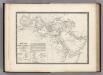
Monde Connu des Hebreux.
Levasseur, E.
Carte d'une Partie de L'Afrique Septentrionale.
1 : 18500000 Vivien de St Martin, L.
Charte der Nordküste Africas oder die Staaten Marocos, Fez, Algier, Tunis, Tripoli und AEgypten
1 : 14000000 Afrika severní Zuccheri, E. von Kunst und Industrie Comptoirs