Maps of Canada
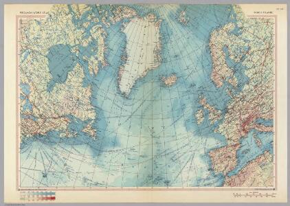
North Atlantic. Pergamon World Atlas.
1 : 15000000 Polish Army Topography Service
Russie d'Asie.
1 : 13800000 Picquet, C.
Russie d'Asie.
1 : 14000000 Levasseur, E.
Russia in Asia and Tartary.
1 : 19500000 Tanner, Henry S.
Russia in Asia.
1 : 30000000 Finley, Anthony
Russia In Asia and Tartary.
1 : 20000000 Tanner, Henry S.
Russia In Asia and Tartary.
1 : 20000000 Tanner, Henry S.
Russia In Asia And Tartary.
1 : 19700000 Mitchell, Samuel Augustus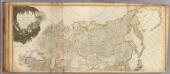
Asia (north)
1 : 11000000 Robert Laurie & James Whittle
Northern Asia, from the Himalaya Mountains to the Arctic Ocean.
1 : 10771200 Arrowsmith, John
Asie Boreale.
1 : 16500000 Garnier, F. A., 1803-1863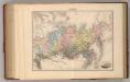
Siberie.
1 : 18700000 Migeon, J.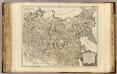
Russie en Asie orientale.
1 : 8700000 Robert de Vaugondy, Gilles, 1688-1766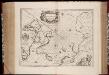
Regiones svb polo arctico / auctore Guiljelmo Blaeu
1 : 13500000 Annotatie: Met wapen; Met opdracht van Joh. Blaeu aan Guilielmus Backer de Corneliis; Origineel is Blad 147 in atlas factice; Annotatie geografische gegevens: Met 3 schaalstokken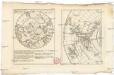
Neue Charte über die Durchfarth gegen Nord-Ost zwischen Asien und America samt den nahegelegenen Inslen [sic] und Ländern
Asie východní Marianus, Joseph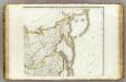
L'Asie 2.
1 : 9500000 Brue, Adrien Hubert, 1786-1832
N. Asia.
1 : 10600000 Arrowsmith, John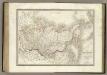
Siberie, Russie d'Asie.
1 : 13500000 Lapie, M. (Pierre), 1779-1850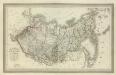
Composite: Carte Generale de la Russie d'Asie ou Siberie.
1 : 14300000 Vivien de St Martin, L.
Das gantze Russische Kaeyserthum mit allen seinen Laendern / verfertiget von J. George Schreibern
1 : 38000000 1 Karte : Kupferdruck ; 16 x 21 cm, Bildgr. 17 x 25 cm Schreiber, Johann Georg [J. G. Schreiber]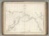
Chart of the Coasts of America and Asia.
1 : 19500000 La Perouse, Jean-Francois de Galaup, comte de, 1741-1788
Grande Tartarie et isles du Japon / par Mr. Brion, Ingénieur Géographe du Roy
1 : 32000000 1 Karte : Kupferdruck ; 22 x 25 cm Brion de la Tour, Louis chez le Sr. Desnos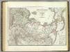
Russische Reich.
1 : 14300000 Weiland, C. F. (Carl Ferdinand), d. 1847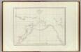
Cotes, l'Amerique, l'Asie.
1 : 25000000 La Perouse, Jean-Francois de Galaup, comte de, 1741-1788
Tartaria sive Magni Chami imperivm
1 : 13300000 Asie severní
Tartaria, sive Magni Chami imperium / ex credendis amplissimi viri D.ni Nicolai Witsen, cos: amst: a
1 : 10000000 1 Karte : Kupferdruck ; 46 x 58 cm Allard, Carel [Allard]
Nova Et Accurata Poli Arctici et terrarum Circum Iacentium Descriptio. [Karte], in: Het vijfde Deel Des Grooten Atlas : Vervatende De Water-Weereld, S. 53.
1 Karte aus Atlas Jansson, Jan Jansson, Jan
Das russische Reich nach seiner allmaehligen Vergrosserung.
1 : 26000000 Spruner von Merz, Karl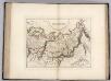
Russian Empire.
1 : 20750000 Carey, Mathew
The Russian empire in Europe and Asia
1 : 21000000 Carey, Mathew, 1760-1839 M. Carey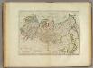
Russian Empire.
1 : 21000000 Carey, Mathew
Russian Empire, in Europe and Asia.
1 : 21000000 Carey, Mathew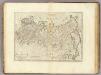
The Russian Empire, in Europe and Asia.
1 : 19008000 Carey, Mathew