Project
Community
News
My maps
Cataloged map
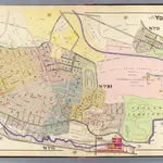
17. Yonkers.
Full title:
17. Yonkers.
Publisher:
A.H. Mueller
Physical Size:
20 x 30 cm
Map scale:
1:3 600
History