Maps of Germany

Germany.
1 : 2429000 Johnson, A.J.
Neueste Karte von Deutschland, der Schweiz und Ober-Italien in 4 Blättern
1 : 1700000 Ravenstein, Ludwig Bibliographisches Institut
Deutschland
Geographischer Atlas über alle Theile der Erde Ziegler, Jakob Melchior Verlag von Joh. Wurster um Comp.
Karte von Deutschland
Grosser Hand-Atlas über alle Theile der Erde in 170 Karten Meyer, J. Verlag des Bibliographischen Instituts


Deutschland
Geographischer Atlas über alle Theile der Erde Ziegler, Jakob Melchior Verlag von Dietrich Reimer
Deutschland.
1 : 2300000 Weiland, C. F. (Carl Ferdinand), d. 1847
Germany, Switzerland, N. Italy.
1 : 5300000 Mitchell, Samuel Augustus
Deutschland
[Allgemeiner Atlas über alle Theile der Erde in 29 Blättern] Ziegler, Jakob Melchior Top. Anstalt v. J. Wurster u. Comp.
Deutschland
1 : 2350000 Evropa střední Weiland, Karl Ferdinand Geographisches Institut
Deutschland
1 : 2350000 Evropa střední Weiland, Karl Ferdinand Geographisches Institut
Deutschland
1 : 2350000 Evropa střední Weiland, Karl Ferdinand Geographisches Institut
Deutschland
Hypsometrischer Atlas Ziegler, Jakob Melchior Topogr. Anstalt v. J. Wurster u. Comp.
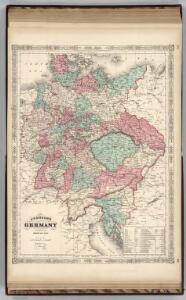
Empire of Germany.
1 : 2450000 Johnson, A.J.
Oro-hydrographische Charte von Deutschland und der Schweiz : insbesondere zur Uebersicht der grossen topographisch-militairischen Charten von Deutschland in 217 und von der Schweiz in 24 Blättern
1 : 3000000 entworfen von C.F. Weiland Weimar : im Verlage des Geograph. Instituts
Deutschland.
1 : 2400000 Ziegler, J. M.
Empire of Germany.
1 : 2450000 Johnson, A.J.
Empire of Germany.
1 : 2450000 Johnson, A.J.
Germany.
1 : 3170000 Tanner, Henry S.
Der Deutsche Bundesstaat in 23 Republiken nach Struve's Grundrechten des deutschen Volks
1 : 4500000 Lithogr. von F. Bruder in Basel Basel : [s.n.]
Oro-hydrographische Charte von Deutschland und der Schweiz
1 : 2890000 Evropa střední Weiland, Karl Ferdinand
Deutschland
1 : 3500000 Evropa střední Handtke, Friedrich Carl Flemming
Germany.
1 : 3170000 Mitchell, Samuel Augustus
Germany.
1 : 3170000 Mitchell, Samuel Augustus
Dějiště války třicetileté po míru vestfálském

Charte von Deutschland
Evropa střední Berra, Marco Marco Berra
[Neuer Atlas der ganzen Erde nach den neuesten Bestimmungen ... : XIV.] Gebirgs- und Gewaesser-Charte von Teutschland, oder der Teutsche Staaten-Bund
Entworfen und gezeichnet von Dr. F.W. Streit H. Leutemann sc. Leipzig : J.C. Hinrichs'sche Buchhandlung
Germaniae Veteris, typus. [Karte], in: Novus atlas absolutissimus, Bd. 2, S. 8.
1 Karte aus Atlas Janssonius Offizin