Maps of North Atlantic Ocean

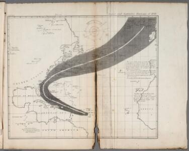
X. August and September Hurricane of 1848
Maury, Matthew Fontaine
A new map or chart in Mercators projection of the Western or Atlantic Ocean: with part of Europe, Africa and America.
from Atlantic Ocean J. (John) Bew?: [London],
Nord-Atlantischer Ocean
Handatlas über alle Theile der Erde und über das Weltgebäude Stieler, Adolf Justus Perthes
Nord-Atlantischer Ocean
Hand-Atlas über alle Theile der Erde und über das Weltgebäude Stieler, Adolf Justus Perthes
Mar del nort
1 : 30000000
A chart of the Atlantic or Western Ocean / drawn from the latest surveys & astronomical observations by J. & A. Walker, London & Liverpool 1830.
from Atlantic Ocean J. & A. Walker,
Part of Brookhaven Suffolk County
from Atlas of ... Suffolk County, Long Island, New York ... : based upon actual measurements by our own corps of engineers, maps on file at county offices, also maps from actual surveys furnished by individual owners / under the supervision of Merritt B. Hyde.
New Jersey / engraved by J.H. Young.
from Whole
North Atlantic Ocean.
1 : 8000000 Blunt, Edmund M. (Edmund March), 1770-1862
Chart Shewing (sic) the Communication between Europe, North America, and the Pacific.
1 : 14500000 Black, Adam & Charles
Mar del Nort / [Joannes Janssonius]
1 : 30000000 Annotatie: Origineel is Blad 3 in atlas factice Janssonius, Joannes (jr.) (1588-1664) [Amsterdam : Joannes Janssonius]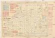
Pilot chart of the North Atlantic Ocean
1 : 14300000 Atlantský oceán (oblast) Maury, Matthew Fontaine Hydrographic Office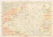
Pilot chart of the North Atlantic Ocean
1 : 14300000 Atlantský oceán (oblast) Maury, Matthew Fontaine Hydrographic Office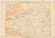
Pilot chart of the North Atlantic Ocean
1 : 14300000 Atlantský oceán (oblast) Maury, Matthew Fontaine Hydrographic Office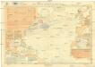
Pilot chart of the North Atlantic Ocean
1 : 11300000 Atlantský oceán (oblast) Hydrographic Office
Mar Del Nort. [Karte], in: Het vijfde Deel Des Grooten Atlas : Vervatende De Water-Weereld, S. 56.
1 Karte aus Atlas Jansson, Jan Jansson, Jan
A new map or chart in Mercators projection, of the Western or Atlantic Ocean, with part of Europe, Africa and America
1 : 18000000
Mar Del Nort. [Karte], in: Novus atlas absolutissimus, Bd. 9, S. 58.
1 Karte aus Atlas Janssonius Offizin
General chart, of the North Atlantic, or Western Ocean, from the equator to 62° north latitude, according to the latest, surveys and observations
1 : 9000000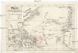
Plavby Krištofa [sic] Kolumba
Atlantský oceán-oblast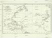
Chart shewing the tracks across the north Atlantic ocean of don Christopher Columbus
Atlantský oceán Toquet, H. Raban
Amerique septentrionale divisée en ses principales parties.
from Whole Chés Ian Bt. Elwe: Amsterdam; Elwe, Jan Barend,
Amerique septentrionale divisée en ses principales parties.
from Whole Chés Ian Bt. Elwe: Amsterdam; Elwe, Jan Barend,
Amerique septentrionale divisée en ses principale parties.
from Whole Ottens, R. (Reinier); Jaillot, Charles Hubert Alexis,
North America divided into its principall parts where are distinguished the severall states which belong to the English, Spanish, and French / described by Sanson; corrected and amended by William Berry.; [A collection of maps of the world] / [described by Sanson; corrected and amended by William Berry.]
from Collection of maps, 1680-1690 Berry, William; Morden, Robert; Petty, William, Sir; Sanson, Nicolas; Slaney, Edward,
Amerique septentrionale divisée en ses principales parties.
from John H. Levine Collection [s.n.]: A Paris; Jaillot, Charles Hubert Alexis,
Amerique septentrionale divisée en ses principales parties.
from John H. Levine Collection [s.n.]: A Paris; Jaillot, Charles Hubert Alexis,
Meteorological chart of the North Atlantic Ocean
1 : 13700000 Atlantský oceán (oblast) Secretary of Agriculture