Maps of Great Britain

Composite: England,
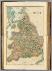
1 : 980000 Lizars, Daniel
England and Wales.
1 : 1450000 Johnson, A.J.
England and Wales.
1 : 1450000 Johnson, A.J.
England & Wales.
1 : 1267200 Fullarton, A. & Co.
England And Wales.
1 : 1330560 Johnson, A.J.
England And Wales.
1 : 1330560 Colton, G.W.
England and Wales.
1 : 2534400 Tallis, J. & F.
Geological map, England, Wales.
1 : 1780000 Society for the Diffusion of Useful Knowledge (Great Britain)
Ancient Britain I.
1 : 1850000 Society for the Diffusion of Useful Knowledge (Great Britain)
Britanniæ romanæ tabula
1 Karte : Kupferdruck ; 32 x 30 cm Gale; Weigel excudit C. Weigelius
England
1 Karte : Kupferdruck ; 65 x 52 cm Mannert; Schneider; Rocque; Kitchin; Campbell; Cary bey Adam Gottl. Schneider und Weigel
England and Wales.
1 : 1500000 Colton, G.W.

England And Wales.
1 : 1300000 Johnson, A.J.
England and Wales.
1 : 2860000 Higgins, W.M.
England and Wales.
1 : 1450000 Johnson, A.J.
England and wales.
1 : 13000000 Colton, G.W.
Regni Angliae et principatus Cambriae tabula nova
1 Karte : Kupferdruck ; 57 x 51 cm Kitchin; Rausch Homännische Erben
England and Wales.
1 : 1550000 Rand McNally and Company
Accuratissima Angliæ regni et Walliæ principatus descriptio
1 Karte : Kupferdruck ; 57 x 47 cm Wit ex officina I. Cóvens et C. Mortier
Accuratissima Angliæ regni et Walliæ principatus descriptio
1 Karte : Kupferdruck ; 57 x 47 cm Wit Frederick de Wit
delineation of the strata of England and Wales, with part of Scotland
Übersichtskarte Smith, William Cary
Anglia II. Nova Tabula [Karte], in: Geographia universalis vetus et nova complectens Claudii Ptolemaei Alexandrini enarrationis libros VIII, S. 305.
1 Karte aus Atlas Münster, Sebastian [und Ptolemaeus, Claudius]
England and Wales.
1 : 1500000 Colton, G.W.
England and Wales.
1 : 13000000 Colton, G.W.
Composite: England and Wales.
1 : 887000 Johnston, W. & A.K.
Ordnance survey map of Roman Britain
1 : 1000000 Velká Británie Ordnance Survey Office
Angleterre.
1 : 1700000 Levasseur, E.
Carte du royaume d'Angleterre
1 Karte : Kupferdruck ; 75 x 51 cm Hérisson; Basset; Basset chez Basset rue St. Jacques no. 670