Maps of Alps
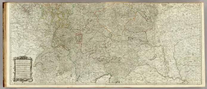
(Map of the Empire of Germany. Southern section)
1 : 1250000 Delarochette, Louis Stanislas d'Arcy
Germany (south)
1 : 1250000 Kitchin, Thomas
Sibérie, avec L'Amérique russe / gravé par Chamouin ; ecrit par Giraldon
1 : 31000000 1 Karte : Kupferdruck ; 21 x 29 cm Chamouin, Jean Baptiste Marie [Verlag nicht ermittelbar]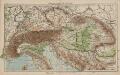
Österreich-Ungarn und Alpenländer
1 : 4000000 Österreich-Ungarn
Österreich-Ungarn und Alpenländer. Bodengestalt
1 : 4000000 Österreich-Ungarn Physische Geografie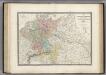
Allemagne en 1789.
1 : 3580000 Levasseur, E.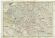
Neue und vollkomene Postkarte durch ganz Teutschland
1 : 2100000 Evropa jihovýchodní bey Artaria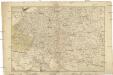
Neue und vollkomene Postkarte durch ganz Teutschland
1 : 2100000 Evropa jihovýchodní Artaria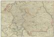
Postkarte durch ganz Teutschland, Italien, Frankreich, Niederland, Preussen, Polen und Ungarn
1 : 2100000 Evropa střední Mollo, Tranquillo T. Mollo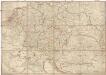
Postkarte durch ganz Teutschland, Italien, Frankreich, Niederland, Preussen, Polen und Ungarn
1 : 2100000 Evropa střední Mollo, Tranquillo T. Mollo & Comp.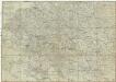
Postkarte durch ganz Teutschland, Italien, Frankreich, Niederland, Preussen, Polen und Ungarn
1 : 2100000 Evropa jihovýchodní Mollo, Tranquillo chez T. Mollo
Post Charte der kais. könig. Erblande
1 : 2440000 Evropa jihovýchodní Metzburg, Georg Ignaz von Mansfeld, Johann Ernst
Oesterreich unter den Römern im Jahre 274 n. Chr
Evropa jihovýchodní F. Tempsky
Oesterreich unter Karl dem Grossen im Jahre 814
Evropa jihovýchodní F. Tempsky
Oesterreich zur Zeit Karl des IV. im Jahre 1378
Evropa jihovýchodní F. Tempsky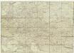
Neue und vollkomene Postkarte durch ganz Teutschland
Francie Artaria
Gebirgs-Karte der Oesterreichischen Monarchie
Rakousko-Uhersko F. Tempský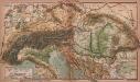
Alpen- und Karpatenländer
1 : 4000000 Alpenländer, Österreich-Ungarn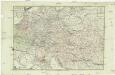
Neue und vollkomene Postkarte durch ganz Deutschland
Florencie (Itálie) Mansfeld, Johann Ernst Artaria & Co.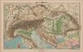
Alpen- und Karpatenländer
1 : 4000000 Alpenländer, Österreich-Ungarn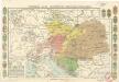
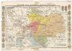
Dějepisná mapa mocnářství Rakousko-uherského
Dějepisná mapa mocnářství Rakousko-Uherského
1 : 8000000 Rakousko-Uhersko Stelzig, Jindřich Kmínek, V. Cl. Jindřich Stelzig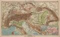
Alpen- und Karpatenländer
1 : 4000000 Alpenländer, Österreich-Ungarn
Map of Germany and the adjoining countries / by Ignatius Heymann
1 : 970000 Heymann, Ignatius London : John Stockdale
L'Allemagne 843 a 911.
1 : 6300000 Houze, Antoine Philippe
La Germanie 741 a 843.
1 : 6300000 Houze, Antoine Philippe
Germany, Austria, and Switzerland.
1 : 4100000 Gray, Ormando Willis
Kaiserthum Oesterreich...

Süddeutsche Bundesstaaten
Evropa střední
Süddeutsche Bundesstaaten
Evropa střední