Maps of North Atlantic Ocean
North Atlantic Ocean.
1 : 17500000 Johnston, Alexander Keith
N. Atlantic Ocean.
1 : 19000000 Johnston, Alexander Keith, 1804-1871
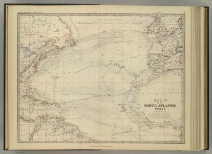
North Atlantic Ocean.
1 : 17500000 Johnston, Alexander Keith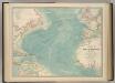
North Atlantic Ocean.
1 : 19000000 Johnston, W. & A.K.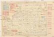
Pilot chart of the North Atlantic Ocean
1 : 14300000 Atlantský oceán (oblast) Maury, Matthew Fontaine Hydrographic Office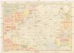
Pilot chart of the North Atlantic Ocean
1 : 14300000 Atlantský oceán (oblast) Maury, Matthew Fontaine Hydrographic Office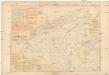
Pilot chart of the North Atlantic Ocean
1 : 14300000 Atlantský oceán (oblast) Maury, Matthew Fontaine Hydrographic Office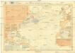
Pilot chart of the North Atlantic Ocean
1 : 11300000 Atlantský oceán (oblast) Hydrographic Office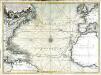
Nouvelle carte de l'ocean Atlantique et théatre de la guerre tant en Europe qu'en Amerique
1 Karte : Kupferdruck ; 52 x 71 cm Denis; Basset; Basset chés Basset rüe St. Jacques au coin de celle des Mathurins à l'image S.te Genevieve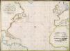
A new chart of the Atlantic or Western Ocean / improved by W. Heather; engraved by J. Stephenson.
from Charts and maps W. Heather; J. Stephenson,
A new chart of the Atlantic or Western Ocean
1 : 9350000 Heather, W. (William) Heather, W. (William)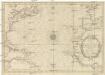
CARTE DE L'OCEAN OCCIDENTAL
1 : 6600000 Atlantský oceán-oblast Bellin, Jacques-Nicolas
Chart of the Atlantic Ocean.
1 : 43000000 Melish, John
A new chart of the vast Atlantic Ocean : exhibiting the seat of war, both in Europe and America, likewise the trade winds & course of sailing from one continent to the other, with the banks, shoals and rocks drawn according to the latest discoveries,
from John H. Levine Collection
Meteorological chart of the North Atlantic Ocean
1 : 13700000 Atlantský oceán (oblast) Secretary of Agriculture
Meteorological chart of the North Atlantic Ocean
1 : 13700000 Atlantský oceán (oblast) Secretary of Agriculture
Mar del Nort / [Joannes Janssonius]
1 : 30000000 Annotatie: Origineel is Blad 3 in atlas factice Janssonius, Joannes (jr.) (1588-1664) [Amsterdam : Joannes Janssonius]
Mar Del Nort. [Karte], in: Het vijfde Deel Des Grooten Atlas : Vervatende De Water-Weereld, S. 56.
1 Karte aus Atlas Jansson, Jan Jansson, Jan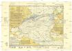
Monatskarte für den Nordatlantischen Ozean
1 : 10700000 Atlantský oceán (oblast) Eckardt & Messtorff
Mar Del Nort. [Karte], in: Novus atlas absolutissimus, Bd. 9, S. 58.
1 Karte aus Atlas Janssonius Offizin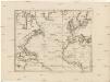
Karte des Atlantischen Oceans
1 : 7500000 Atlantský oceán-oblast Schraembl, Franz Anton F.A. Schraembl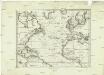
Karte des Atlantischen Oceans
1 : 22500000 Atlantský oceán-oblast Schraembl, Franz Anton F.A. Schraembl
Karte des Atlantischen Oceans
Atlantský oceán-oblast Schraembl, Franz Anton F.A. Schraembl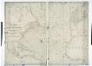
A chart of the Atlantic or Western Ocean / drawn from the latest surveys & astronomical observations by J. & A. Walker, London & Liverpool 1830.
from Atlantic Ocean J. & A. Walker,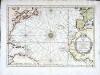
Carte de l'ocean occidental
1 Karte : Kupferdruck ; 31 x 44 cm Bellin Arkstée et Merkus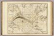
The Atlantic Ocean.
1 : 22500000 Pownall, Thomas
Karte des Atlantischen Oceans
1 Karte : Kupferdruck ; 48 x 60 cm Schrämbl zu finden in eigenem Verlage Schrämbl
Tableau des courants observés dans l'Océan Atlantique Septentrional, au moyen de bouteilles jetées à la mer. / dressé par P. Daussy, ingénieur hydrographe en chef de la Marine; gravé par Michel; écrit par J.M. Hacq.
from Atlantic Ocean P. Daussy; Michel; J.M. Hacq.,
North Atlantic Ocean.
1 : 8000000 Blunt, Edmund M. (Edmund March), 1770-1862
Carte de l'ocean Atlantique
1 Karte : Kupferdruck ; 47 x 61 cm Jefferys; Le Rouge chez Le Rouge rue des g.ds Augustins