Maps of Metropolitan France
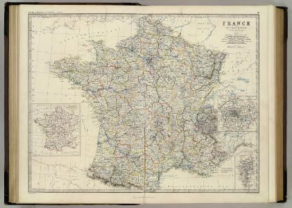
France.
1 : 2232000 Johnston, Alexander Keith, 1804-1871
Les routes exactes des postes du royaume de France
1 Karte : Kupferdruck ; 42 x 49 cm, Bildgrösse: 45 x 58 cm Seutter; Lotter aux depens Tob. Conr. Lotter geogr
Les routes exactes des postes du royaume de France
1 Karte : Kupferdruck ; 42 x 49 cm Seutter s.n.
Les routes exactes des postes du royaume de France
1 Karte : Kupferdruck ; 42 x 49 cm Seutter; Lotter aux depens Tob. Conr. Lotter geogr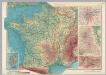
France. Pergamon World Atlas.
1 : 2500000 Polish Army Topography Service
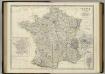
Carte de la France divisée en ses LXXXIII départements
1 : 2580000 Francie par les freres Lotter
France.
1 : 2476000 Hammond, C.S.
Frankreich.
1 : 3500000 Radefeld, Carl Christian Franz, 1788-1874
France Politique.
1 : 2500000 Vivien St Martin, L.
Frankreich mit besonderer Rücksicht auf die Unebenheiten
1 : 20000000 Francie Berghaus, Heinrich Karl Wilhelm Brose, Heinr. im Magazin für Kunst, Geographie und Musik
Charte von Frankreich
1 : 2090000 Francie Weiland, Karl Ferdinand Beyer, Leonh. im Verlage des Geogr. Instituts
France.
1 : 3200000 Mitchell, Samuel Augustus
France.
1 : 3200000 Mitchell, Samuel Augustus
Frankreich
Schul-Atlas über alle Theile der Erde nach dem neuesten Zustande, und über das Weltgebäude Stieler, Adolf Justus Perthes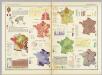
France (Republique Francaise). Pergamon World Atlas.
Polish Army Topography Service
Frankreich.
1 : 10000000 Brudin, J. L.; Stieler, Adolf
France, departemens.
1 : 6000000 Delamarche, Charles Francois; Lattre, Jean
Frankreich
1 : 1150000 Francie Handtke, Friedrich Flemming, C. C. Flemming
Karte von Frankreich für den Hand- und Reisegebracht
1 : 2000000 Francie Seitz, J. B. litter. artistischen Anstalt
Frankreich mit besonderer Rücksicht auf die Unebeheiten
1 : 2000000 Francie Berghaus, Heinrich Karl Wilhelm Brose, Heinrich im Magazin für Kunst, Geographie und Musik
Frontiere du Sud-Est de la France.
1 : 1650000 Jouvet et Cie.
France.
1 : 4815360 Tallis, J. & F.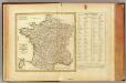
La France, departemens.
1 : 3500000 Bonne, Rigobert, 1727-1794
France.
Andriveau-Goujon, J.
Frankreich.
1 : 4700000 Reichard, C. G.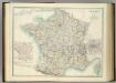
France in Departments.
1 : 2232000 Johnston, Alexander Keith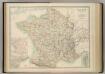
France in Departments.
1 : 2232000 Johnston, W. & A.K.
Tableau d'Assemblage des Six Feuilles de la Carte Géologique de la France
1 : 2000000 Dufrénoy, Ours-Pierre-Armand Petit- ; Elie de Beaumont, Jean Baptiste Armand Louis Léonce ; Brochant de Villiers, André Jean François Marie Ministère des Travaux Publics
Frankreich
Schul-Atlas über alle Theile der Erde nach dem neuesten Zustande, und über das Weltgebäude Stieler, Adolf bei Justus Perthes