Maps of Cumberland County

Composite: New England.
1 : 440000 Jefferys, Thomas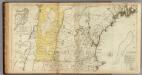
The Provinces of Massachusetts Bay and New Hampshire. (Northern section)
1 : 440000 Jefferys, Thomas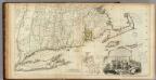
The Provinces of Massachusetts Bay and New Hampshire. (Southern section)
1 : 440000 Jefferys, Thomas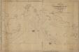
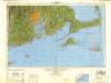
A new chart of Massachusetts Bay, and part of the coast of Maine : drawn from the latest authorities
1 : 200000 Lambert, Samuel, 1768-1832 Whipple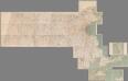
Composite Map: (Massachusetts).
1 : 63680 Walker, O.W.
The south part of New-England, as it is planted this yeare, 1635
1 : 990000 Wood, William Frank Gair, Macomber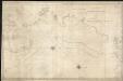
A new chart of Massachusetts Bay drawn from the latest authorities
1 : 235000 Lambert, Samuel Lambert, Samuel
Old Colony Railroad and connections
1 : 633600 Winslow, E. N [s.n.]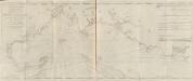
A new and correct chart of the sea coast of New-England from Cape Codd to Casco Bay
1 : 142560 Barnsley, Henry Sold by W. & I. Mount & T. Page on Tower hill
Trolley wayfinder, birds eye view of trolley routes in New England
Geo. H. Walker & Co New England Street Railway Club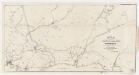
Map of the Boston & Maine Railroad : showing its relative position & connection with other railroads
1 : 162925 Boston and Maine Railroad. Committee of Investigation W.C. Sharp's Lith.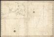
A new chart of Nantucket Shoals & George's Bank with the adjacent coast
1 : 490000 Lambert, Samuel Lambert, Samuel
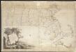
Massachusetts.
1 : 696960 Carey, Mathew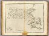
State of Massachusetts.
1 : 696960 Carey, Mathew
State of Massachusetts.
1 : 696960 Lewis, Samuel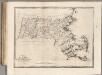
State of Massachusetts.
1 : 696960 Carey, Mathew
A new and accurate map of the Colony of Massachusetts Bay, in North America, from a late survey

Massachusetts.
1 : 1130000 Tanner, Henry S.
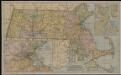
National topographic map of Massachusetts and Rhode Island : showing counties, townships, cities, villages and post offices ... according to the latest census.
1 : 253440 National Map Company National Map Company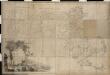
Map of Massachusetts proper compiled from actual surveys made by order of the General Court

Carte géographique, statistique et historique de Massachusetts
Map of Massachusetts proper

Map of Massachsuetts showing state highways laid out & petitioned for
The Matthews-Northrup up-to-date map of Massachusetts

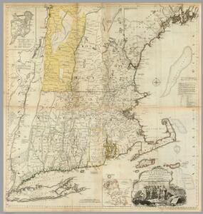
A map of the province of Massachusets Bay and colony of Rhode Island, with part of Connecticut, New Hampshire, and Vermont

The seat of war in New England, by an American volunteer, with the marches of the several corps sent by the Colonies towards Boston, with the attack on Bunkers-Hill

Providence
1 : 250000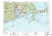
Providence
1 : 250000
Providence
1 : 250000
Providence
1 : 250000
Providence
1 : 250000