Maps of Bridgeport
Fairfield Co. S.
1 : 72000 D.H. Hurd & Co.
Norwalk
1 : 62500
Norwalk
1 : 62500
Norwalk
1 : 62500
Norwalk
1 : 62500
Norwalk
1 : 62500
Norwalk
1 : 62500
Norwalk
1 : 62500
Norwalk
1 : 62500
Norwalk
1 : 62500
Norwalk
1 : 62500
Norwalk
1 : 62500
32. Norwalk sheet.
1 : 62500 Geological Survey (U.S.)
Norwalk
1 : 62500
Norwalk
1 : 62500
31. Stamford sheet.
1 : 62500 Geological Survey (U.S.)
Westchester, Plate No. 28 [Map of Town of North Castle] / prepared under the direction of Joseph R. Bien, from general surveys and official records.
From Atlas of Westchester County, New York
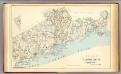
6. Long Id. Sound-Talmadge Hill-Cos Cob-S. Norwalk.
1 : 80000 Servoss, R. D.
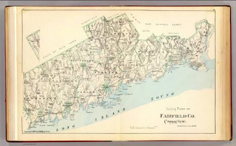
Town of Fairfield, Fairfield County, Connecticut.
1 : 31680 Beers, Frederick W.
Westchester, V. 2, Double Page Plate No. 45 [Map bounded by State of Connecticut, Bedford]
From Vol. 2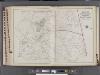
Westchester, V. 2, Double Page Plate No. 40 [Map bounded by Part of the Towns of Poundridge, Bedford, North Castle]
From Vol. 2
6. Long Id. Sound-Talmadge Hill-Cos Cob-S. Norwalk.
1 : 80000 Servoss, R. D.
9. Darien-Trinity Lake-Stanwich-Wilton.
1 : 80000 Servoss, R. D.
Town of Poundridge, Westchester County, New York.
1 : 31680 Beers, J.B.
Poundridge, Town.
1 : 31680 Beers, F. W. (Frederick W.)
Plate 56: Town of Poundridge, Westerchester Co. N.Y.
from Atlas of New York and vicinity : from actual surveys / by and under the direction of F. W. Beers, assisted by A. B. Prindle & others
Town of Wilton, Fairfield County, Connecticut. (inset) Wilton.
1 : 31680 Beers, Frederick W.
Stamford
1 : 24000
Stamford
1 : 24000
Stamford
1 : 24000
Norwalk South
1 : 24000
Norwalk South
1 : 24000
Norwalk South
1 : 24000
Sherwood Point
1 : 24000
Sherwood Point
1 : 24000
Norwalk South
1 : 24000
Norwalk South
1 : 31680
Norwalk South
1 : 24000
Norwalk South
1 : 31680
Sherwood Point
1 : 24000
Sherwood Point
1 : 31680
Sherwood Point
1 : 31680
Sherwood Point
1 : 24000
Norwalk South
1 : 31680
Sherwood Point
1 : 31680