Maps of Illinois

Ohio, Indiana, Illinois, Michigan.
1 : 2063000 Finley, Anthony
Map of the States Of Ohio Indiana & Illinois And Part Of Michigan Territory.
1 : 2000000 Finley, Anthony
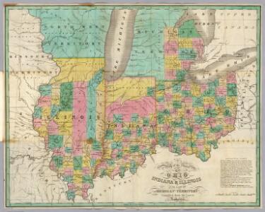
Ohio, Indiana & Illinois And Part Of Michigan Territory.
1 : 2060000 Mitchell, Samuel Augustus
Guide through Ohio, Michigan, Indiana, Illinois, Missouri, Wisconsin & Iowa : showing the township lines of the United States Surveys, location of cities, towns, villages, post hamlets, canals, rail and stage roads / by J. Calvin Smith ; engr. by S. Stiles, Sherman & Smith
1 : 2200000 Annotatie: Gerestaureerd en op Japans papier geplakt; Met statistische gegevens m.b.t. bevolking, landbouw en veeteelt, industrie en openbare financiën J. Calvin Smith; S. Stiles, Sherman & Smith New York, [N.Y.] : J.H. Colton & Co.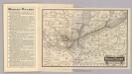
Map Wabash Railway.
1 : 6623200 Wabash Railway Company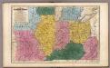
Map of the Western States.
1 : 3200000 Mitchell, Samuel Augustus
Map of the Back Settlements.
1 : 6336000 Morse, Jedidiah
Map Pittsburgh & Western Railway Co.
1 : 5844000 Pittsburgh & Western Railway Company
Western States.
1 : 4200000 Huntington, Nathaniel G. (Nathaniel Gilbert), 1785-1848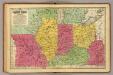
Western States.
1 : 3200000 Mitchell, Samuel Augustus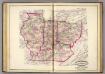
Ind., Ill., Mo., Ohio, Ky, Tenn.
1 : 2100000 Asher, Adams & Higgins; Higgins & Ryan
Maps showing the Indiana & Illinois Central Railway.
1 : 1267200 G.W. & C.B. Colton & Co.
Ohio, Indiana, Kentucky, and Tennessee.
1 : 3651000 Fisher, Richard Swainson
Ohio, Indiana & Illinois.
1 : 2400000 Black, Adam & Charles
County map of Ohio and Indiana.
from New general atlas.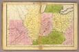
Western States.
1 : 3000000 Huntington, Francis Junius, 1802-1878
Western States.
1 : 6400000 Adams, Daniel
Western States, United States.
Goodrich, S.G.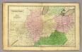
Western States.
1 : 3000000 Olney, J. (Jesse), 1798-1872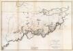
General Map of the Course of the Ohio.
1 : 563200 Tardieu, P.F.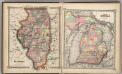
Illinois. Part of Michigan.
1 : 1900000 Schonberg & Co.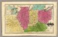
Western States. (with) inset map of Upper Michigan.
1 : 3000000 Smiley, Thomas T.
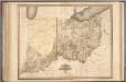
The State of Ohio, with part of Upper Canada, &c.
from Carey's general atlas, improved and enlarged : being a collection of maps of the world and quarters, their principal empires, kingdoms, &c.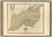
Ohio and Indiana.
1 : 1110000 Tanner, Henry S.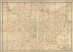
Post route map of the states of Ohio and Indiana with Cinncinnati and environs.
1 : 506880 United States. Post Office Dept.
Illinois, Indiana, Ohio.
1 : 1584000 Smith, J. Calvin
Map of part of the N: W: Territory of the United States.
1 : 1013760 Carey, Mathew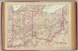
Ohio, Indiana.
1 : 1267200 Asher & Adams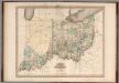
Ohio and Indiana.
1 : 1100000 Tanner, Henry S.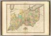
Ohio And Indiana.
1 : 1140480 Tanner, Henry S.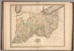
Ohio and Indiana.
1 : 1100000 Tanner, Henry S.
Ohio and Indiana.
1 : 1100000 Tanner, Henry S.