Maps of British Isles
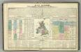
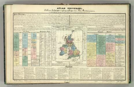
Tableau l'historie des Iles Britanniques.
1 : 8200000 Duval, Henri

Carte Physique et Mineralogique des Isles Britanniques
1 : 15000000 Malte-Brun, Conrad, 1775-1826
Charte der vereinigten Königreiche Grosbritanien und Ireland
1 Karte : Kupferdruck ; 59 x 47 cm Weidner im Verlage des Industrie Comptoirs
Grossbritannien und Irland
1 Karte : Kupferdruck ; 29 x 25 cm Sotzmann; Jättnig s.n.
A compleat map of the British Isles or Great Britain and Ireland
1 Karte : Kupferdruck ; 59 x 46 cm Sayer publish'd by Rob.t Sayer no. 53 Fleet Street as the act directs
Carte réduite des isles Britanniques
1 Karte : Kupferdruck ; 85 x 53 cm Bellin; Haussard s.n.
Petit neptune anglois ou carte marine des côtes d'Angleterre, d'Ecosse et d'Irlande
1 Karte : Kupferdruck ; 66 x 51 cm Bonne; Lattré; Marillier; Berthault chez Lattré graveur rue St. Jacques près la fontaine St. Severin à la ville de Bordeaux
Map of the British Isles
1 : 908500 Shetlandy (Skotsko) Cary, John
Britischen Inseln.
1 : 1800000 Kiepert, Heinrich, 1818-1899
British Islands.
1 : 5500000 Fitch, George W.
Gt. Britain, Ireland.
1 : 4800000 Mitchell, Samuel Augustus
Iles Britanniques.
1 : 2500000 Andriveau-Goujon, J.
British Isles.
1 : 5000000 Adams, Daniel

[Grossbritannien; England, Scotland und Ireland]
Geographischer Atlas über alle Theile der Erde Ziegler, Jakob Melchior Verlag von Dietrich Reimer
[Grossbritannien; England, Scotland und Ireland]
Geographischer Atlas über alle Theile der Erde Ziegler, Jakob Melchior Verlag von Joh. Wurster um Comp.
Die britischen Inseln
Hypsometrischer Atlas Ziegler, Jakob Melchior Topogr. Anstalt v. J. Wurster u. Comp.
Welká Britanie a Iry

Die Britischen Jnseln England, Schotland, Jreland
Stieler's Hand-Atlas Stieler, Adolf bei Justus Perthes
Carte des isles Britanniques et de la Manche
1 Karte : Kupferdruck ; 72 x 49 cm Brion de la Tour; Esnault; Rapilly chez Esnauts et Rapilly rue S. Jacques à la ville de Coutances
Iles Britanniques.
1 : 2950000 Montemont, A.
Die Brittischen Inseln
Schul-Atlas über alle Theile der Erde nach dem neuesten Zustande, und über das Weltgebäude Stieler, Adolf bei Justus Perthes
Composite: Geological, palaeontological map British Islands.
1 : 1550000 Johnston, Alexander Keith, 1804-1871
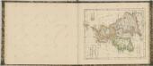
Insvlæ britannicæ antiqvæ
1 Karte : Kupferdruck ; 31 x 38 cm Weigel Christoph Weigel
Die Britischen Inseln
E. von Sydow's Schul-Atlas in sechs und dreissig Karten Sydow, Emil von bei Justus Perthes
Soubor němých map pro gymnasia a odborné školy

Géographie. croquis n12, Iles britanniques
1 : 2000000 Lambin, Capitaine 18..-.... [Paris] : Service Géographique de l'Armée