Maps of Balkan Pen.
Continental Europe.
1 : 9000000 Cornell, S. S. (Sarah S.)
Océan atlantique et mers adjacentes, 1
2 Blätter : 48 x 135 cm Le Rouge
Das Zeitalter der Hohenstaufen
Mitteleuropa
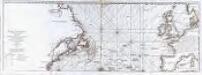
The Western Ocean.
from Charts and maps Jeremiah Seller & Charles Price?: [London?],
Germanie, France, Italie, Espagne, Isles Britanniques.
1 : 5200000 Anville, Jean Baptiste Bourguignon d, 1697-1782
Das Reich Karl des Großen
Europa Karl I., Heiliges Römisches Reich, Kaiser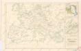
Západní a střední Evropa v době absolutismu až do konce francouzské revoluce

Karte von mittel und sued Europa
Evropa Hauslab, Franz von Artaria
Europe, intermediate century.
1 : 22500000 Fenner, Rest.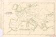
Evropa v době humdsko - germánské od 4. do 6. stol.

Europa Prima Nova Tabula [Karte], in: Geographia universalis vetus et nova complectens Claudii Ptolemaei Alexandrini enarrationis libros VIII, S. 302.
1 Karte aus Atlas Münster, Sebastian [und Ptolemaeus, Claudius]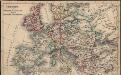
Europa seit Friedrich dem Grossen bis zur französ. Revolution
Europa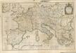

[Personifizierte Europa als Königin mit Reichsapfel und Zepter, Hispania bildet den Kopf]
1 Karte : Holzschnitt ; 16 x 26 cm Münster, Sebastian [Sebastian Münster]
[Personifizierte Europa als Königin mit Reichsapfel und Zepter, Hispania bildet den Kopf]
1 Karte : Holzschnitt ; 16 x 26 cm Münster, Sebastian [Sebastian Münster]
Europe centrale. Chemins de fer, lignes de navigation
1 : 4000000 A. Taride Paris : A. Taride
[Historisch-geographischer Atlas zu den allgemeinen Geschichtswerken von C. v. Rotteck, Pölitz u. Becker] : Das Weströmische Reich bis zu seinem Untergange unter Romulus Augustulus
von Julius Loewenberg Lithographie von B. Herder in Freiburg im Breisgau [Freiburg im Breisgau] : [Herder]
Europa zur Zeit Napoleons
Europa Napoleon I., Frankreich, Kaiser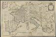
IMPERII | CAROLI MAGNI | et vicinarum regionum | DESCRIPTIO, | Dedicata et inscripta | LVDOVICO, | REGI, VICTORI, | ET DEFENSORI ECCLESIÆ | CHRISTI
ab Auctore Petro Bertio | ejusdem Cosmographo. [Amsterdam : Joan Blaeu]
Europe
1 : 4000000 Evropa Andriveau-Goujon, E. E. Andriveau-Goujon
Cestovní spoje v Evropě
Evropa
Carte Generale des Chemin de Fer Europeens.
1 : 3200000 Migeon, J.
Kriegszusammenhänge III (1700 - 1721)
1 : 20000000 Europa Nordischer Krieg <1700-1721>, Türkenkriege
Europa im Zeitalter Napoleons
1 : 15000000 Europa Napoleon I., Frankreich, Kaiser
[Historisch-geographischer Atlas zu den allgemeinen Geschichtswerken von C. v. Rotteck, Pölitz u. Becker] : Die Reiche im Süden Europa's im Anfange des achten Jahrhunderts
von Julius Loewenberg Lithographie von B. Herder in Freiburg im Breisg. [Freiburg im Breisgau] : [Herder]
Carte Routiere et Postale de la France
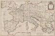
Imperii Caroli Magni et vicinarum regionum Descriptio [Karte], in: Theatrum orbis terrarum, sive, Atlas novus, Bd. 2, S. 167.
1 Karte aus Atlas Blaeu, Joan Blaeu, Willem Janszoon