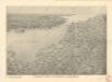
Maps of Sainte-Marguerite-sur-Mer
Sheets 7-8. (Cary's England, Wales, and Scotland).
1 : 360000 Cary, John, ca. 1754-1835
3) II.O. ''Boulogne'', uit: Carte géologique de France
1 : 500000 Annotatie: Voor aanwezige bladen zie bladoverzicht [S.l : s.n.]
delineation of the strata of England and Wales, with part of Scotland
1 : 320000 Blatt 14 Smith, William Cary
Les costes du Boulenois et de la Picardie
1 : 110000 Boulogne-sur-Mer (Francie) Fricx, Eugene Henry Harrewyn, Jacques chez Eugene Henry Fricx
SVTHSEXIA, | Vernacule | SUSSEX.
[Amsterdam : Joan Blaeu]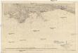
Der Kanal
1 : 150000 Lamanšský průliv Reichs-Marine-Amt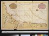
Een gedeelte van het Kanaal van Boulogne tot aen Sotteville int groodt
France Gerard van Keulen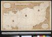
Het oostelijkste gedeelte vant Kanaal vertoonende de kust van Engeland van Dover tot Portland
England Gerard van Keulen
Watershed map England, Wales 6.
1 : 760320 Letts, Son & Co.
Duché et gouvernement general de Normandie, divise en haut et bas en divers pays et balliages avec le gouvernement general de Havre de Grace
1 : 450000 par F. de Witt A Amsterdam : [F. de Wit]
Duche et gouvernement general de Normandie
1 Karte : Kupferdruck ; 49 x 58 cm Seutter; Lotter M. Seutter
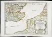
Duche et gouvernement general de Normandie
1 Karte : Kupferdruck ; 48 x 59 cm Wit se vend chez J. Cóvens et C. Mortier
Duche et gouvernement general de Normandie
1 Karte : Kupferdruck ; 48 x 59 cm Wit F. de Wit
Carte de France, 2
2 Blätter : Kupferdruck ; 53 x 45 cm Crepy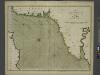
The sea-coasts of FRANCE from Calais to the River Seine
from The sea-atlas : containing an hydrographical description of most of the sea-coasts of the known parts of the world.
La plus grande partie de la Manche
1 Karte : Kupferdruck ; 47 x 55 cm Lotter aux depens de Tob: Conr: Lotter geogr
La plus grande partie de la Manche
1 Karte : Kupferdruck ; 48 x 56 cm Seutter aux depens de Matthieu Seutter
La plus grande partie de la Manche
1 Karte : Kupferdruck ; 45 x 58 cm Ottens; Ottens chez R. et J. Ottens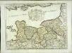
Duché et gouvernement de Normandie
1 Karte : Kupferdruck ; 37 x 50 cm Sanson; Cordier s.n.
England & Wales SE.
1 : 633600 Stanford, Edward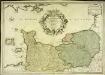
Le gouvernement general de Normandie
1 Karte : Kupferdruck ; 45 x 65 cm Fer; Danet; Starckman chez Danet gendre de l'auteur sur le pont Notre Dame a la Sphere royale
Ooster-deel Van 'T Canaal [Karte], in: De Nieuwe Groote Vermeerderde Zee-Atlas ofte Water-Werelt, S. 43.
1 Karte aus Atlas Doncker, Hendrick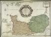
Le gouvernement general de Normandie
1 Karte : Kupferdruck ; 45 x 63 cm Desnos chez Desnos géographe ingénieur pour les globes spheres et instruments de mathématique rue St. Jacques au globe
La plus grande partie de La Manche, qui contient les côtes d'Angleterre et celles de France les bords maritimes de Picardie
1 : 650000 Anglie Lotter, Tobias Conrad Tob. Conr. Lotter
Charte von England und Wallis, 4
1 Blatt : 62 x 53 cm Walch
Karte von England und Wallis, 4
1 Blatt : 62 x 53 cm Schrämbl
Anciens royaumes de Kent, d'Essex, et de Sussex
1 Karte : Kupferdruck ; 36 x 47 cm Sanson chez l'auteur pres de S. Germain l'Auxerrois
Le Duché et gouvernement de Normandie
1 Karte : Kupferdruck ; 47 x 59 cm Jaillot A.-H. Jaillot