Maps of Ozark Plateau
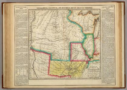
Map Of Arkansas Territory.
1 : 4752000 Lea, I.
Composite: Country drained by the Mississippi.
1 : 4625280 Long, Stephen H.
Commercial Map, Chicago to Denver.
1 : 3950000 Rand McNally and Company
United States of America - Central. Pergamon World Atlas.
1 : 5000000 Polish Army Topography Service
(United States) Denver to Chicago.
1 : 3802000 Rand McNally and Company
Arkansas.
1 : 4700000 Buchon, J. A. C.; Carey, H. C.; Lea, I.
Spojené státy severoamerické II. Prostřední část

Country drained by the Mississippi Western Section.
1 : 4752000 Long, Stephen H.
State of Kansas, and Nebraska and Indian Territories.
1 : 3000000 Colton, G.W.
Map of an exploring expedition to the Rocky Mountains in the year 1842 and to Oregon & north California in the years 1843-44 / by Brevet Capt. J.C. Frémont of the Corps of Topographical Engineers under the orders of Col. J.J. Abert, Chief of the Topog...
From Parts
Shell Highway Map of Central United States.
1 : 3421440 Shell Oil Company
Map showing the lands assigned to emigrant Indians west of Arkansas & Missouri / prepared at the Topographical Bureau Feby. 23d, 1836, [by] R. Jones, Adj. Gene.
from Parts
Kansas, and Nebraska and Indian Territories.
1 : 3000000 Colton, G.W.
Nebraska And Kansas.
1 : 3850000 Colton, J. H.
Les États Unis de l'Amérique septentrionale
1 : 6050000 Spojené státy americké-oblast západní Bonne, Rigobert André
Map of Kansas, Nebraska, and Colorado. Showing also the eastern portion of Idaho.
from New general atlas.
Il paese de' Selvaggi Outagamiani, Mascoutensi, Illinesi, e parte delle VI. Nazioni.
from Le colonie unite dell' America settentrle : di nuova projezione a s.s.e.e. li Signori Riformatori dello Studio di Padova.
Charte pour servir au voyage des cap.es Lewis et Clarke a l'ocean Pacifique 1804
Severní Amerika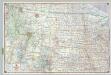
Shell Sectional Map No. 9 - Northwestern States.
1 : 3104640 Shell Oil Company
Nebraska and Kansas.
1 : 3850000 Colton, J. H.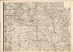
A Map of the British Empire in America. (Sheet 5).
1 : 2000000 Popple, Henry
Nebraska and Kansas.
1 : 3850000 Colton, J. H.
Vereinigte Staaten Von Nord-Amerika In 6 Blattern, Bl. 2.
1 : 3700000 Petermann, A.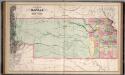
A New Map of Kansas.
1 : 1457280 Mitchell, Samuel Augustus
Nebraska, Kansas, New Mexico, and Indian Territories
1 : 6600000 Mitchell, Samuel Augustus
Nebraska, Kansas, New Mexico, and Indian Territories
1 : 6600000 Mitchell, Samuel Augustus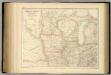
United States ... North Central Section.
1 : 2851200 Fullarton, A. & Co.
[Horní tok Mississippi]
Mississippi, řeka-oblast
States Of Illinois, Missouri, And Arkansas.
1 : 3453120 Rogers, Henry Darwin