Maps of Canada
North America.
1 : 25000000 Lea, I.
North America.
1 : 14982000 Johnston, W. & A.K.
North America.
1 : 23300000 Tanner, Henry S.
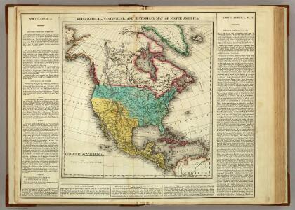
North America.
1 : 23300000 Tanner, Henry S.
North America.
1 : 23000000 Mitchell, Samuel Augustus
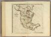
North America.
1 : 47000000 Carey, Mathew
North America.
1 : 45000000 Carey, Mathew
North America - political.
1 : 17000000 John Bartholomew & Co.
Map of North America: exhibiting the recent discoveries, geographical & nautical / by James Wyld, Geographer to Her Majesty; J.W. del.; Stockley sc.
from Whole James Wyld,
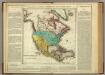
Amerique Septentrionale en 1840.
1 : 33000000 Houze, Antoine Philippe
North America.
1 : 20600000 Schlitz Brewing Company
North America : a working map for illustrating, by coloration, the geographical distribution of life
1 : 15000000 Cleveland, William C. Boston Society of Natural History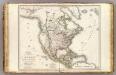
Amerique Septentrionale.
1 : 15000000 Brue, Adrien Hubert, 1786-1832
Composite: Amerique Septentrionale.
1 : 7500000 Brue, Adrien Hubert, 1786-1832
North America.
1 : 20600000 Rand McNally and Company
North America
1 : 14826240 Stanford, Edward
North America.
1 : 34800000 Finley, Anthony
Map of North America
1 : 5274720 Lloyd, J. T.
North America. Pergamon World Atlas.
1 : 60000000 Polish Army Topography Service
North America.
1 : 27500000 Colton, G.W.
Nord-America.
1 : 27750000 Stulpnagel, F.v.
Map of North America
1 : 5000000 Aleutské ostrovy (Aljaška) U. S. Geological Survey
North America.
1 : 33000000 Cornell, S. S. (Sarah S.)
North America.
1 : 14982000 Johnston, Alexander Keith
North America.
1 : 27500000 Colton, G.W.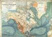
Physikalische Wandkarte der Erde in Merkartor's Projection

North America (political).
1 : 28990200 Fisher, Richard Swainson
A new map of North America: with the British, French, Spanish, Dutch & Danish dominions on that great continent, and the West India Islands, according to the definitive treaty concluded at Paris 10th February 1763 / with great improvements from the Sieurs d'Anville & Robert.
from Charts and maps Printed for Robt. Sayer, map and printseller at the Golden Bunk in Fleet Street: London; Robert de Vaugondy, Didier; Anville, Jean Baptiste Bourguignon d',
North America.
1 : 26000000 Carey, Mathew