Maps of Alaska
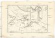
Possessions russes.
1 : 7600000 Pierron, Jean Antoine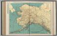
Alaska.
1 : 4055000 Rand McNally and Company
Alaska.
1 : 8200000 Rand McNally and Company
Map of Alaska / comp. by Alaska Branch
1 : 5000000 United States Geological Survey. Alaskan Branch [Washington, D.C. : U.S. Geological Survey]
Territory of Alaska.
1 : 7500000 Colton, G.W.
North America...N.W. Sheet.
1 : 7500000 Tanner, Henry S.
North America...N.W. Sheet.
1 : 7500000 Tanner, Henry S.
Alaska.
1 : 3817000 U.S. General Land Office
Map Of Alaska.
1 : 3484800 Punnett Brothers
NW America.
1 : 11900000 Mitchell, Samuel Augustus
Mexico, Central America, West Indies.
1 : 12000000 Mitchell, Samuel Augustus
NW America.
1 : 11900000 Mitchell, Samuel Augustus Jr.
NW America.
1 : 11900000 Mitchell, Samuel Augustus
NW America.
1 : 11900000 Mitchell, Samuel Augustus
Alaska.
1 : 7315000 Colton, G. Woolworth
Alaska.
1 : 8400000 Rand McNally and Company
Alaska.
1 : 8200000 Rand McNally and Company
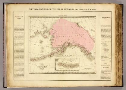
Territory of Alaska (Russian America).
1 : 7000000 Colton, G.W.
Rand-McNally Official 24x36 Map Of Alaska.
1 : 3611520 Rand McNally and Company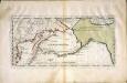
Carte der Entdekvngen zwischen Sibirien und America bis auf das Jahr 1780
1 Karte : Kupferdruck ; 18 x 40 cm Pallas s.n.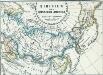
Sibirien und Russisch Amerika
1 : 70000000 Sibirien, Russisch-Amerika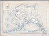
Map of Alaska
1 : 5000000 [Washington, D.C. : United States Department of the Interior, Geological Survey]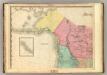
North America, N.W. Sheet..
1 : 7600000 Tanner, Henry S.
Territory of Alaska.
1 : 7500000 Colton, G.W.
Alaska.
1 : 7857000 Rand McNally and Company
North western America showing the territory ceded by Russia to the United States.
1 : 12100000 United States Coast Survey
North western America showing the territory ceded by Russia to the United States.
1 : 12100000 United States Coast Survey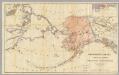
Northwestern America Showing The Territory Ceded By Russia To The United States.
1 : 5000000 Sumner, Charles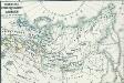
Russisches Eroberungsgebiet in Sibirien XVI. und XVII. Jahrh.
1 : 47000000 Sibirien, Eroberung