Maps of San Bernardino County
Calif., Nev. south.
1 : 1267200 Asher & Adams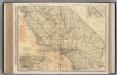
California (Southern Section).
1 : 1140000 Rand McNally and Company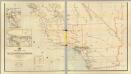
California, Nevada (lower)
1 : 696960 Von Haake, A.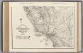
California. Nevada.
1 : 1341000 Rand McNally and Company
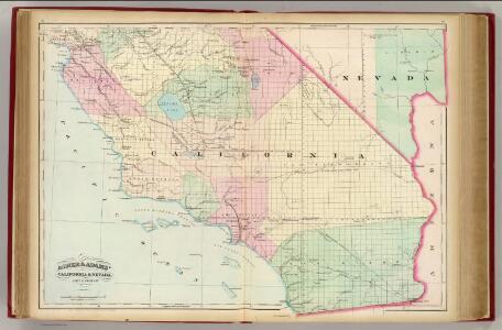
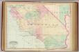
California and Nevada. South Portion.
1 : 1290000 Asher & Adams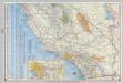
Shell Highway Map of California (southern portion).
1 : 1330560 Shell Oil Company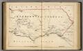
Southern California.
1 : 3300000 Holdredge, Sterling M.
From San Francisco Bay to Plains of Los Angeles.
1 : 760320 Parke, John G.
Topographic Map of the Los Angeles Aqueduct and Adjacent Territory
1 : 1316800 [California? : s.n.]
Topographic map of the Los Angeles Aqueduct and adjacent territory
1 : 1316800 Relief shown by contours and hachures. Blue line print. Includes "Key to index system." Map Library copy annotated in colored pen. [California? : s.n.]
San Benito, Fresno, Monterey, San Luis Obispo, Kings, Kern, and Santa Barbara Counties.
1 : 950400 Blum, George W.
73. Part Of Southern California.
1 : 506880 Wheeler, G.M.
Ventura, Los Angeles, San Bernardino, Orange, and San Diego Counties.
1 : 760320 Blum, George W.
Map showing a part of the Palomas Mining District and the Piru creek ditch, situated in Los Angles [sic] and Ventura Cs. California
1 : 147520 Shows mining claims including "Patented Gold Gravel" claim by Jenkins, townships and ranges, creeks and rivers, residences, and local features. De Laveaux, Gustave. Manuscript Map
Map and condensed profile showing Los Angeles Aqueduct, completed in 1913, and proposed extension to Mono Basin : also condensed profile of Colorado River Aqueduct now under construction by Metropolitan Water District.
1 : 1430000 One map shows southern portion of Los Angeles Aqueduct (to Fairmont Reservoir) and the route of the Colorado River Aqueduct; the other map shows the Los Angeles Aqueduct and proposed Mono Craters Tunnel. Photostat. Los Angeles Aqueduct hand colored in red and blue on one map. Los Angeles (Calif.). Bureau of Water Works & Supply. [Los Angeles, Calif.? : Bureau of Water Works and Supply?]
Coast Ranges showing San Andreas Rift.
1 : 760320 California. State Earthquake Investigation Commission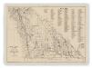
Map of Inyo County, California : showing locations of principal mines
1 : 135000 Includes indexes of mines and mineral monuments. "Accompanying State Mineralogist's Report XXXIV. October 1938." Tucker W.B., Sampson R.J. [Sacramento] : Division of Mines
Map of a part of Southern California, showing gaging stations
1 : 1250000 Relief shown by contours and spot heights. Map is plate 1 and 2 from the U.S. Geological Survey's Water- supply paper 447. Includes index. Geologic Survey (U.S.) [Washington, D.C.] : U.S. Geological Survey, 1920.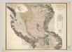
Sheet No. 4, Southern Portion, Irrigation Map of the San Joaquin Valley, California.
1 : 190000 California State Engineering Department
Composite: Sheets Nos. 1-4, Irrigation Map of the San Joaquin Valley, California.
1 : 190000 California State Engineering Department
66. Parts Of Eastern & Southeastern Nevada & Southwestern Utah.
1 : 506880 Wheeler, G.M.
66. Parts Of Eastern & Southeastern Nevada & Southwestern Utah.
1 : 506880 Wheeler, G.M.
Map Fresno County.
1 : 278000 McKay, Scott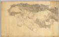
Los Angeles & San Bernardino topography.
1 : 126720 Hall, Wm. Ham. (William Hammond)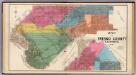
Fresno County, Calif.
1 : 380160 Thompson, Thos. H.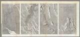
Rio Colorado of the West.
1 : 380160 Ives, J.C.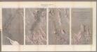
Geological Map ... Rio Colorado of the West.
1 : 380160 Ives, J.C.
Reconnaissance map of the Salton Sick California
1 : 500000 Kalifornie Douglas, Edward Morehouse Department of the interior, United States Geological survey
Existing airports & landing fields, County of Los Angeles
1 : 1250000 Includes inset of north part of Los Angeles County and index. Los Angeles County (Calif.). Regional Planning Commission [Los Angeles, Calif.] The Commission