Maps of Apulia

S. Italy.
1 : 1250000 Arrowsmith, John
Die Königreich Sicilien u: Neapolis
1 : 2500000 Mollova mapová sbírka Riegel, Christoph Riegel, Christoph
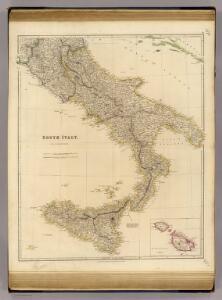
South Italy (with) The Maltese Islands.
1 : 1267200 Arrowsmith, John
South Italy.
1 : 1267200 Stanford, Edward
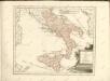
Kingdom of Naples.
1 : 2500000 Tanner, Henry S.
Italiae regiones I-IIII, Sicilia.
1 : 1900000 Menke, Th.
Unter Italien, beider Sicilien.
1 : 1200000 Kiepert, Heinrich, 1818-1899
Les Royaumes De Naples Et De Sicile
1 : 1400000 Mollova mapová sbírka Fer, Nicolas de Fer, Nicolas de
Italie Ancienne.
1 : 3600000 Malte-Brun, Conrad, 1775-1826
Koenigreich beyder Sicilien
1 : 2420000 Itálie jižní Mollo, Tranquillo T. Mollo
Koenigreich beyder Sicilien
1 : 2420000 Itálie jižní Mollo, Tranquillo T. Mollo

Southern Italy.
1 : 2000000 Colton, G.W.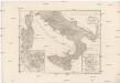
Italia inferior, Sicilia, Sardinia, Corsica
1 : 1320000 Itálie jižní Reichard, Christian Gottlieb Campius, D. a D. Campio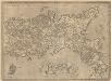
Regni Neapolitani Verissima Secundum Antiquorum Et Recentiorum Traditionem Descriptio [Karte], in: Theatrum orbis terrarum, S. 328.
1 Karte aus Atlas Ortelius, Abraham Vrients, Jan Baptista
[Italia]
1 : 1700000 Itálie jižní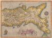
Regni Neapolitani Verissima Secundum Antiquorum Et Recentiorum Traditionem Descriptio [Karte], in: Theatrum orbis terrarum, S. 233.
1 Karte aus Atlas Ortelius, Abraham
Southern Italy.
1 : 3168000 Tallis, J. & F.
[Südliches Jtalien enthält Neapel und Sicilien]
Stieler's Hand-Atlas Stieler, Adolf bei Justus Perthes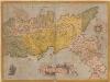
Regni Neapolitani Verissima Secundum Antiquorum Et Recentiorum Traditionem Descriptio. [Karte], in: Theatrum orbis terrarum, S. 89.
1 Karte aus Atlas Ortelius, Abraham
Südliches Italien enthält Neapel und Sicilien nebst dem südlichen Theile des Kirchenstaates
Hand-Atlas über alle Theile der Erde nach dem neuesten Zustande und über das Weltgebäude Stieler, Adolf bei Justus Perthes
Königreich beider Sicilien nebst Südlichen Theile des Kirchenstaats / [Adolf Stieler]
1 : 1850000 Annotatie: Met administratieve indeling Gotha : Justus Perthes
Südliches Italien

Süd-Italien
Hand-Atlas über alle Theile der Erde und über das Weltgebäude Stieler, Adolf Justus Perthes
Königreich Beider Sicilien nebst dem Südlichen Theile des Kirchenstaats
Hand-Atlas über alle Theile der Erde nach dem neuesten Zustande und über das Weltgebäude Stieler, Adolf bei Justus Perthes
Südliches Italien
1 : 1525000 Comino (Malta) Geographisches Institut
Südliches Italien
1 : 4440000 Itálie jižní