Maps of Netherlands

Holland, Belgium.
1 : 770000 Arrowsmith, John
Niederlande und Belgien
Hand-Atlas über alle Theile der Erde und über das Weltgebäude Stieler, Adolf Justus Perthes
Niederlande und Belgien
Handatlas über alle Theile der Erde und über das Weltgebäude Stieler, Adolf Justus Perthes
Netherlands.
1 : 1237000 Teesdale, Henry
[Niederlande, Belgien, Luxemburg]
Hand-Atlas über alle Theile der Erde nach dem neuesten Zustande und über das Weltgebäude Stieler, Adolf bei Justus Perthes
Niederlande, Belgien, Luxemburg
Hand-Atlas über alle Theile der Erde nach dem neuesten Zustande und über das Weltgebäude Stieler, Adolf bei Justus Perthes
Karte der Niederlande
1 : 980000 Belgie C. Hennigs Verlag
Karte der Niederlande
1 : 1000000 Belgie C. Hennig
Holland and Belgium.
1 : 1290000 Colton, G.W.
Království Hollandské (Nizozemsko), Království Belgické
Belgie Hynek Fuchs
Belgique, Hollande, Limbourg, Luxembourg.
1 : 1000000 Picquet, C.
Holland & Belgium.
1 : 792000 Arrowsmith, John
Belgique et de Hollande, 1812.
1 : 3500000 Malte-Brun, Conrad, 1775-1826
The Kingdom of the Netherlands
1 : 1500000 engraved by J. & C. Walker. London : Baldwin & Cradock
44. Belgio e Olanda.
1 : 1500000 Touring club italiano
Holland and Belgium.
1 : 1330560 Colton, G.W.
Pays-Bas et Belgique.
1 : 1180000 Migeon, J.
Nieuwe kaart van het Koningryk der Nederlanden en het Groot-hertogdom Luxemburg
1 : 600000 Belgie Weygand, F. J. Baarsel, Cornelis van
Holland and Belgium.
1 : 4000000 Colton, G.W.
Holland and Belgium.
1 : 1110000 Sharpe, J.
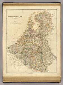
Holland & Belgium.
1 : 950400 Fullarton, A. & Co.
Niederlande Und Belgien.
1 : 1110000 Vogel, C.
Belgium and the Netherlands
1 : 789237 Johnston, W. & A.K.
Belgium, Netherlands, Luxembourg. Pergamon World Atlas.
Polish Army Topography Service
Das Koenigreich der Niederlande nebst dem Grossherzogthume Luxemburg
1 : 925000 Belgie Weiland, Karl Ferdinand Geographisches Institut
Belgium, Netherlands, Luxembourg. Pergamon World Atlas.
Polish Army Topography Service
Holland and Belgium.
1 : 1290000 Colton, G.W.
Holland And Belgium.
1 : 1187000 Johnson, A.J.
Pays-Bas, Belgique, Luxembourg.
1 : 1000000 Levasseur, E.