Maps of Middlesex County
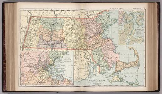
Map of Massachusetts. 70
1 : 633600 Appleton, D. & Co.
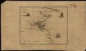
An accurate map of the country round Boston in New England : from the best authorities
1 : 362500 Hamilton, Archibald, d. 1792 Published as the Act directs by A. Hamilton, Junr. near St. John's Gate
An accurate map of the country round Boston in New England
Die gegund um Boston

Carte des environs de Boston, capitale de Nlle. Angleterre en Amerique

Thirty-miles round Boston

Map of Middlesex County, Massachusetts : based upon the trigonometrical survey of the state
1 : 50000 Walling, Henry Francis, 1825-1888 Smith & Bumstead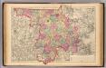
Middlesex County.
1 : 158400 Gray, Ormando Willis; Walling, H. F.
Map of Boston and its vicinity : from actual survey..., with corrections in 1833
1 : 63360 Hales, John Groves John G. Hales
Map of Boston and its vicinity : from actual survey
1 : 63360 Hales, John Groves Published by John G. Hales ; J. Melish
Map Of Boston.
1 : 63360 Walling, H. F.
Boston
1 : 100000
Boston
1 : 100000
Boston
1 : 100000
A topographical map of Essex County, Massachusetts : based upon the trigonometrical survey of the state
1 : 50000 Walling, Henry Francis, 1825-1888 Smith and Morley
Map of the county of Bristol, Massachusetts : based upon the trigonometrical survey of the state
1 : 47520 Walling, Henry Francis, 1825-1888 John L. Smith & Co.
Shell Metropolitan Boston and Vicinity.
1 : 110880 Shell Oil Company
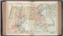
Map of the county of Norfolk, Massachusetts
1 : 40000 Walling, Henry Francis, 1825-1888 Smith & Bumstead
Map of the County of Norfolk, Massachusetts.
1 : 40000 Walling, H. F.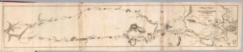
Plan of a survey for the proposed Boston and Providence rail way
1 : 63360 Hayward, James
Plymouth County.
1 : 158400 Gray, Ormando Willis; Walling, H. F.
Boston
1 : 125000
Map of Boston and its vicinity from actual survey

Map of Boston and its vicinity from actual survey

Map of Boston and its vicinity from actual survey

Map of the city and vicinity of Boston, Massachusetts : from original surveys
1 : 39600 Sidney, J. C. (James C.) J.B. Shields
Map of the county of Plymouth, Massachusetts : from actual surveys
1 : 47520 Walling, Henry Francis, 1825-1888 D.R. Smith & Co.
Map of the Metropolitan District of Boston : showing local public reservations, the holdings of the Metropolitan Park Commission and additions which have been proposed
1 : 62500 Massachusetts. Metropolitan Park Commission Metropolitan Park Commission
Chart of Boston Harbor and Massachusetts Bay : with map of the adjacent country
1 : 65400 E.P. Dutton (Firm) E.P. Dutton & Co.