Maps of Caesar Creek Township

Maps of Caesar Creek Township

$title$

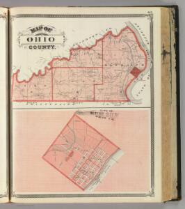
Map of Ohio County. (with) City of Rising Sun, Ohio Co.

1 : 85000 Baskin, Forster and Company
$title$

Aberdeen

1 : 24000
$title$

Aberdeen

1 : 24000
$title$

Aberdeen

1 : 24000
$title$

Bear Branch

1 : 24000
$title$

Bear Branch

1 : 24000
$title$

Bear Branch

1 : 24000
$title$

Aberdeen

1 : 24000
$title$

Aberdeen

1 : 24000
$title$

Aberdeen

1 : 24000
$title$

Rising Sun

1 : 24000
$title$

Rising Sun

1 : 24000
$title$

Rising Sun

1 : 24000
$title$

Rising Sun

1 : 24000
$title$

Dillsboro

1 : 24000
$title$

Aurora

1 : 24000
$title$

Aurora

1 : 24000
$title$

Aurora

1 : 24000
$title$

Dillsboro

1 : 24000
$title$

Dillsboro

1 : 24000
$title$

Dillsboro

1 : 24000
$title$

Aurora

1 : 24000
$title$

Aurora

1 : 24000
$title$

Aurora

1 : 24000
$title$

Map of Dearborn County (with) Greendale, Moore's Hill, Cochran.

1 : 126720 Baskin, Forster and Company
$title$

Map of Switzerland County.

1 : 100000 Baskin, Forster and Company
$title$

Lawrenceburg

1 : 62500
$title$

Lawrenceburg

1 : 62500
$title$

Lawrenceburg

1 : 48000
$title$

Lawrenceburg

1 : 62500
$title$

Lawrenceburg

1 : 48000
© MapTiler © OpenStreetMap contributors
How does it work?
These instructions will show you how to find historical maps online.
Getting started
Type the place name in the search box to find the exact location. You can further adjust the search by zooming in and out.
Zoom
Zoom in and out with the buttons or use your mouse or touchpad natively.
Exact Area tool
Click here and draw a rectangle over the map to precisely define the search area.
Set filters
Narrow your search with advanced settings, such as Years (from/to), Fulltext, Publisher, etc.
Results
See the results of your search on the right side. You can scroll down to find more maps of this location.
?

Download OldMapsOnline Mobile