Maps of Mahaska County

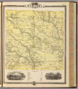
Map of Mahaska County, State of Iowa.
1 : 126720 Andreas, A. T. (Alfred Theodore), 1839-1900
Oskaloosa
1 : 24000
University Park
1 : 24000
New Sharon
1 : 24000
Union Mills
1 : 24000
Leighton
1 : 24000
Peoria
1 : 24000
Rose Hill
1 : 24000
Gibson
1 : 24000
Eddyville
1 : 24000
Kirkville
1 : 24000
Buxton
1 : 24000
Pella
1 : 62500
Pella
1 : 62500
Pella
1 : 62500
Fremont
1 : 24000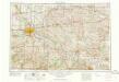
Des Moines
1 : 250000
Des Moines
1 : 250000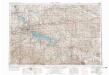
Des Moines
1 : 250000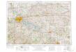
Des Moines
1 : 250000
Albia
1 : 62500
Albia
1 : 62500
Albia
1 : 62500
Ottumwa North
1 : 62500
Searsboro
1 : 24000
Montezuma
1 : 24000
Sully
1 : 24000
Barnes City
1 : 24000
Iowa.
1 : 1393920 Mitchell, Samuel Augustus