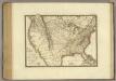
Maps of United States

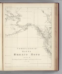
Facsimile: Russian Admiralty's Chart Northeast Pacific.
1 : 13250000 Russian Admiralty

North America : Showing the Origin & Progress of the Storm of March 14-17, 1859
1 : 15000000 This map is one of the earliest weather maps of the United States, which traced an 1859 storm across the continent. Manuscript annotations in red ink show dates and positions of the storm front. The base map was prepared for the Boston Society of Natural History by William C. Cleveland; and shows isothermal lines of mean temperatures. The lower right margin reads: "American Photo-Lithographic Co., Osborne's Process." Lapham, Increase Allen
Facsimile: Hudsons Bay Company Map of North America.
1 : 15300000 Hudson's Bay Company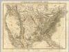
Die Vereinigten Staaten von Nord-America.
1 : 8000000 Bromme, Traugott
[Neuer Atlas der ganzen Erde nach den neuesten Bestimmungen ... : XXIV.] Charte von dem Nordamericanischen Staatenbunde
Entworfen und gezeichnet von F.W. Streit H. Leutemann sc. Leipzig : J.C. Hinrichs'sche Buchhandlung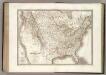
Etats-Unis d'Amerique.
1 : 9300000 Lapie, M. (Pierre), 1779-1850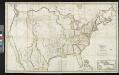
Map of the United States: with the contiguous British & Spanish possessions / compiled from the latest & best authorities by John Melish; engraved by J. Vallance & H.S. Tanner.
from Whole John Melish; J. Vallance; Henry S. Tanner,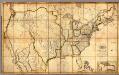
Map of the United States with the contiguous British & Spanish Possessions.
1 : 3900000 Melish, John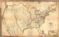
Composite: Map of the United States with the contiguous British & Spanish Possessions.
1 : 3900000 Melish, John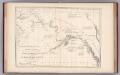
Facsimile: Russian Map (Enclosure in Sir C. Bagot's Dispatch).
1 : 7500000 Alaskan Boundary Tribunal
[Vereinigte Staaten von Nord-America und Canada]
Schul-Atlas über alle Theile der Erde nach dem neuesten Zustande, und über das Weltgebäude Stieler, Adolf bei Justus Perthes
Vereinigte Staaten von Nord-America
Hand-Atlas über alle Theile der Erde nach dem neuesten Zustande und über das Weltgebäude Stieler, Adolf bei Justus Perthes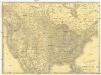
Rand McNally new official railroad map of the United States and southern Canada
1 : 5258880 Kanada Rand McNally
Vereinigte Staaten von Nord-America
Stieler's Hand-Atlas Stieler, Adolf bei Justus Perthes
Nord-Americanische Freistaaten
Grosser Hand-Atlas über alle Theile der Erde in 170 Karten Meyer, J. Verlag des Bibliographischen Instituts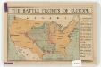
The battle fronts of Europe
1 : 2500000 Map of battle fronts drawn to scale upon a map of the United States showing relative distances of fronts. Roberts & Leete. London : Stanford's Geographical Establishment
Carte de la Nouvelle France: où se voit le cours des Grandes Rivieres de S. Laurens & de Mississipi, aujour d'hui S. Louïs, aux environs des-quelles se trouvent les etats, païs, nations, peuples &c. de la Floride, de la Louïsiane, de la Virginie, de la Marie-lande, de la Pensilvanie, du Nouveau Jersay, de la Nouvelle Yorck, de la Nouv. Angleterre, de l'Acadie, du Canada, des Esquimaux, des Hurons, des Iroquois, des Ilinois &c., et de la Grande Ile de Terre Neuve / dressée sur les memoires les plus nouveaux recueillis pour l'établissement de la Compagnie françoise occident.
from Charts and maps Chez L'Honoré & Châtelain Libraires?: [Amsterdam?]; Chatelain, Henri Abraham,
Geognostische Karte der Nord-Americanischen Freistaaten
Grosser Hand-Atlas über alle Theile der Erde in 170 Karten Meyer, J. Verlag des Bibliographischen Instituts
Etats-Unis.
1 : 11700000 Migeon, J.
Vereinigte Staaten von Nord-America
1 : 13000000
Vereinigte Staaten
1 : 10000000 Nové Skotsko Elfert, Paul Geogr. anstalt von Wagner & Debes
United States Of America.
1 : 7603200 Lea, I.
Nord Americanische Freistaaten
Schul-Atlas in 36 Karten Völter, Daniel Verlag der J.M. Dannheimer'schen Buchhandlung
United States.
1 : 21000000 Grigg, John
Hypsometric sketch US.
1 : 10400000 United States. Census Office
Facsimile: Walch's North America (portion).
1 : 13000000 Walch, Joh.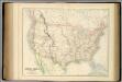
United States.
1 : 9504000 Fullarton, A. & Co.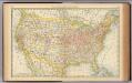
United States.
1 : 10560000 Rand McNally and Company