Cataloged map
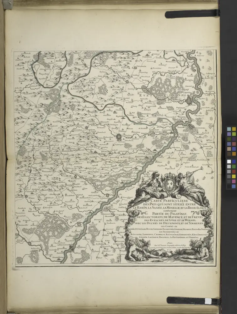
Carte particulìere des pays quì sont sítuéz entre la Rhein, la Saare, la Mosselle et la basse Alsace, contenant partìe du Palatinat, des Electorats de Mayence de Treves des Eveschés de Spìres et de Wormes avec les Duchés de Deuxponts et des Sìmmeren.

Full title:Carte particulìere des pays quì sont sítuéz entre la Rhein, la Saare, la Mosselle et la basse Alsace, contenant partìe du Palatinat, des Electorats de Mayence de Treves des Eveschés de Spìres et de Wormes avec les Duchés de Deuxponts et des Sìmmeren.
Depicted:1716
Physical Size:20 x 30 cm
Des Herzogthums Würtemberg nordwestliche Aemter mit der freyen Reichsstadt Weil
1806
Reilly
Die untere Markgrafschaft Baaden oder die Grafschaft Eberstein mit den Durlachischen Landen
1806
Reilly
Totius s.r.i. circuli Suevici tabula chorographica, 1
1750
R. et J. Ottens
Suevia universa IX. tabulis delineata, 1
1740
s.n.
Carte particulìere des pays quì sont sítuéz entre la Rhein, la Saare, la Mosselle et la basse Alsace, contenant partìe du Palatinat, des Electorats de Mayence de Treves des Eveschés de Spìres et de Wormes avec les Duchés de Deuxponts et des Sìmmeren.
1716
Wirtenbergensis dvcatvs
1600
Gadner; Quad; Bussemacher
Geographica provinciarum Sueviae descriptio, 1
1690
Johann Georg Bodenehr
Des Herzogthums Würtemberg nordwestliche Aemter mit der freyen Reichsstadt Weil : Nro. 187
1791
Reilly, Franz Johann Joseph von
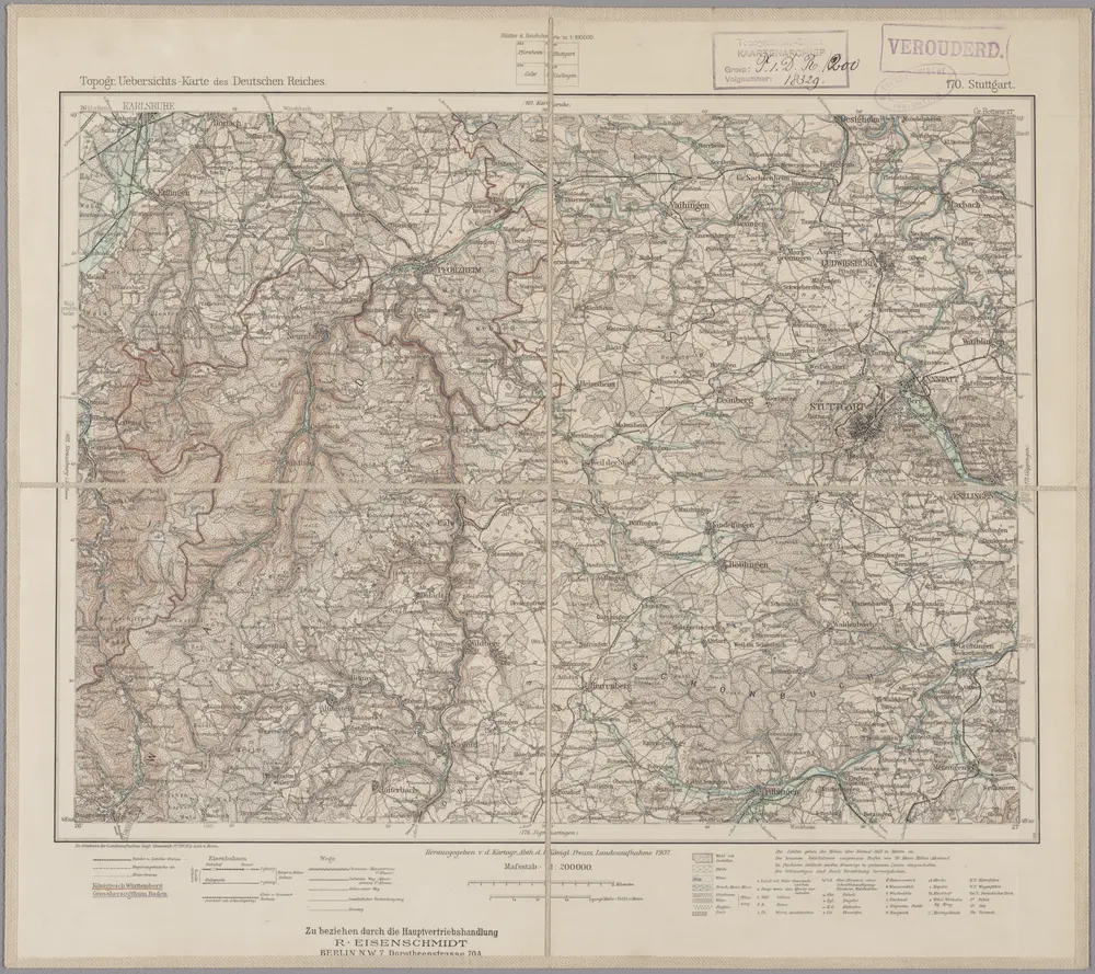
170. Stuttgart, uit: Topographische Uebersichtskarte des Deutschen Reiches / herausgegeben v. d. Kartogr. Abt. d. Königl. Preuß. Landesaufnahme
1899
Königlich Preußische Landesaufnahme. Kartographische Abtheilung
1:200k
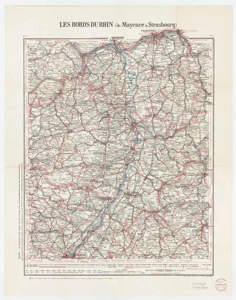
Carte routière No. 27 Les bords du Rhin (de Mayence à Strasbourg), uit: Les bords du Rhin (de Mayence à Strasbourg)
1925
Paris : Taride
1:350k