Maps of Burlington County

A new map of Virginia, Mary-land and the improved parts of Penn-sylvania & New Jersey / revised by I. Senex.
from Charts and maps I. Senex,
Carte de la Baye et Riviere de Délaware, contenant une éxacte et entiére description des rivages, criques, havres, sondes, bas-sonds, sables et gissements des marques ...
1 : 31000 France. Dépôt des cartes et plans de la marine France. Dépôt des cartes et plans de la marine
D'Engelze volkplanting in Virginie / door Iohan Smith bezogt en verder uytgeset; uytgevoerd te Leyden door Pieter vander Aa.
from Charts and maps Pieter vander Aa,
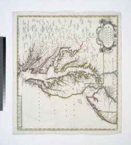
Carte particuliere de Virginie, Maryland, Pennsilvanie, la Nouvelle Iarsey orient et occidentale.
from John H. Levine Collection Mortier, Pierre,
Virginia and Maryland.
1 : 1340000 Moll, Herman, d. 1732
Delaware, from the best authorities / W. Barker sculp., Philada.
from Charts and maps W. Barker,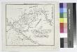
The bay and river of Delaware / A.M. Peasley, sc.
from Charts and maps
Delaware / engraved by A. Doolittle, Newhaven.; Carey's American pocket atlas; containing nineteen maps... with a brief description of each state.
from Carey's American pocket atlas; containing nineteen maps... with a brief description of each state. Carey, Mathew; Sweitzer, Henry,
Delaware / Young & Delleker sc.
from Charts and maps Young & Delleker,
A chart of Delaware Bay and River : containing a full and exact description of the shores, creeks, harbours, soundings, shoals, sands, and bearings of the most considerable land marks &c. &c. / faithfully coppied [sic] from that published at Philadelphia
from A new edition, much enlarged, of the second part of the North American pilot, for New England, New York, Pennsylvania, New Jersey, Maryland, Virginia, North and South Carolina, Georgia, Florida, and the Havanna : including general charts of the British Ch
Delaware.
1 : 1013760 Scott, Joseph
A chart of Delawar Bay : with soundings and nautical observations / taken by Capt. Sir Andrew Snape Hammond of the Navy and others ; composed ... for the use of pilotage by J.F.W. Des Barres esqr.
from Charts and maps
New Jersey.
1 : 1077120 Scott, Joseph
Delaware.
1 : 328000 Carey, Mathew
Delaware.
1 : 440000 Carey, Mathew
Delaware.
1 : 443529 Carey, Mathew
Delaware.
1 : 950400 Carey, Mathew
Delaware.
1 : 443529 Carey, Mathew
Delaware.
1 : 443529 Carey, Mathew
Delaware.
1 : 443529 Carey, Mathew
A plan of Fort Montgomery & Fort Clinton, taken by His Majesty's forces, under the command of Maj. Genl. Sir Henry Clinton, K.B. / survey'd by Major Holland, Survr. Genl. &c.
from Cartographic materials from the Emmet Collection of Manuscripts Etc. Relating to American History.
Composite: Delaware Bay, River.
1 : 80000 Hassler, F. R.
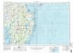
Chincoteague
1 : 250000
Chincoteague
1 : 250000
Salisbury
1 : 250000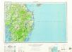
Salisbury
1 : 250000
Salisbury
1 : 250000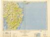
Salisbury
1 : 250000
Salisbury
1 : 250000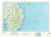
Salisbury
1 : 250000
Salisbury
1 : 250000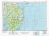
Salisbury
1 : 250000