Maps of Bronx County

Petersen's New Map of the Bronx showing all present and proposed Trolley and rapid transit lines. [Also showing Congressional Districts]
From Bronx
Westchester, Double Page Plate No. 3 [Map of Towns of Westchester and Pelham] / prepared under the direction of Joseph R. Bien, from general surveys and official records.
From Atlas of Westchester County, New York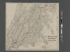
Map of the Bronx showing present and proposed transit system.
From Bronx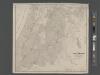
Map of the Bronx. [including part of Yonkers, Mount Vernon, and New Rochelle].
From Bronx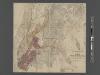
Map of the Borough of the Bronx, City of New York, showing street pavements on January 1st, 1913.
From Bronx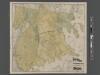
New Standard map of the Borough of Bronx.
From Bronx
Plan of East Chester, Pelham and New Rochelle, Westchester County, New York.
1 : 42240 Beers, Frederick W.
Map or plan showing the system of streets, avenues, public squares and places, parks, bridges, etc. in that part of the borough of the Bronx, City of New York lying easterly of the Bronx River.
From Bronx
Hammods Atlas of New York City and the metropolitan district

Westchester, Pelham towns.
1 : 21120 Bien, Joseph Rudolf
Flushing
1 : 24000
Flushing
1 : 24000
Flushing
1 : 24000
Flushing
1 : 24000
Flushing
1 : 24000
Flushing
1 : 24000
Flushing
1 : 24000
Flushing
1 : 24000
Flushing
1 : 24000
Sheet 29: Map of Pelham Bay Park, City of New York, forming sheet 29 of the Topographical Atlas of the Territory East of the Bronx River.
from Topographical survey and new street system of the borough of the Bronx, easterly of the Bronx River
Plate 50: Town of Westchester, Westchester Co. N.Y.
from County atlas of Westchester, New York. Published by J.B. Beers & Co., assisted by S.W. Wilson and others.
Area District Map Section No. 4
from Area district map / City of New York, Board of Estimate and Apportionment.
Area District Map Section No. 2
from Area district map / City of New York, Board of Estimate and Apportionment.
From New York to Stratford. (2)
1 : 35000 Colles, Christopher
Area District Map Section No. 7
from Area district map / City of New York, Board of Estimate and Apportionment.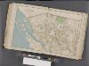
Westchester, Double Page Plate No. 14 [Map bounded by Pelham Winthrop St., Echo Ave., Long Island Sound] / prepared under the direction of Joseph R. Bien, from general surveys and official records.
From Atlas of Westchester County, New York
Use District Map Section No. 7; Use district map / City of New York, Board of Estimate and Apportionment.
from Use district map / City of New York, Board of Estimate and Apportionment. New York (N.Y.). Board of Estimate and Apportionment,
Height District Map Section No. 7; Height district map / City of New York, Board of Estimate and Apportionment.
from Height district map / City of New York, Board of Estimate and Apportionment. New York (N.Y.). Board of Estimate and Apportionment,
Height District Map Section No. 4; Height district map / City of New York, Board of Estimate and Apportionment.
from Height district map / City of New York, Board of Estimate and Apportionment. New York (N.Y.). Board of Estimate and Apportionment,
![Petersen's New Map of the Bronx showing all present and proposed Trolley and rapid transit lines. [Also showing Congressional Districts]](https://images-2.georeferencer.com/images/iiif/117434369451/full/,300/0/native.jpg)

