Maps of Ontario
Upper & Lower Canada.
1 : 4700000 Cary, John, ca. 1754-1835
A new map of Upper & Lower Canada / from the latest authorities by John Cary, engraver.
from Canada John Cary,
Canada.
1 : 8870400 Finley, Anthony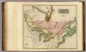
Canada, Nova Scotia.
1 : 4800000 Thomson, John
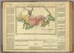
New Map of Upper & Lower Canada.
1 : 130000000 Morse, Jedidiah
Canada.
1 : 9000000 Finley, Anthony
(Vereinigte Staate)n v. Nordamerika II.
1 : 8000000 Berghaus, Heinrich; Flemming, Carl; Sohr, Karl
Map of the Northern and Middle States.
1 : 6900000 Morse, Jedidiah
Canada.
1 : 11088000 Lucas, Fielding Jr.
Canada.
1 : 9000000 Tanner, Henry S.
Map of the Northern and Middle States.
1 : 6950000 Morse, Jedidiah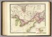
Canada, New Brusnwick, and Nova Scotia.
1 : 6600000 Teesdale, Henry
Canada, N.B., N.S.
1 : 5100000 Hall, S. (Sidney)
A map of the northern and middle states
Map Of Upper And Lower Canada.
1 : 2217600 Lea, I.
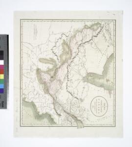
(West sheet) Map of the Provinces of Upper & Lower Canada with parts of the United States of America &c.
1 : 2300000 Faden, William, 1750?-1836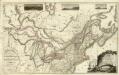
Composite: Upper, Lower Canada; United States &c.
1 : 2300000 Faden, William, 1750?-1836
Map of the province of Ontario, dominion of Canada
1 : 2217600 Ontario Department of Lands, Forests & Mines, Bureau of Colonization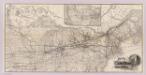
Grand Trunk Ry. of Canada.
1 : 3362700 Grand Trunk Railway Company of Canada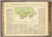
Possessions anglaises.
1 : 4700000 Buchon, J. A. C.; Carey, H. C.; Lea, I.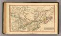
Canada.
1 : 11000000 Fenner, Rest.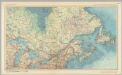
Canada - Ontario, Quebec, and Maritime Provinces. Pergamon World Atlas.
1 : 5000000 Polish Army Topography Service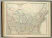
United States of North America (North East Sheet).
1 : 3984000 Johnston, W. & A.K.
Copy of a map attached to Govr. Colden's History of the Five Indian Natio[ns] : printed in London, A.D. MDCCXLVII.
from Parts
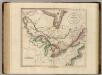
British America.
1 : 10200000 Grigg, John
Etats Unis Flle. N.E.
1 : 5000000 Vivien St Martin, L.
British Provinces in Canada.
1 : 7247550 Fisher, Richard Swainson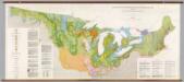
United States: East of the Rocky Mountains -- Glacial Deposits
1 : 1750000 The Geological Society of America
Map of the United States of North America / compiled from the latest and most authentic information by David H. Vance ; engraved by J.H. Young.
From Whole