Maps of New Jersey

A map of the roads leading to the town of Britania in the British settlement, Susquehanna County, Penna. / drawn by H.S. Tanner; T.V.K. & Co. sc.
from Cities and towns, A - Z Henry S. Tanner,
A Map Of The State Of Pennsylvania.
1 : 310000 Howell, Reading
The Province of New Jersey, divided into East and West, commonly called the Jerseys / engraved & published by Wm. Faden.
from Charts and maps
Map of the State of New Jersey
from Atlas of Hunterdon County, New Jersey : from recent and actual surveys and records / under the superintendence of F.W. Beers.
New Jersey / engraved by J.H. Young.
from Whole
The Province of New Jersey, divided into East and West, commonly called the Jerseys / engraved & published by Wm. Faden, Charing Cross, December 1st, 1777 ; Croisey, sculpt.
from Whole
New Jersey
1 : 505000 Sotzmann, D. F Bey Carl Ernst Bohn
Map of The State of New Jersey
from Atlas of Monmouth co., New Jersey. From recent and actual surveys and records, under the superintendence of F.W. Beers.
Map of the canals and rail roads for transporting anthracite coal from the several coal fields to the city of New York
1 : 322000 Lorenz, William Hunckel & Son
A Map of the country round Philadelphia: including part of New Jersey, New York, Staten Island, & Long Island.; The Gentleman's magazine.
from The Gentleman's magazine. The Gentleman's magazine,
Pennsylvania.
1 : 539000 Rand McNally and Company
Seat of war in the environs of Philadelphia / by Thos. Kitchin Senr., hydrographer to His Majesty.
from Revolutionary War, 1775-1783
The State of New Jersey / compiled from the most accurate surveys / Martin sculpt.
from Whole
New Jersey.
1 : 680000 Rand McNally and Company
New Jersey.
1 : 860000 Schonberg & Co.
Pennsylvania (Eastern Part).
1 : 585000 Hammond, C.S.
[Neueste Karte von New Jersey mit seinen Strassen, Entfernungen der Hauptpunkte und Routen für Dampfschiffe]
Grosser Hand-Atlas über alle Theile der Erde in 170 Karten Meyer, J. Verlag des Bibliographischen Instituts
New Jersey.
1 : 980000 Lucas, Fielding Jr.
The province of New Jersey, divided into east and west, commonly called the Jerseys
1 : 420000 Faden, William Faden, William
New Jersey.
1 : 1000000 Finley, Anthony
New Jersey.
1 : 750000 Colton, G.W.
New Jersey.
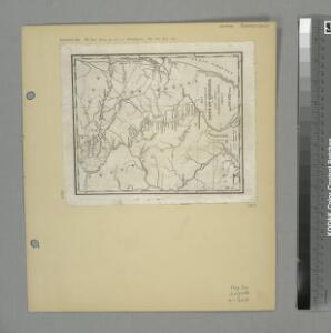
1 : 778000 Tanner, Henry S.
The province of New Jersey, divided into east and west, commonly called the Jerseys
1 : 430000 Faden, William Perrier et Verrier
New Jersey.
1 : 1100000 Tanner, Henry S.
New Jersey.
1 : 506880 Beers, F. W. (Frederick W.)
New Jersey.
1 : 475200 Colton, G.W.
Shell Highway Map of New Jersey.
1 : 427680 Shell Oil Company
New Jersey.
1 : 500000 Colton, G.W.
New Jersey.
1 : 570000 Rand McNally and Company