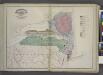
Maps of Allegheny Plat.

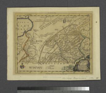
A map of the province of Pensilvania / drawn from the best authorities, by T. Kitchin, gr.
from John H. Levine Collection
New York, New Jersey, Pennsylvania, and Delaware.
1 : 3652000 Fisher, Richard Swainson
Map of New Jersey and Pennsylvania : exhibiting the post offices, post roads, canals, rail roads, &c. / by David H. Burr (late topographer to the Post Office), geographer to the House of Representatives of the U.S.
from Parts
Middle States.
1 : 3600000 Huntington, Nathaniel G. (Nathaniel Gilbert), 1785-1848
A general map of the middle British colonies, in America, containing Virginia, Maryland, the Delaware counties, Pennsylvania and New Jersey : with the addition of New York, and the greatest part of New England, as also of the bordering parts ...
A general map of the middle British colonies in America, viz. Virginia, Maryland, Delaware, Pensilvania, New-Jersey, New York, Connecticut & Rhode-Island, of Aquanishuonigy the country of the confederate Indians comprehending Aquanishuonigy proper ...

Middle States.
1 : 5700000 Grigg, John
Map of the Middle States.
1 : 3041280 Mitchell, Samuel Augustus
Bowles's new pocket map of the following independent states of North America: viz. Virginia, Maryland, Delaware, Pensylvania, New Jersey, New York, Connecticut & Rhode Island: comprehending also the habitations & hunting countries of the confederate Indians / by Lewis Evans.
from Charts and maps Lewis Evans,
Middle States.
1 : 3050000 Smiley, Thomas T.
Map of the interior travels through America, delineating the march of the army

Middle States.
1 : 2800000 Olney, J. (Jesse), 1798-1872
Middle States.
1 : 2900000 Mitchell, Samuel Augustus
Middle States.
1 : 2800000 Huntington, Hezekiah, 1795-1865
Northern or Middle States.
1 : 3000000 Cornell, S. S. (Sarah S.)
Virginia and Maryland / By H. Moll, geographer.
from Parts
Neu York, Pennsylvanien u. Neu Jersey.
1 : 3400000 Lange, Henry, 1821-1893.
Map of the middle states of America, comprehends New-York, New-Jersey, Pennsylvania, Delaware, and the territory N.W. of Ohio
Russell, John Symonds, Henry Delahoy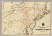
Lines and Metallic Circuit Connections.
1 : 2534400 American Telephone and Telegraph Company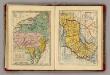
Middle & Southern States.
Goodrich, S.G.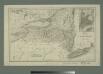
Map of the state of New York with part of Upper Canada / engraved & printed by Fenner Sears & Co.
from Whole
Pennsylvania.
1 : 2175000 Schonberg & Co.
County map of Pennsylvania, New Jersey, Maryland and Delaware ; City of Philadelphia [inset]; City of Baltimore [inset].
from Mitchell's new general atlas, containing maps of the various countries of the world, plans of cities, etc., embraced in fifty-three quarto maps., forming a series of eighty four maps and plans, together with valuable statistical tables.
Map shewing the rail roads between Lake Erie, New York & Boston : intended to illustrate the importance of the N. York & Erie Rail Road / J.F. Smith, del.
from Whole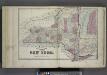
Plan of The State of New York.
from Atlas of Steuben County, New York : from actual surveys and official records / compiled & published by D.G. Beers & Co.
A map of the canals & rail roads of Pennsylvania and New Jersey, and the adjoining states / by H.S. Tanner; engraved by H.S. Tanner & assistants.
from Parts Henry S. Tanner,
A map of the canals & rail roads of Pennsylvania and New Jersey and the adjoining states / by H. S. Tanner; engraved by H.S. Tanner & assistants.
from Parts Henry S. Tanner,
Carte des Provines Septles. des Etats-Unis.
1 : 2400000 Marshall, John
Shell Sectional Map No. 2 - North Atlantic States.
1 : 1457280 Shell Oil Company