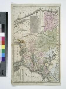
Maps of United States

United States.
from Whole D.F. Robinson & Co.: [Hartford, Conn.];,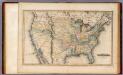
United States.
1 : 11088000 Lucas, Fielding Jr.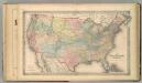
The United States of America.
1 : 8000000 Colton, G.W.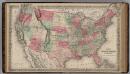
United States of America.
1 : 6336000 Colton, G.W.
A Map of the frontier of British North America and the United States: describing the boundary line as fixed by the Treaty of 1783 which has never been respected by the American government ...
from Whole Printed for J.M. Richardson, Cornhill, by T. Davison, Whitefriars: [London],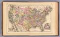
United States.
1 : 10000000 Mitchell, Samuel Augustus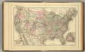
United States.
1 : 10000000 Mitchell, Samuel Augustus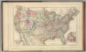
United States.
1 : 10000000 Mitchell, Samuel Augustus Jr.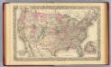
United States.
1 : 10000000 Williams, W. (Wellington)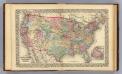
United States.
1 : 10000000 Williams, W. (Wellington)
Nord-Americanische Freistaaten.
1 : 12800000 Radefeld, Carl Christian Franz, 1788-1874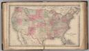
United States of America.
1 : 8000000 Colton, G.W.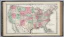
United States of America.
1 : 8000000 Colton, G.W.
Acquisition of territory US.
1 : 10300000 United States. Census Office
Geognos. Karte, Nord-Amer. Freistaate.
1 : 12800000 Radefeld, Carl Christian Franz, 1788-1874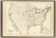
Barometer, air movement US.
1 : 7200000 United States. Census Office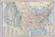
Shell Highway Map of United States.
1 : 7476480 Shell Oil Company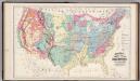
Geological Formations of the United States.
1 : 7520000 Gray, Ormando Willis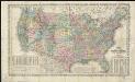
A new map of the United States of America
1 : 8750000
United States.
1 : 8183000 Hammond, C.S.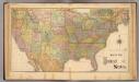
United States.
1 : 8600000 Rand McNally and Company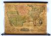
United States.
1 : 7000000 Thrall, Willis
United States.
from Whole Richardson & Lord: [Boston]; Morse, Jedidiah -- Geographer (not in Relator list),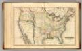
United States.
1 : 11100000 Lucas, Fielding Jr.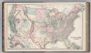
United States of America.
1 : 7240000 Colton, G. Woolworth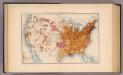
10. Population 1870.
1 : 14000000 Gannett, Henry, 1846-1914; United States. Census Office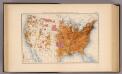
11. Population 1880.
1 : 14000000 Gannett, Henry, 1846-1914; United States. Census Office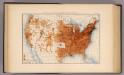
12. Population 1890.
1 : 14000000 Gannett, Henry, 1846-1914; United States. Census Office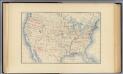
1. Accessions of territory.
1 : 14000000 Gannett, Henry, 1846-1914; United States. Census Office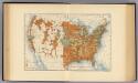
28. Increase 1890 to 1900.
1 : 14000000 Gannett, Henry, 1846-1914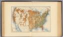
29. Predominating sex.
1 : 14000000 Gannett, Henry, 1846-1914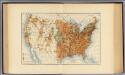
25. Density of increase of population, U.S., 1890-1900.
1 : 14000000 Gannett, Henry, 1846-1914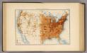
13. Population 1900.
1 : 14000000 Gannett, Henry, 1846-1914; United States. Census Office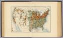
26. Population in cities >2000 inhabitants, 1900.
1 : 14000000 Gannett, Henry, 1846-1914