Cataloged map
Map of the city of Brooklyn, as laid out by commissioners, and confirmed by acts of the Legislature of the state of New York : made from actual surveys, the farm lines and names of original owners, being accurately drawn from authentic sources, containin
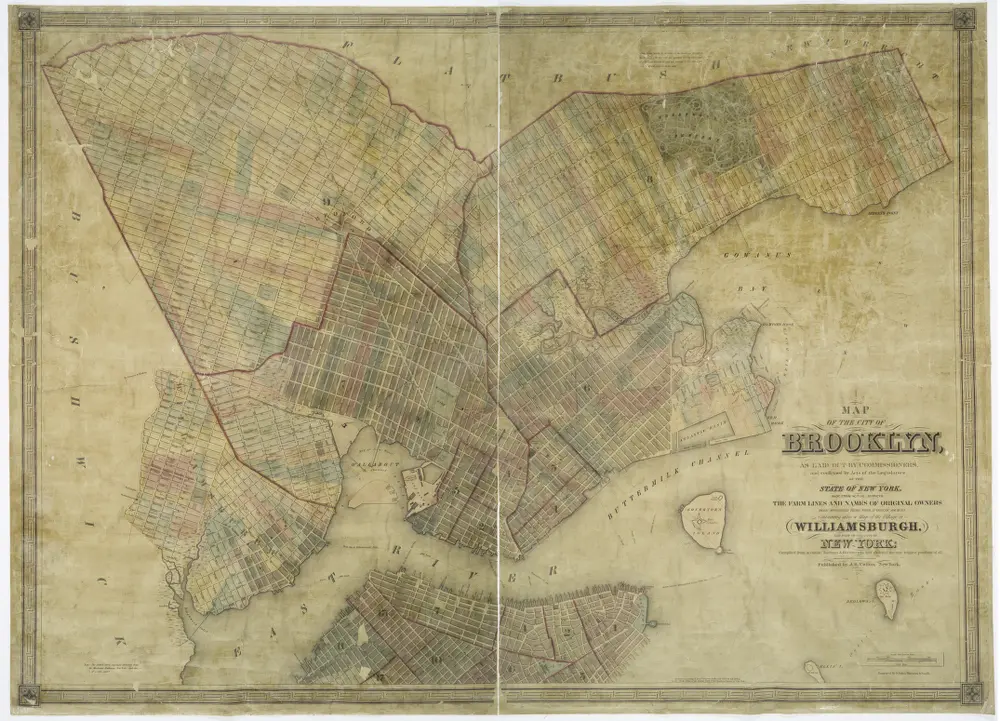

Full title:Map of the city of Brooklyn, as laid out by commissioners, and confirmed by acts of the Legislature of the state of New York : made from actual surveys, the farm lines and names of original owners, being accurately drawn from authentic sources, containin
Physical Size:20 x 30 cm
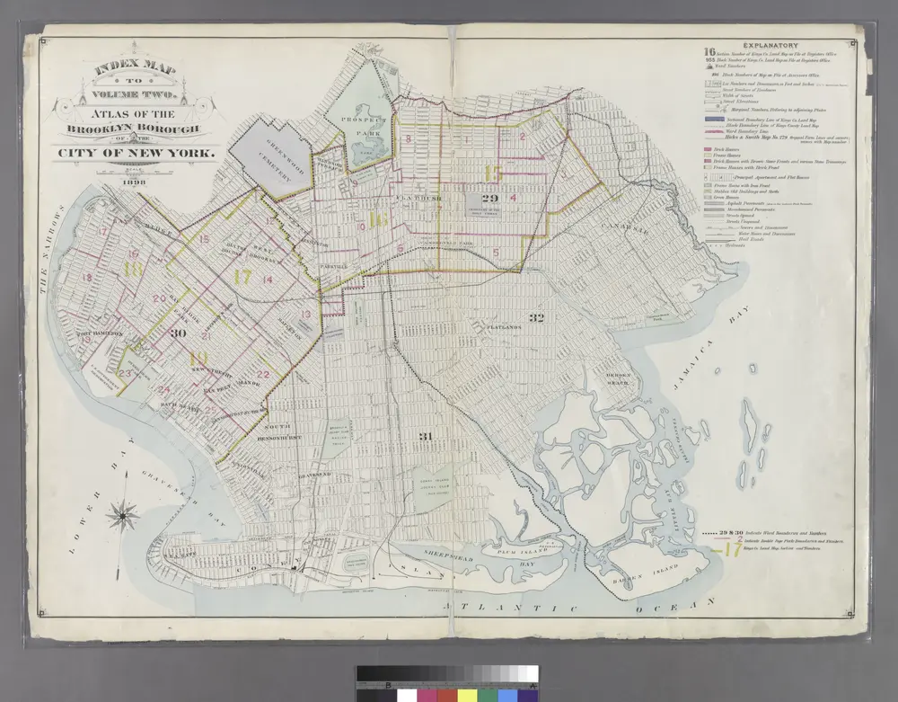
Index Map to Volume Two. Atlas of the Brooklyn Borough of the City of New York.
1899
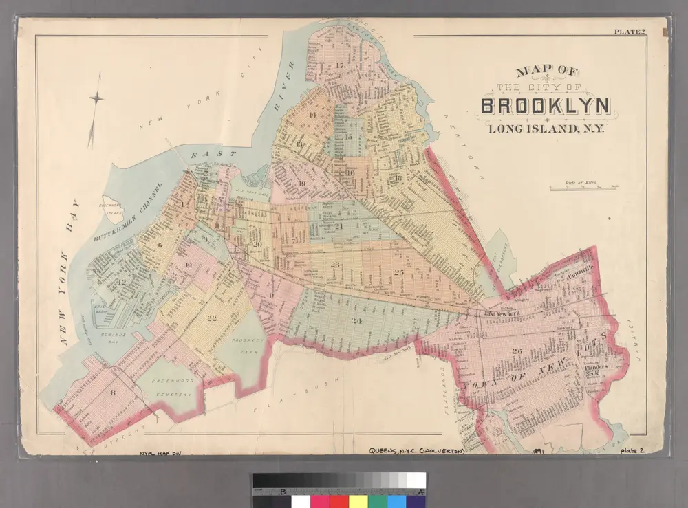
Plate 2: Map of the City of Brooklyn, Long Island, N.Y.
1891
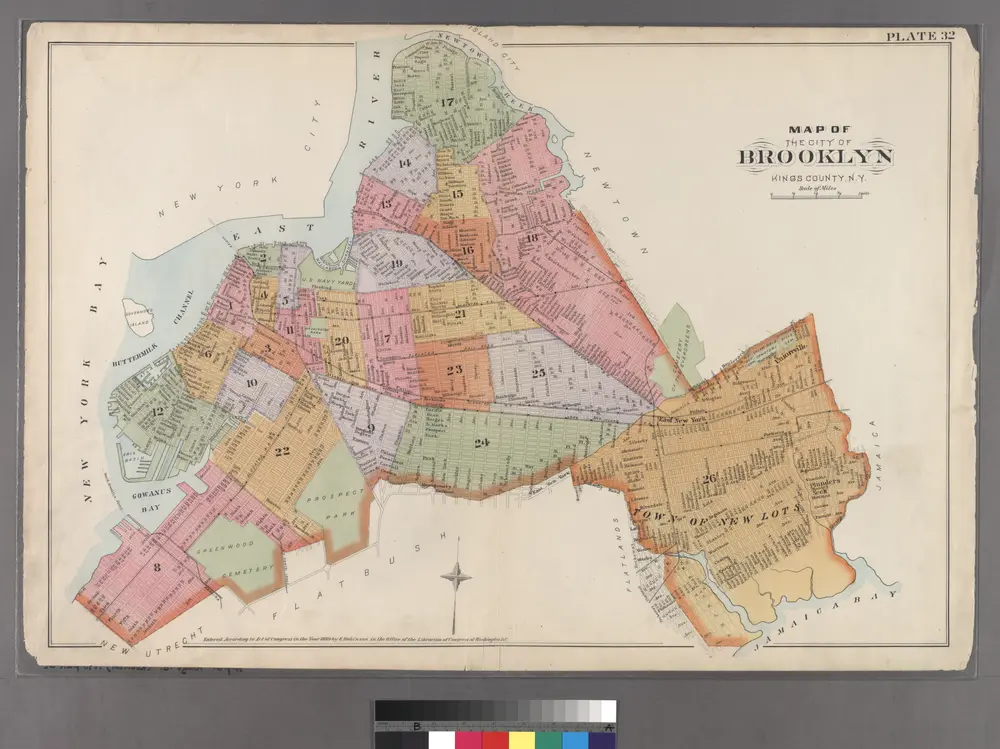
Plate 32: Map of the City of Brooklyn, Kings Co., N.Y.
1890
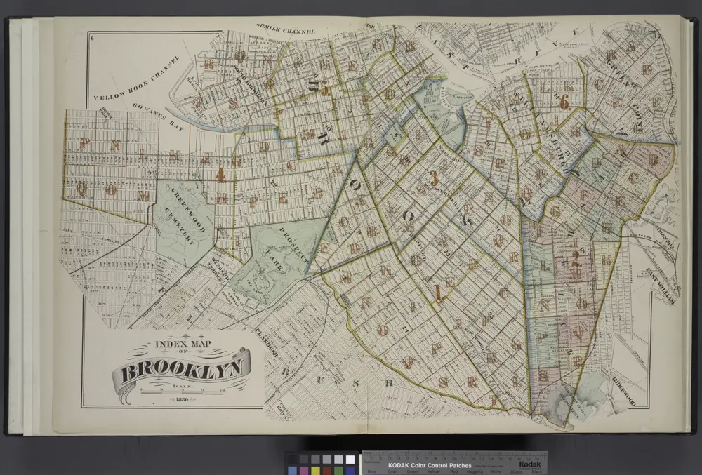
Index Map of Brooklyn
1880
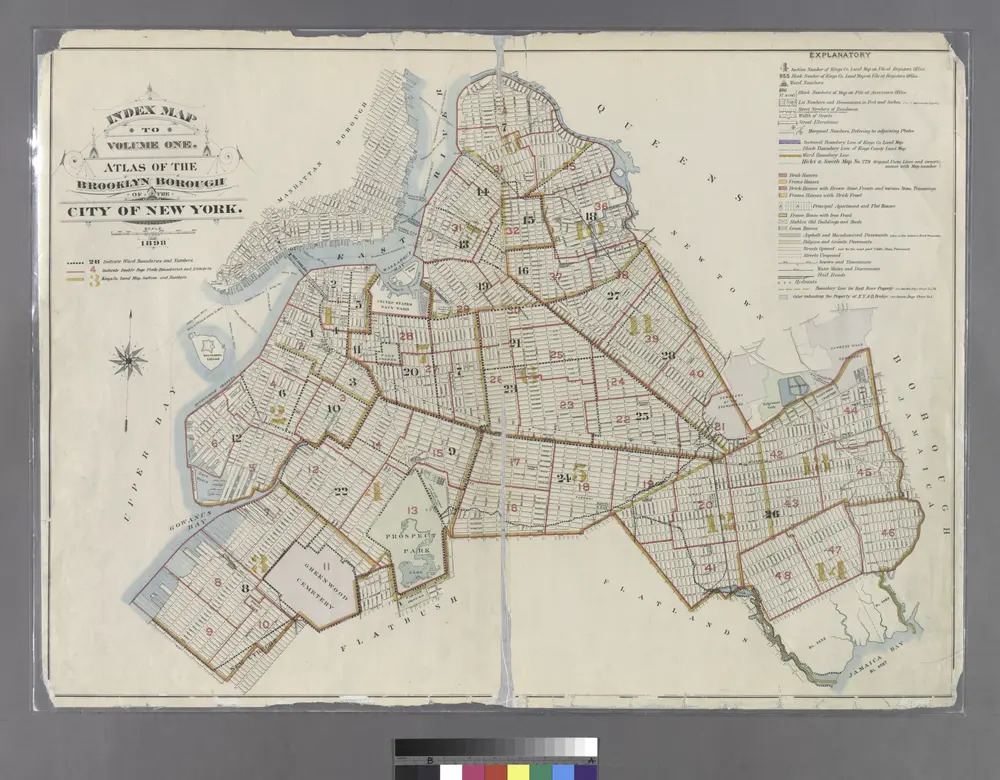
Index Map to Volume One. Atlas of the Brooklyn Borough of the City of New York.
1899
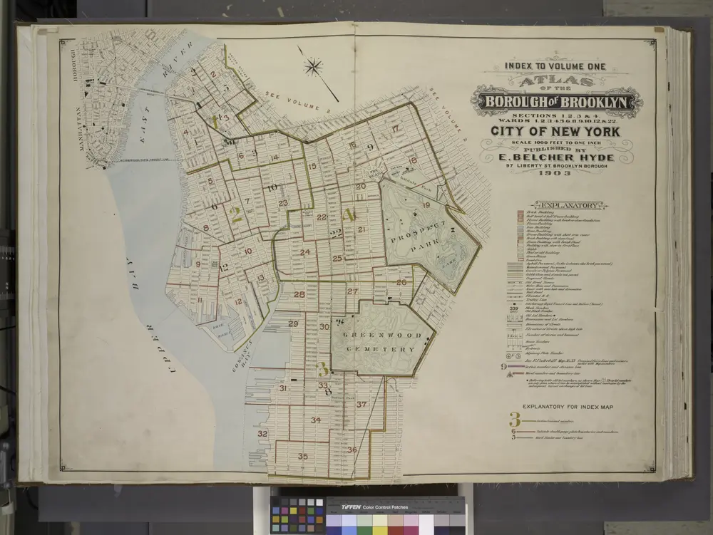
Index to Volume One, Atlas of the Borough of Brooklyn Sections 1, 2, 3 & 4. Wards 1, 2, 3, 4, 5, 6, 8, 9, 10, 12 & 22. City of New York. Published by E. Belcher Hyde, 97 Liberty St., Brooklyn. 1903.
1903
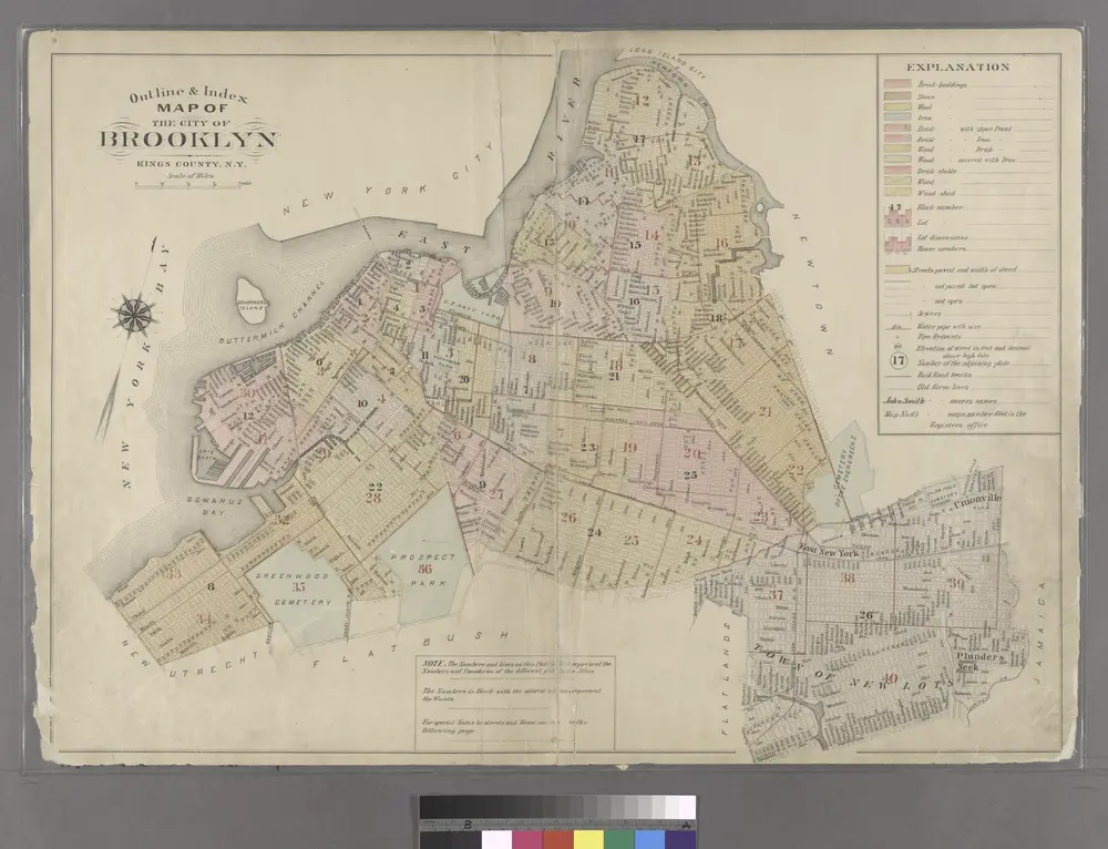
Outline & Index Map of the City of Brooklyn, Kings County, N.Y.
1886
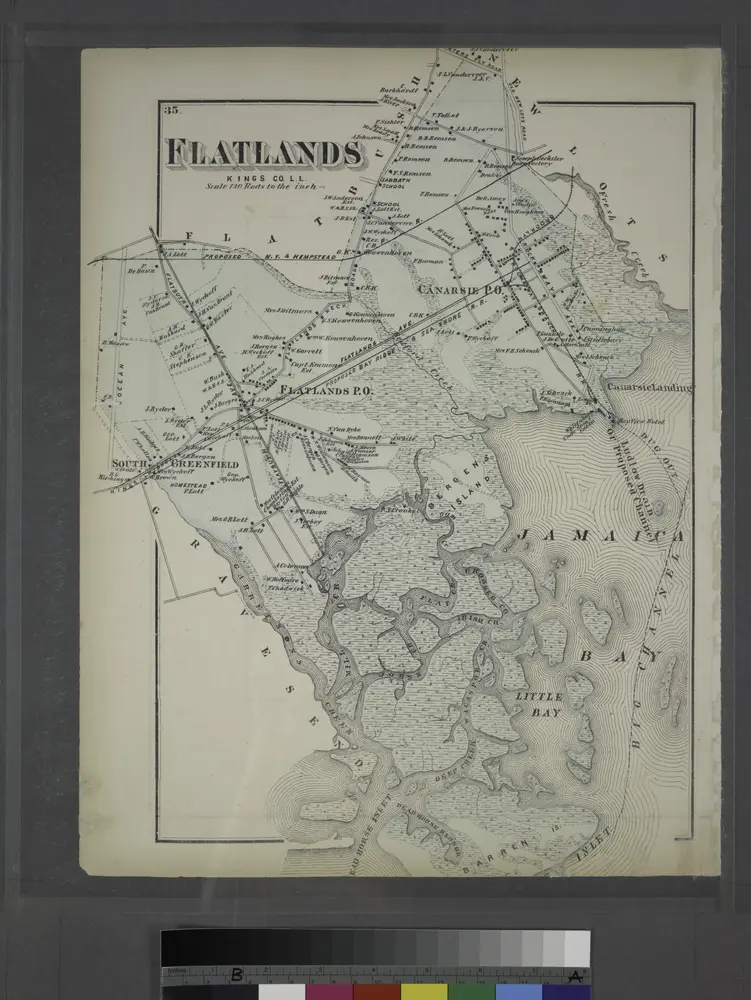
Flatlands. Kings Co. L.I.
1873
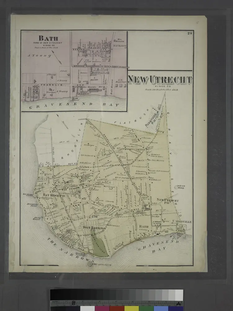
Bath, Town on New Utrecht, Kings Co.
1873
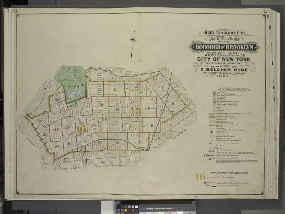
Index to Volume Five. Atlas of the Borough of Brooklyn. Sections 15 & 16. Ward 29 and part of 32. City of New York. E. Belcher Hyde, 97 Liberty St., Brooklyn Borough. 1906.
1906