Maps of Hoboken

Map of the city of New York : with the adjacent cities of Brooklyn & Jersey City, & the village of Williamsburg / drawn & engraved by John M. Atwood, 145 Fulton St., N.Y.
from Manhattan
Topographical map of New York City, County and vicinity : showing old farm lines &c. / based on Randells and other official surveys, drawings and modern surveys by J.F. Harrison & T. Magrane ; printed by C. Wadlow.
from (A-Z)
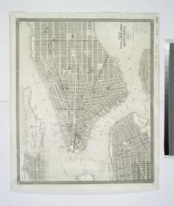
New map of the city of New York.
from Manhattan
New York.
from Manhattan
Topographical Atlas Of The City Of New York
1 : 12000 Viele, Egbert L.
Map of the city of New York : with the adjacent cities of Brooklyn & Jersey City, & the village of Williamsburg / drawn & engraved by Story & Atwood, 151 Fulton St., N.Y.
from Manhattan
New York City, Brooklyn, Jersey City, Hoboken.
1 : 30000 Colton, G.W.
Map showing the original high and low grounds, salt marsh and shore lines in the city of Brooklyn: from original government surveys made in 1776-7.
from Brooklyn
New York (City).
1 : 20600 Colton, G.W.
Plan of the city of New York in North America : surveyed in the years 1766 & 1767 / B. Ratzer, lieutt. in His Majestys 60th or Royal American Regt. ; Thos. Kitchin, sculpt., engraver to His Late Royal Highness, the Duke of York, &c.
from Manhattan
New York City, Brooklyn, Jersey City, Hoboken.
1 : 30000 Colton, G.W.
Map of the City of New York with the adjacent cities of Brooklyn & Jersey City, & the village of Williamsburg.
From Manhattan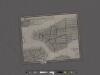
Amap of the city and county of New York, with the adjacent cities of Brooklyn and Jersey City, and the village of Williamsburg: with a street directory of the city of New York.
From Manhattan
Plan of New York &c.
Mitchell, Samuel Augustus Jr.
[New York City elevated Railroads.]
From Manhattan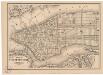
Map of the city of New York
1 mapa. Datat a partir de 1900 aproximadament. D. Appleton & Co.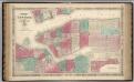
New York City.
1 : 20000 Johnson, A.J.
Hagstrom's Map of lower New York City, House Number and Subway Guide.
From Manhattan
Plan of the city of New York in North America : surveyed in the years 1766 & 1767 / B. Ratzer, lieutt. in His Majestys 60th or Royal American Regt. ; Thos. Kitchin, sculpt., engraver to His Late Royal Highness, the Duke of York, &c.
from Charts and maps
Map of the city of New-York / drawn by D.H. Burr, for "New York as it is, in 1834" ; engraved by S. Stiles & Co., New York.
from Manhattan
Map of the local boundaries of the Protestant Episcopal Churches of the city of New York.
from Manhattan
Topographical atlas of the city of New York, including the annexed territory showing original water courses and made land. / prepared under the direction of Egbert L. Viele.
From Topographical atlas of the city of New York, including the annexed territory showing original water courses and made land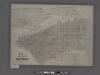
Map of the city of New York showing the original high water line and the location of the different farms and estates.
From Manhattan
Map of the city of New York with the adjacent cities of Brooklyn and Jersey City, and the village of Williamsburg
1 : 14000 Story & Atwood H. Phelps
Topographical map of New York City, County and vicinity, showing old farm lines, etc. Based on Radell's and other official surveys, drawings and modern surveys.
From Manhattan
Plan of New York
1 : 2000
Map of the City of New-York with part of Brooklyn and Williamsburgh : population in the year 1850: 450,000 inhabitants / D. Völker, sc.
from Manhattan
Map of the city of New York : with street directory showing house-numbers, hotels, churches, banks, theatres, ferries, house-car, steam and elevated R.R'ds, &c
1 : 12670 Dripps, M. (Matthew) M. Dripps
This actual map and comparative plans showing 88 years growth of the City of New York : is inscribed to the citizens by the proprietor, David Longworth / G.B. King sc. N.Y. 1817 ; engraved by Jas. D. Stout.
from Manhattan